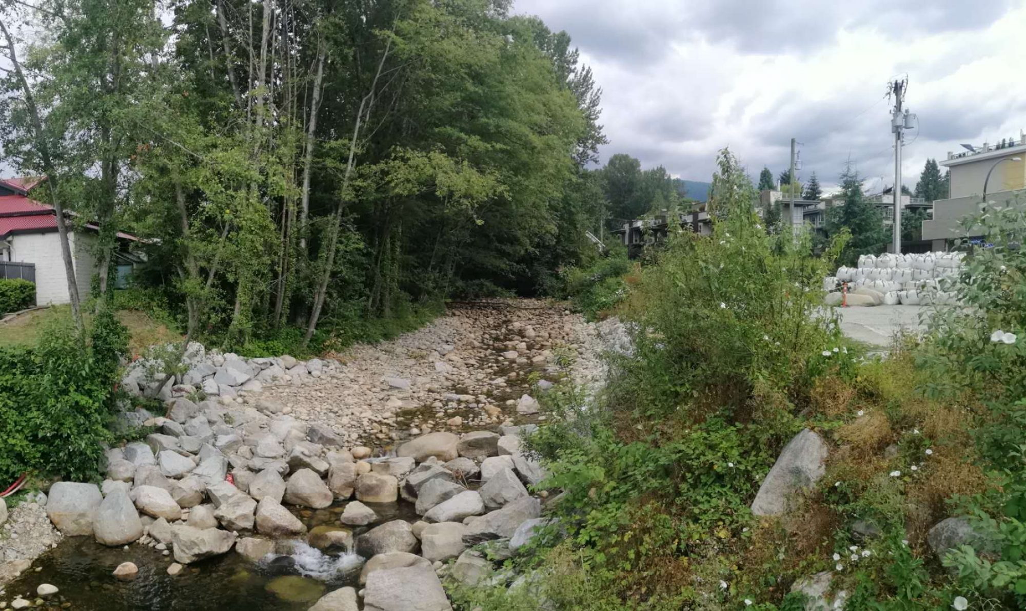
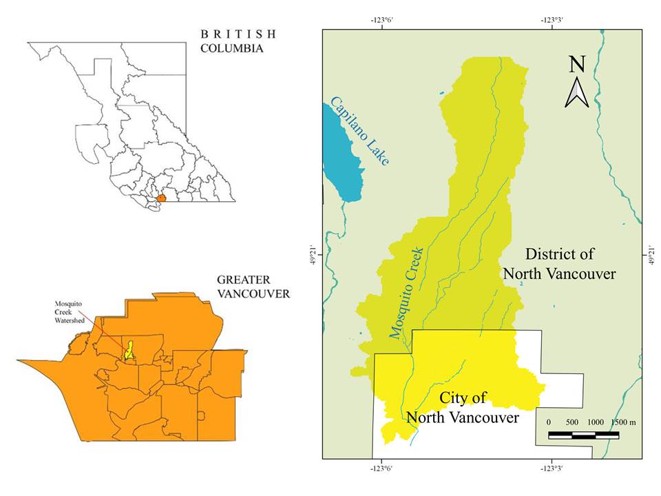
Study Site
This case study investigated the frequencies of the 24h precipitation over 40mm events from 2001 to 2020 and presented spatial analyses of land use and imperviousness in 2011 in Mosquito Creek watershed, North Vancouver, based on accessible data. The Water Balance Model (WBM) was then applied to model the surface runoff discharge rates and direct runoff depths for 2011 surface conditions and 2041 projections without LID practices, as well as performances of selected LID practices (absorbent landscapes, rain gardens, and pervious paving). The modeling results are intended to compare the changes in runoff discharge rates and depths caused by altered surface conditions and the adoption of urban storm runoff mitigation practices.
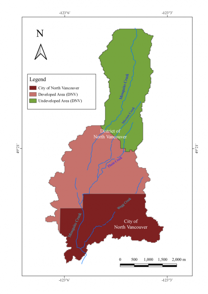
Developed Area in Mosquito Creek Watershed
The lower watershed located within the boundary of City of North Vancouver (CNV) has an elevation ranging from 0 – 80m, and the remaining watershed covers both developed (middle watershed, elevation: 80 – 340 m) and undeveloped areas (elevation: 340 – 1300 m) mapped by the District of North Vancouver (DNV). The projected urbanization process would predominantly take the form of redevelopment/intensification in developed areas and the municipality of CNV. Therefore, the project will focus on low and middle elevation areas (watershed below the city border and developed areas in DNV).
___________________________________________________________________________________________
Project Objectives
This project aims to better understand the trends associated with the redevelopment/intensification of single houses within residential landscapes, and the expansion of impervious surface areas such as driveways, walkways, and rooftops. By comparing the watershed landscapes before and after surface modification with the application of LID practices, this project helps understand the significance of LID practices in stormwater management in Mosquito Creek Watershed and potentially other urbanizing watersheds. Specifically, the goals of this project include:
(1) Investigating the variability of accumulated winter precipitation (24h precipitation events) at different elevations within or in close proximity to Mosquito Creek from 2001 to 2020;
(2) Examining the relationship between different surface conditions and discharge rates and depths to determine the impacts of impervious surface areas in the lower and middle watershed;
(3) Projecting future surface runoff discharge rates and direct runoff depths based on Metro Vancouver’s land use change prediction; and
(4) Providing recommendations to determine the most appropriate LID practice(s) for different precipitation regimes and land uses, with a focus on a) absorbent landscapes, b) rain gardens, and c) pervious paving.
___________________________________________________________________________________________
About the Author

This project was conducted by Guowei Li, an MLWS 2019-2020 student as his major project to meet the graduation requirement. Guowei Li has over four years’ experience in the environment sectors, including studying experience in Environmental Engineering as well as internship experience in air pollution control and wastewater treatment. His areas of expertise include Environmental Impact Assessment, Environmental Planning & Management, and Air Pollution Control.