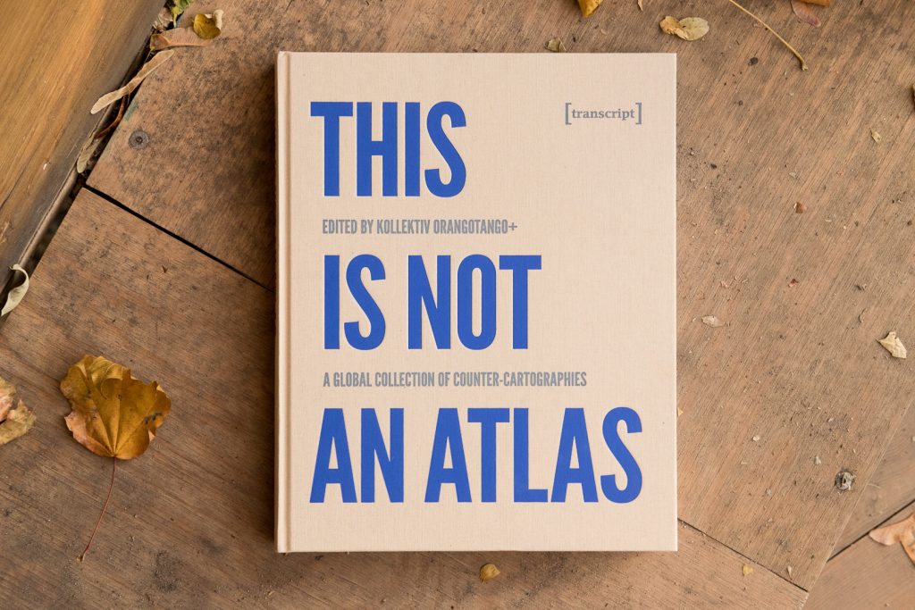
kollektiv orangotango+. 2018. This Is Not an Atlas: A Global Collection of Counter-Cartographies. Bielefeld: transcript Verlog
notanatlas.org An open-access book, This Is Not an Atlas gathers more than 40 counter-cartographies from all over the world. This collection shows how maps are created and transformed as a part of political struggle, for critical research or in art and education: from Indigenous territories in the Amazon to the anti-eviction movement in San Francisco; from defending commons in Mexico to mapping refugee camps with balloons in Lebanon; from slums in Nairobi to squats in Berlin; from supporting communities in the Philippines to reporting sexual harassment in Cairo. This Is Not an Atlas seeks to inspire, to document the underrepresented, and to be a useful companion when becoming a counter-cartographer yourself.
Powell, Kimberly. 2016. “Multimodal Mapmaking: Working Toward an Entangled Methodology of Place” Anthropology & Education Quarterly. 47(4): 402-420
Anthropology & Education Quarterly Abstract: This article addresses mapmaking as a multimodal method and lens for place-based ethnographic inquiry. I describe three contexts drawn from my research on and teaching of mapmaking. Drawing from my own sense-making of mapping as an embodied phenomenon, I discuss how the fields of sensory and materialist studies might expand the interpretive possibilities of multimodal ethnography as an epistemological and ontological lens involving the entanglement of place, body, and experience with knowing and becoming.
Brody, Hugh. 1981. “Maps and Dreams”, Douglas & McIntyre
Douglas & McIntyre Synopsis: The Canadian subarctic is a world of forest, prairie, and muskeg; of rainbow trout, moose, and caribou; of Indian hunters and trappers. It is also a world of boomtowns and bars, oil rigs and seismic soundings; of white energy speculators, ranchers, and sports hunters. Brody came to this dual world with the job of “mapping” the lands of northwest British Columbia as well as the way of life of a small group of Beaver Indians with a viable hunting economy living in the path of a projected oil pipeline. The result is Maps and Dreams, Brody’s account of his extraordinary eighteen-month journey through the world of a people who have no intention of vanishing into the past.
Martin, Tom. 2022. “Ethnographic Mapping”, Tyner-Mullings, Alia, Gatta, Mary, & Coughlan, Ryan (eds.). Ethnography Made Easy. New York: CUNY
Ethnographic Made Simple This is a chapter in an open-access textbook on ethnographic research. The chapter discusses why ethnographers need to consider the role of location and surroundings in their research and how maps can contribute to filed research as a valuable tool for recording how participants interact with physical environments and other people. Ethnographic maps go beyond traditional maps by representing not only geographical features but also the interactions and cultural practices within a space. While our focus here is spatial maps, the chapter also provides the reader with information on how maps can be used to represent non-spatial phenomena such as life histories, organizational structures, and processes. These maps provide a unique perspective on participants’ lives and support the goals of the research project. The chapter also introduces resources and techniques for ethnographic map-making, including, working from pictures, using video, utilizing copyright-free resources, or collaborating with participants. These maps help capture and interpret the complexities of human action and interaction in research settings.
kollektiv orangotango+. 2018. This Is Not an Atlas: A Global Collection of Counter-Cartographies. Bielefeld: transcript Verlog
notanatlas.org An open-access book, This Is Not an Atlas gathers more than 40 counter-cartographies from all over the world. This collection shows how maps are created and transformed as a part of political struggle, for critical research or in art and education: from Indigenous territories in the Amazon to the anti-eviction movement in San Francisco; from defending commons in Mexico to mapping refugee camps with balloons in Lebanon; from slums in Nairobi to squats in Berlin; from supporting communities in the Philippines to reporting sexual harassment in Cairo. This Is Not an Atlas seeks to inspire, to document the underrepresented, and to be a useful companion when becoming a counter-cartographer yourself.
Powell, Kimberly. 2016. “Multimodal Mapmaking: Working Toward an Entangled Methodology of Place” Anthropology & Education Quarterly. 47(4): 402-420
Anthropology & Education Quarterly Abstract: This article addresses mapmaking as a multimodal method and lens for place-based ethnographic inquiry. I describe three contexts drawn from my research on and teaching of mapmaking. Drawing from my own sense-making of mapping as an embodied phenomenon, I discuss how the fields of sensory and materialist studies might expand the interpretive possibilities of multimodal ethnography as an epistemological and ontological lens involving the entanglement of place, body, and experience with knowing and becoming.
Brody, Hugh. 1981. “Maps and Dreams”, Douglas & McIntyre
Douglas & McIntyre Synopsis: The Canadian subarctic is a world of forest, prairie, and muskeg; of rainbow trout, moose, and caribou; of Indian hunters and trappers. It is also a world of boomtowns and bars, oil rigs and seismic soundings; of white energy speculators, ranchers, and sports hunters. Brody came to this dual world with the job of “mapping” the lands of northwest British Columbia as well as the way of life of a small group of Beaver Indians with a viable hunting economy living in the path of a projected oil pipeline. The result is Maps and Dreams, Brody’s account of his extraordinary eighteen-month journey through the world of a people who have no intention of vanishing into the past.
Hunt, Dallas & Stevenson, Shaun. 2017. “Decolonizing Geographies of Power: Indigenous Digital Counter-mapping Practices on Turtle Island”, Settler Colonial Studies, 7 (3): 372-392
Settler Colonial Studies Abstract: This paper addresses the decolonizing potential of Indigenous counter-mapping in the context of (what is now called) Canada. After historicizing cartography as a technique of colonial power, and situating Indigenous counter-mapping as an assertion of political and intellectual sovereignty, we examine the digital map of Amiskwaciwâskahikan (Plains Cree for Edmonton, Alberta) produced by the Pipelines Collective, which overlays Treaty 6 Indigenous maps onto ‘conventional’ maps to denaturalize and challenge colonial renderings of city space. We then discuss the expanding trend of guerrilla mapping techniques engaged in by Indigenous groups, emphasizing the Ogimaa Mikana project in Toronto, wherein Anishinaabemowin names were stickered over settler street names. Expanding the spatial theories of Michel de Certeau and Gilles Deleuze, and drawing on the research and insights of Indigenous scholars Jodi Byrd and Mishuana Goeman, our paper considers how emerging digital counter-mapping efforts offer ambivalent possibilities for Indigenous peoples to assert their presence in material ways.
Martin, Tom. 2022. “Ethnographic Mapping”, Tyner-Mullings, Alia, Gatta, Mary, & Coughlan, Ryan (eds.). Ethnography Made Easy. New York: CUNY
Ethnographic Made Simple This is a chapter in an open-access textbook on ethnographic research. The chapter discusses why ethnographers need to consider the role of location and surroundings in their research and how maps can contribute to filed research as a valuable tool for recording how participants interact with physical environments and other people. Ethnographic maps go beyond traditional maps by representing not only geographical features but also the interactions and cultural practices within a space. While our focus here is spatial maps, the chapter also provides the reader with information on how maps can be used to represent non-spatial phenomena such as life histories, organizational structures, and processes. These maps provide a unique perspective on participants’ lives and support the goals of the research project. The chapter also introduces resources and techniques for ethnographic map-making, including, working from pictures, using video, utilizing copyright-free resources, or collaborating with participants. These maps help capture and interpret the complexities of human action and interaction in research settings.
kollektiv orangotango+. 2018. This Is Not an Atlas: A Global Collection of Counter-Cartographies. Bielefeld: transcript Verlog
notanatlas.org An open-access book, This Is Not an Atlas gathers more than 40 counter-cartographies from all over the world. This collection shows how maps are created and transformed as a part of political struggle, for critical research or in art and education: from Indigenous territories in the Amazon to the anti-eviction movement in San Francisco; from defending commons in Mexico to mapping refugee camps with balloons in Lebanon; from slums in Nairobi to squats in Berlin; from supporting communities in the Philippines to reporting sexual harassment in Cairo. This Is Not an Atlas seeks to inspire, to document the underrepresented, and to be a useful companion when becoming a counter-cartographer yourself.
Powell, Kimberly. 2016. “Multimodal Mapmaking: Working Toward an Entangled Methodology of Place” Anthropology & Education Quarterly. 47(4): 402-420
Anthropology & Education Quarterly Abstract: This article addresses mapmaking as a multimodal method and lens for place-based ethnographic inquiry. I describe three contexts drawn from my research on and teaching of mapmaking. Drawing from my own sense-making of mapping as an embodied phenomenon, I discuss how the fields of sensory and materialist studies might expand the interpretive possibilities of multimodal ethnography as an epistemological and ontological lens involving the entanglement of place, body, and experience with knowing and becoming.
Brody, Hugh. 1981. “Maps and Dreams”, Douglas & McIntyre
Douglas & McIntyre Synopsis: The Canadian subarctic is a world of forest, prairie, and muskeg; of rainbow trout, moose, and caribou; of Indian hunters and trappers. It is also a world of boomtowns and bars, oil rigs and seismic soundings; of white energy speculators, ranchers, and sports hunters. Brody came to this dual world with the job of “mapping” the lands of northwest British Columbia as well as the way of life of a small group of Beaver Indians with a viable hunting economy living in the path of a projected oil pipeline. The result is Maps and Dreams, Brody’s account of his extraordinary eighteen-month journey through the world of a people who have no intention of vanishing into the past.
Hunt, Dallas & Stevenson, Shaun. 2017. “Decolonizing Geographies of Power: Indigenous Digital Counter-mapping Practices on Turtle Island”, Settler Colonial Studies, 7 (3): 372-392
Settler Colonial Studies Abstract: This paper addresses the decolonizing potential of Indigenous counter-mapping in the context of (what is now called) Canada. After historicizing cartography as a technique of colonial power, and situating Indigenous counter-mapping as an assertion of political and intellectual sovereignty, we examine the digital map of Amiskwaciwâskahikan (Plains Cree for Edmonton, Alberta) produced by the Pipelines Collective, which overlays Treaty 6 Indigenous maps onto ‘conventional’ maps to denaturalize and challenge colonial renderings of city space. We then discuss the expanding trend of guerrilla mapping techniques engaged in by Indigenous groups, emphasizing the Ogimaa Mikana project in Toronto, wherein Anishinaabemowin names were stickered over settler street names. Expanding the spatial theories of Michel de Certeau and Gilles Deleuze, and drawing on the research and insights of Indigenous scholars Jodi Byrd and Mishuana Goeman, our paper considers how emerging digital counter-mapping efforts offer ambivalent possibilities for Indigenous peoples to assert their presence in material ways.
Martin, Tom. 2022. “Ethnographic Mapping”, Tyner-Mullings, Alia, Gatta, Mary, & Coughlan, Ryan (eds.). Ethnography Made Easy. New York: CUNY
Ethnographic Made Simple This is a chapter in an open-access textbook on ethnographic research. The chapter discusses why ethnographers need to consider the role of location and surroundings in their research and how maps can contribute to filed research as a valuable tool for recording how participants interact with physical environments and other people. Ethnographic maps go beyond traditional maps by representing not only geographical features but also the interactions and cultural practices within a space. While our focus here is spatial maps, the chapter also provides the reader with information on how maps can be used to represent non-spatial phenomena such as life histories, organizational structures, and processes. These maps provide a unique perspective on participants’ lives and support the goals of the research project. The chapter also introduces resources and techniques for ethnographic map-making, including, working from pictures, using video, utilizing copyright-free resources, or collaborating with participants. These maps help capture and interpret the complexities of human action and interaction in research settings.
kollektiv orangotango+. 2018. This Is Not an Atlas: A Global Collection of Counter-Cartographies. Bielefeld: transcript Verlog
notanatlas.org An open-access book, This Is Not an Atlas gathers more than 40 counter-cartographies from all over the world. This collection shows how maps are created and transformed as a part of political struggle, for critical research or in art and education: from Indigenous territories in the Amazon to the anti-eviction movement in San Francisco; from defending commons in Mexico to mapping refugee camps with balloons in Lebanon; from slums in Nairobi to squats in Berlin; from supporting communities in the Philippines to reporting sexual harassment in Cairo. This Is Not an Atlas seeks to inspire, to document the underrepresented, and to be a useful companion when becoming a counter-cartographer yourself.
Powell, Kimberly. 2016. “Multimodal Mapmaking: Working Toward an Entangled Methodology of Place” Anthropology & Education Quarterly. 47(4): 402-420
Anthropology & Education Quarterly Abstract: This article addresses mapmaking as a multimodal method and lens for place-based ethnographic inquiry. I describe three contexts drawn from my research on and teaching of mapmaking. Drawing from my own sense-making of mapping as an embodied phenomenon, I discuss how the fields of sensory and materialist studies might expand the interpretive possibilities of multimodal ethnography as an epistemological and ontological lens involving the entanglement of place, body, and experience with knowing and becoming.