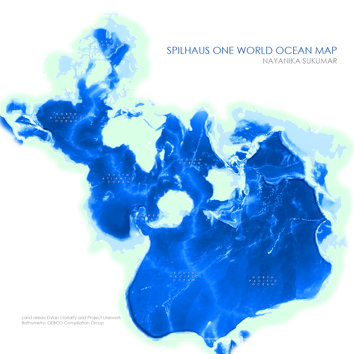
Overview:
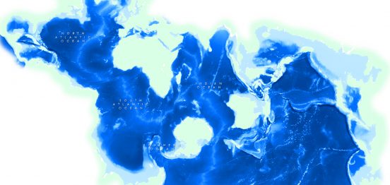
Some maps are designed to challenge our assumptions of the world and force us to look at our world from a different perspective. Seventy-one percent of the earth is covered in oceans but the vast majority of projections available to cartographers favour land areas, with the seams and distortions relegated to the vast and ’empty’ oceans. But our oceans are not empty! This exercise was a fun opportunity to explore a new projection that is ocean-centric.
What is a Spilhaus map?
In 1942, South African meteorologist, oceanography and inventor Athelstan Spilhaus created the world’s first fully ocean-centered map projection. Essentially a combination of the Hammer and Spielmann projections, Spilhaus ocean map is an Antarctica-centered projection.
Map: