GEOB 270 Final Project
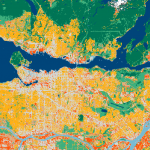
The final project for GEOB 270 looked at the Tsunami risk for Tofino and Victoria, BC. These two municipalities fall within the Canadian Pacific Coast which is a highly seismic region, susceptible to intense flooding from potential tsunamis. Our group created three different comparison maps though this project. The first map looked at elevations in both Tofino and Victoria. A buffer of 1km inland and 8 meters elevation was created to highlight regions that were at risk of a tsunami. The second map looked at dissemination areas and population density which were again at risk for a tsunami and the final map looked at key facilities that would be at risk.
A key issue we faced was we did not know how to judge the effects of a tsunami as it is highly variable and depends on what causes it. We created this project while assuming tsunamis to be independent of any other variable while in fact there are many other secondary effects that could put populations at risk.