Overview:
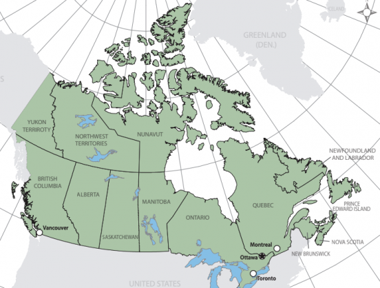
Create a coloured reference map of the provinces, territories and cities of Canada. Audience of the map is for a high school social studies textbook.
Objectives:
- Understand and employ good visual hierarchy practices.
- Understand the Adobe Illustrator interface
Map: