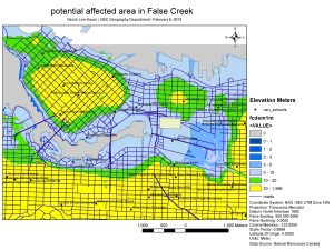
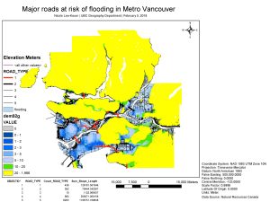
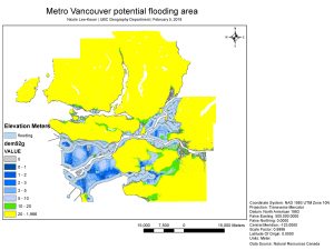
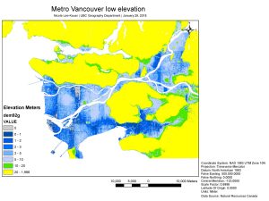
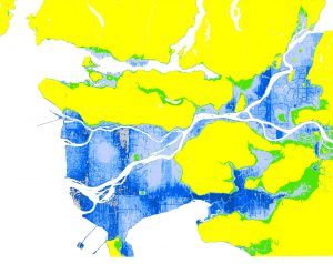
Due to climate change, the magnitude and frequency of natural disasters has been increasing. As a coastal city, Vancouver is one of the more susceptible cities to storm surges. Therefore, I was tasked to look at the potential urban effects of storm surges on the Metro Vancouver area. We performed various GIS analysis methods such as calculate shape areas using raster data, creating buffers, reclassifying data to point out major roads affected, and understand discrepancies due to the compression of raster data. I produced four maps that employed different GIS analysis methods. I’ve learned the importance of using symbology to highlight data of interest. I’ve learned to conduct a risk assessment by locating the purposed hospital location.