In this project, I conducted a Environment Impact Assessment on Garibaldi park.
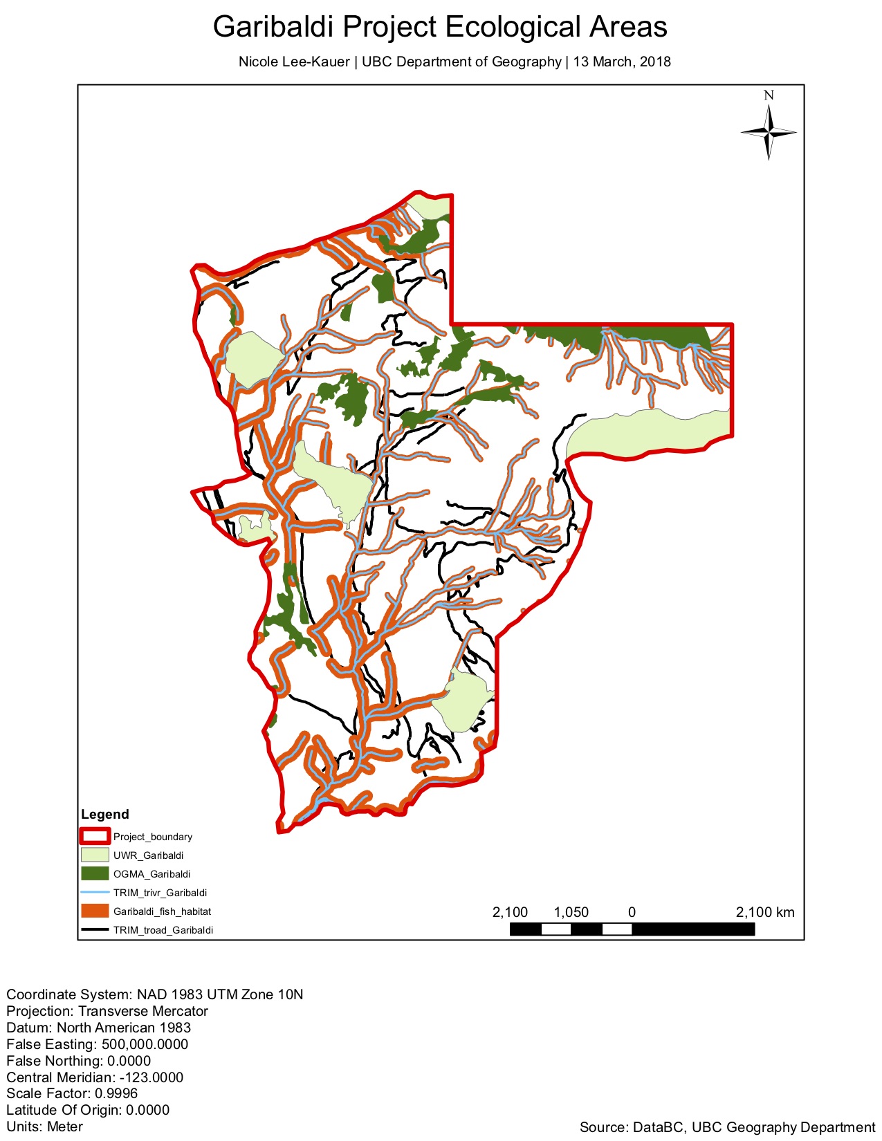
There were 5 steps I used to analyze the data at hand. Firstly, I obtained the data from DataBC and department of Geography at UBC. After that, I parse them together so that the coordinate systems are the same. This is very important for the data to align to conduct analysis. Since we are focusing on the Garibaldi project area, I clipped all the layers to filter out unnecessary data. Next, I used various GIS analysis tools such as Intersect, Join, Dissolve observe patterns. In this case, we were looking at the percentage of protected areas such as fish habitat, ungulate habitats, and old growth forests. This process allowed me to eliminate data that were duplicated because they overlapped. My data was represented using polygons, polylines, raster data and contour lines. I changed the symbology in each layer to make them more fitting to the feature being represented, and so they are easier to spot. Lastly, I made the contour line lighter so other features are more visible.
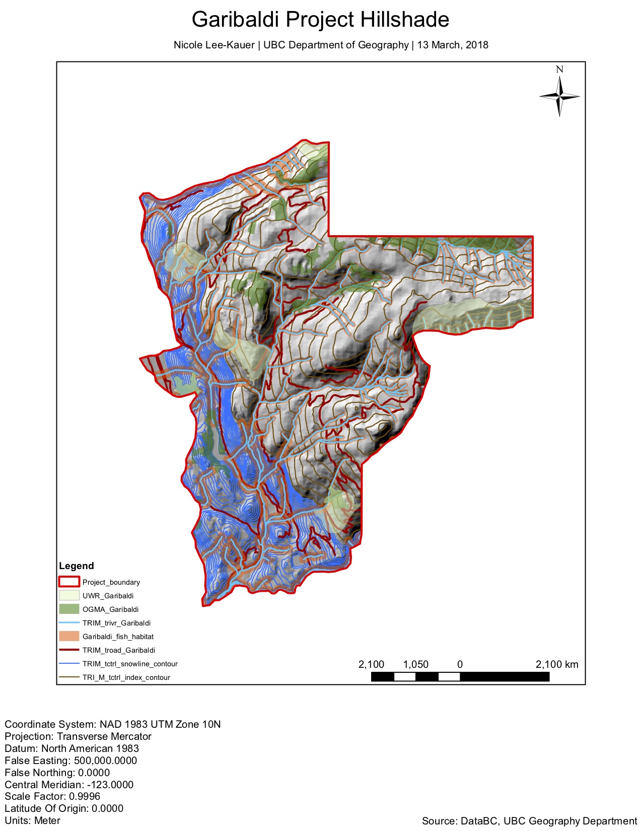
As a result, I was able to identify the key ecological areas in the proposed Garibaldi project. I’ve discovered 38.25% of the project area will directly impact old growth forest, ungulate and fish habitat. Areas that are below 555m elevation have more fish habitat, while areas above that elevation has more ungulate habitat and old growth forest. To address the primary concern, 29.9% of the project is below 555m in elevation.
Through this spatial analysis, there are two problematic concerns that needs to be addressed. Firstly, there are proposed roads that intersect with fish habitat. Secondly, there is one area of old growth forest and two areas of ungulate habitat below 555m elevation. To mitigate both issues, we should change to direction of the roads so that they are running adjacent from the fish habitats. Although this is already the case for most of the roads below 555m, I am particularly concerned about the southern part of the proposed project area.
The roads in this part of the project are within the buffer area. I suggest that we should move them further away from the fish habitat. We can also set up parking spaces on the southwestern part of the proposed area, in efforts to limit number of cars in fish habitat. Moreover, the purpose of this project is to serve as a ski resort. Hence, I believe limiting the number of cars on roads that are close to the protected areas would be helpful in preserving the ecology of the environment.
We should also decrease the number of roads above 555m. I don’t think it is necessary to have too many roads up high because it would be difficult to maintain due to how remote the region is. As for the old growth forest areas and two ungulate habitats below 555m, we should design the ski runs so that they are going around these areas. We can also set the ski lodge and hotels on the southern part of the region, because it is further away from the protected areas.