In this lab, we used data on elevation as well as distance to create a map to determine what parts of Vancouver would be affected by a tsunami.
![]()
The education and healthcare facilities that would be affected by a tsunami in Vancouver are as follows: Emily Carr Institute of Art & Design, Henry Hudson Elementary, False Creek Elementary, St Anthony of Padua, Ecole Rose des Vents, False Creek Residence, Villa Cathay Care Home, Broadway Pentecostal Lodge, and Yaletown House Society. To figure this out, I used select by location, and selected the education and healthcare facilities that fell within the danger zone. I then created new layers to show only those facilities in danger.
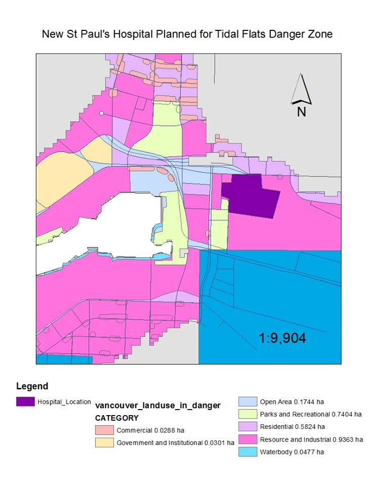
As shown in this map, in dark purple, the proposed new location of the St Paul’s hospital falls directly in the tsunami danger zone. This region is referred to as the “tidal flats” for a reason. It is possibly not such a good idea to build a hospital in this spot, especially considering that Vancouver is due for an earthquake at any time. In fact it would be quite ironic to see a hospital fall right to the ground shortly after being built.