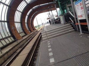
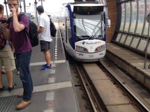
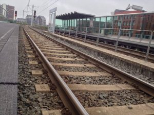
Today we performed a 3.5 hour trip on the HTM trams. Our route went from the Delft station to Nieuwe Plantage through Ypenburg. Ypenburg which is near The Hague was built in the 90’s, so like Houten, we could see how the Dutch built modern cities, the model is called the “VINEX wijken” We then stopped at Leidschenveen. Here there was both the light rail system and the metro system, with the light rail vehicles being on the lower section and the metro being on the higher section. However both trains share the same tracks, it is just that the one rides higher than the other:
Next we went to Zoetermeer, known as a “growth city” (a city near a large city that was expanded because of growth in the large city). It was developed in the 70’s to accommodate for all the growth in the Hague. Next, we went down to the Grote Markt, the Kalvermarkt Stadhuis, Beatrixlaan station, Leyenburg, and then finally stopped at Den Haag Centraal.

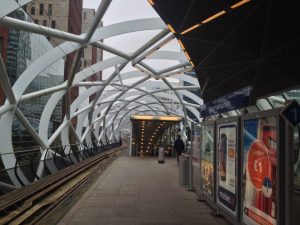
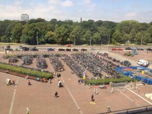
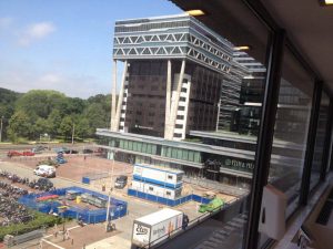
Den Haag Centraal is the main train station in the Hague, although it is also a bus station, light rail station, subway station, and a tram station. Also, there is a ton of bike parking, so Den Haag Centraal is a very multi modal facility.

At Den Haag Centraal, we went up to the HTM office and were lectured by two guys from HTM about their company and public transportation in the Hague. The HTM company supports 171 million passengers per year and employs 1900 employees. They take car of the LTR, trams, busses, and private transport in the Hague. During the lecture, we were swamped with a lot of information, the following are some key points I picked up from the first lecture:
- local municipalities plan local transit and land use while regional provinces plan regional transport and land use
- every 7-10 years, people reconsider their mobility needs
- location defines vehicle ownership (if you live in city centre, maybe owning a car is not necessary)
- LTR (light rail transit) was developed in the 90’s, it’s much more direct and fast than the heavy rail trains
- eventually they want to extend a tram line from the Hague all the way to TU Delft (by 2020)
- OV chip card (for all public transportation methods) was introduced in 2001
- In the Netherlands, every door needs to be within 400 metres of a transit stop – I thought this was amazing, what a way to plan!
- there are approximately 60 million bikes in the Netherlands, so with a population of only 17 million, there are more than 3 bikes per citizen
After the first lecture, we participated in a group discussion regarding where we presented which city we thought had the best transportation. My group decided to go with Berlin, as it has every single mode of transportation needed which are all really well connected (multi modal stations). Berlin has the Strassenbahn (street cars / trams), Ubahn (underground metro), Sbahn (above ground light rail which goes in a circle around Berlin), busses, ICE trains (high speed connecting to a bunch of large cities in Europe), and last but not least, bikes. I was in Berlin in the beginning of June and really appreciated how easy it was to navigate around the city using the above integrated systems. I rode my bike around the city and found it to be quite convenient, and I felt safe riding around there as there were bike lanes and paths throughout most of the city. Also, in Berlin, there is no OV chip system, you just have to have the card in your pocket and you will randomly get checked if you have your pass, the fines are expensive enough that you will want to make sure that you have a pass. I prefer this to the OV chip system because you don’t have to constantly take out a card and scan it every time you get on and off a transportation vehicle. Finally, most of the transportation in Berlin runs 24 hours a day, so it is really easy to get around in the middle of the night which is nice for weekends.
After this exercise, we had another lecture regarding the data systems that HTM uses to monitor everything about their systems and ultimately try to make it better. Again, this lecture was jam packed with so much interesting information that I will summarize below in point form:
- a program called “tableau” is used a lot for their data collection and organization (supposedly it is really good)
- average trip length with HTM is 4 kilometres
- every vehicle’s movement is tracked on their ov radar page
- for a successful public transit system, you want to make sure that the public transit mde is the fastest compared to other modes
- KPI’s (key performance indicators) are monitored and data collected to ensure that the system is running at it’s best
- They survey the public annually and use the data to better their service
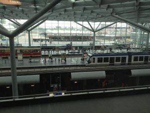
Below are some pictures from the office buildings of HTM inside Den Haag Centraal station: