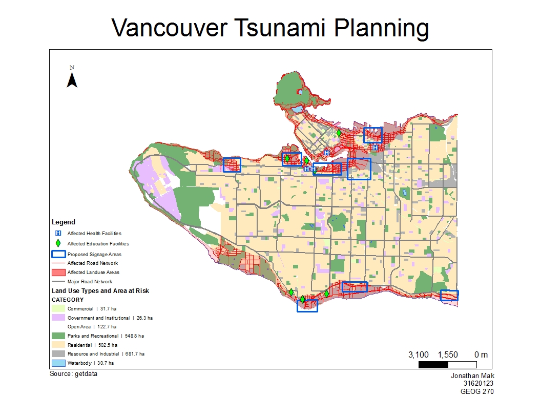
After completing an analysis of the data, I have determined that 14.8% of the area of Vancouver is in danger in a tsunami scenario. I determined this by using tools to determine areas that are at risk with elevation and other spatial information and overlaying it on Vancouver as a whole.
Education and Health facilities that lie in the danger zone:
Educational Facilities in Danger:
a. Emily Carr Institute of Art and Design
b. Institute of Indigenous Government
c. Henry Hudson Elementary
d. False Creek Elementary
e. Vancouver Montessori School
f. Heritage 3R’s School
g. St. Anthony of Padua
h. Ecole Rose des Vents
Health Facilities
a. False Creek Residence
b. Villa Cathay Care Home
c. Broadway Pentecostal Lodge
d. Yaletown House Society
Accomplishment Statements
- Gained practical knowledge is combining tabular and spatial datasets to acquire useful information.
- Learned how to use ArcMap’s Overlay tools to extract datasets and combine vector data layers (intesect, clip)
- Gained knowledge on feature classes, including making new ones and editing existing ones.