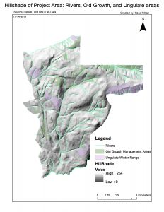
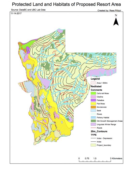
The proposed project is an environmental assessment of the Garibaldi at Squamish project. The project aims to build a year-round mountain resort on Brohm Ridge over 20 years. I have been retained as a natural resource planner by the British Columbia Snowmobile Federation (BCSF) to do said assessment. Current opposition to the project is based on concerns of environmental impact and climatological considerations due to climate change over the last 40 years since an initial report was given from Resort Municipality of Whistler in 1974.
Obtaining area data from DataBC and UBC lab data, I created a GIS to evaluate these concerns. The GIS included elevation data, endangered species, old growth forests, ungulate winter range, streams/fisheries, and local infrastructure (mainly roads). I cut the data to fit the proposed project area to only represent the things the project would have a direct impact on. With the frame set, I found how much area was below 600m in elevation to check the concerns of poor skiing conditions at this level due to climate change presented by the Resort Municipality of Whistler. Next, I found the total area of each endangered species in the area as well as the total area of Old-growth forests and the ungulate winter range. With these areas delineated on the map, I mapped the rivers and added a buffer of 50m around rivers above 600m and 50m for rivers below 600m to show the protected area around these rivers. The percent of the total area for each concern was then calculated. 6.78% of the total area has old growth forests. Mule Deer habitat accounted for 4.24% of total area, and Mountain Goat habitat claiming 3.65%. Red-listed ecosystems accounted for the second most project area at 24.8%. Fish habitat/streams and the protected area surrounding them totalled 13.35%. Total project area under 600m elevation was 31.8%.
Upon viewing the final map, two large concerns are building a large amount of resort infrastructure when a majority of the area is covered in protected ecosystems, and elevation. A majority of these ecosystems are below 600m in elevation, so a solution would be to build higher, especially since the snowpack at that level wouldn’t yield great skiing conditions. The remaining area is cut by roads and protected rivers. A solution would be to strategically plan the resort, chairlifts, etc. around these areas. It would limit creativity, but it is possible.
In conclusion, the proposed project area contains a lot of protected land and ecosystems. It is still possible to execute, but the time and resources used to appropriately build around these areas could become very costly.
Personally, I believe the project should be allowed to continue. Resort runs and chairlifts can be built around and over protected areas. The resort itself can be placed on a plot of land open enough for its footprint, and away from protected land.

