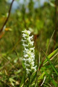
Through the course Advanced Geographic Information Science (GEOB 370) I solidified my conceptual and technical understanding of integral GIS concepts and practices while simultaneously refining my skill-set to solve complex multifaceted problems with ArcGIS. I used least-cost path analysis to optimize routing of a power-line through Vancouver to supply power to a greenhouse, performed a multi-criteria analysis using Digital Terrain Models to locate potential survey areas for a rare species of orchid and evaluated spatial autocorrelation and the Modifiable Areal Unit Problem (MAUP) for census data to identify patterns in crime in Vancouver.