Case Studies
The parks and open spaces in this study were selected due to their stark contrast from one another. Examining the sizes, existing amenities, variety of terrain, canopy cover and infrastructure the study hopes to provide ample descriptions and data for architects, landscape architects, and urban designers to reinforce existing public spaces to better serve as spaces of refuge during an earthquake disaster.
The case studies include:
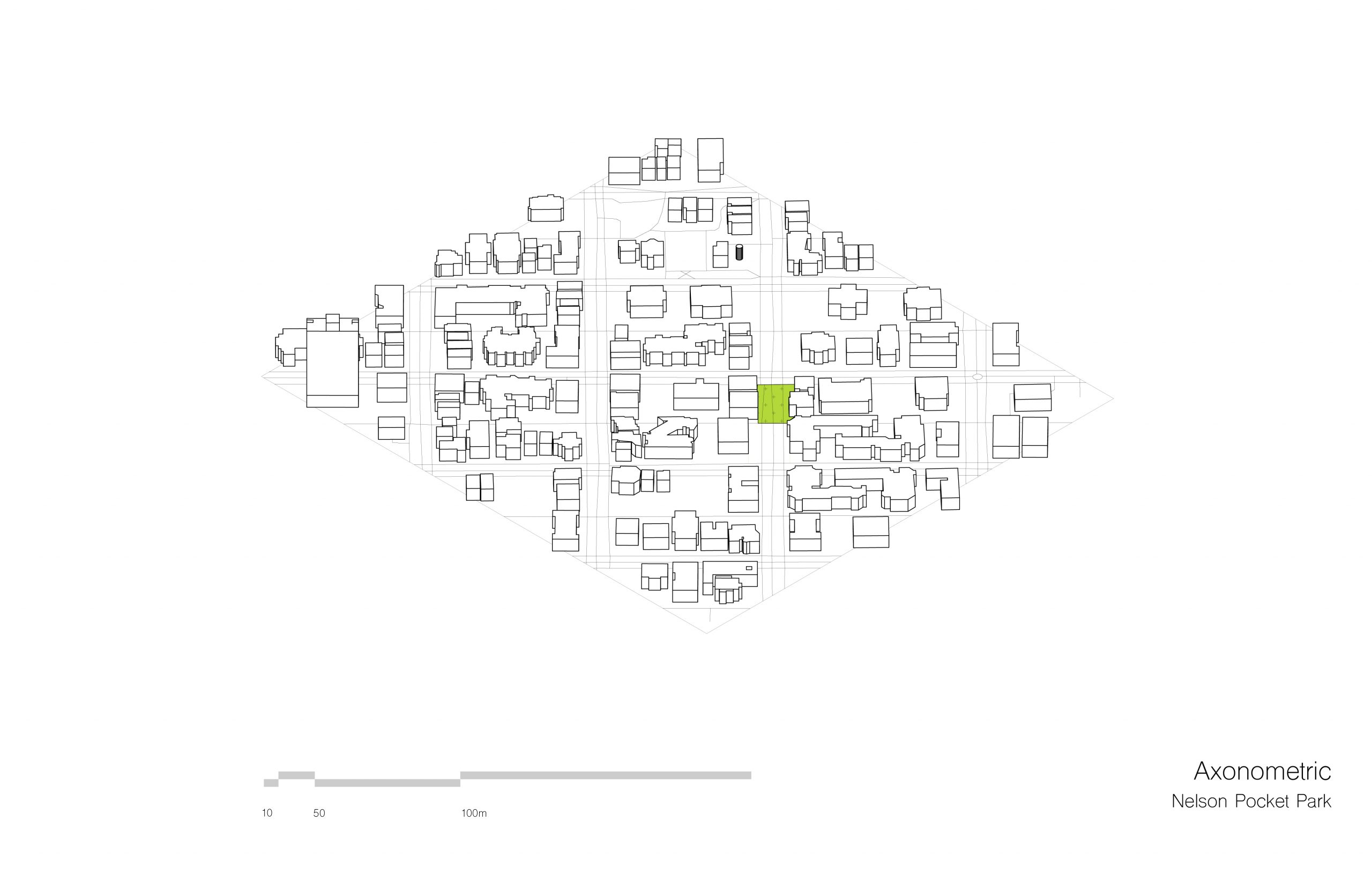
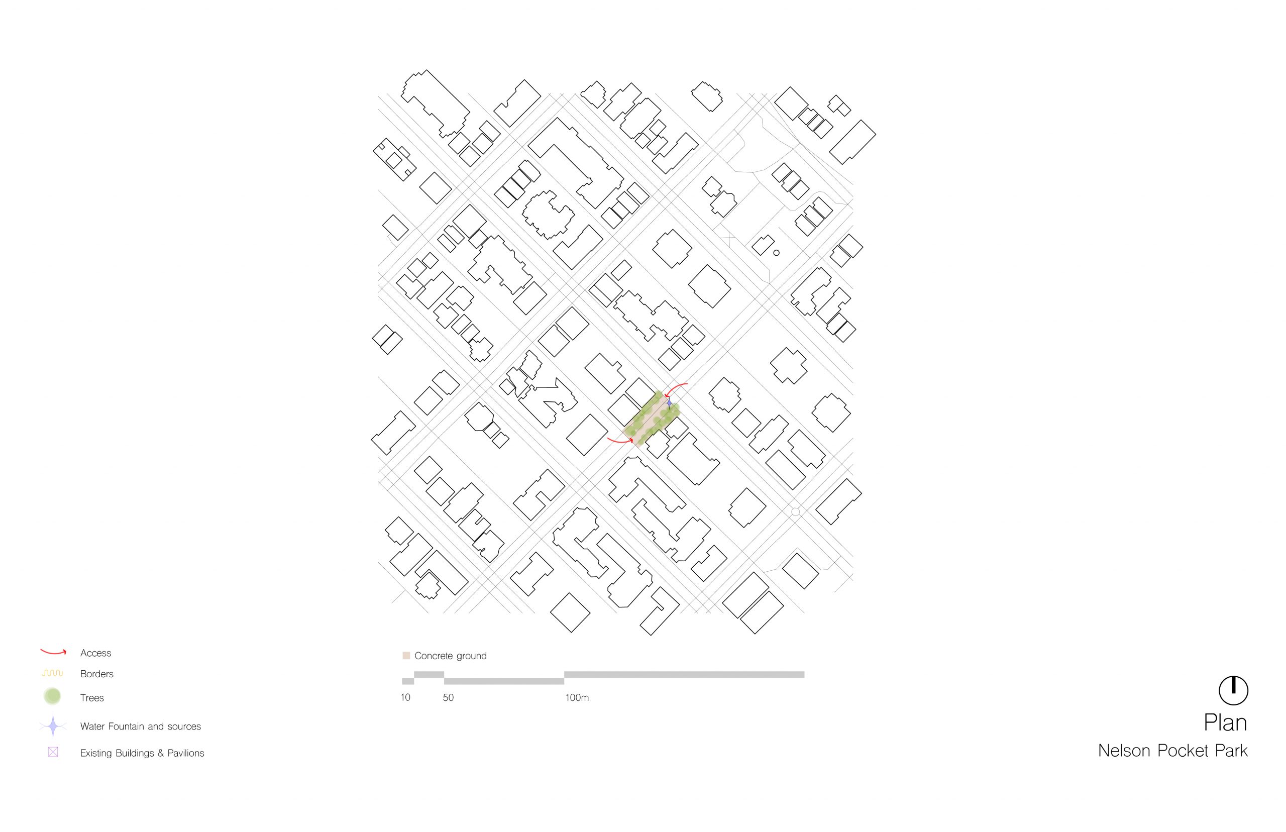
Nelson Pocket Park (West End)
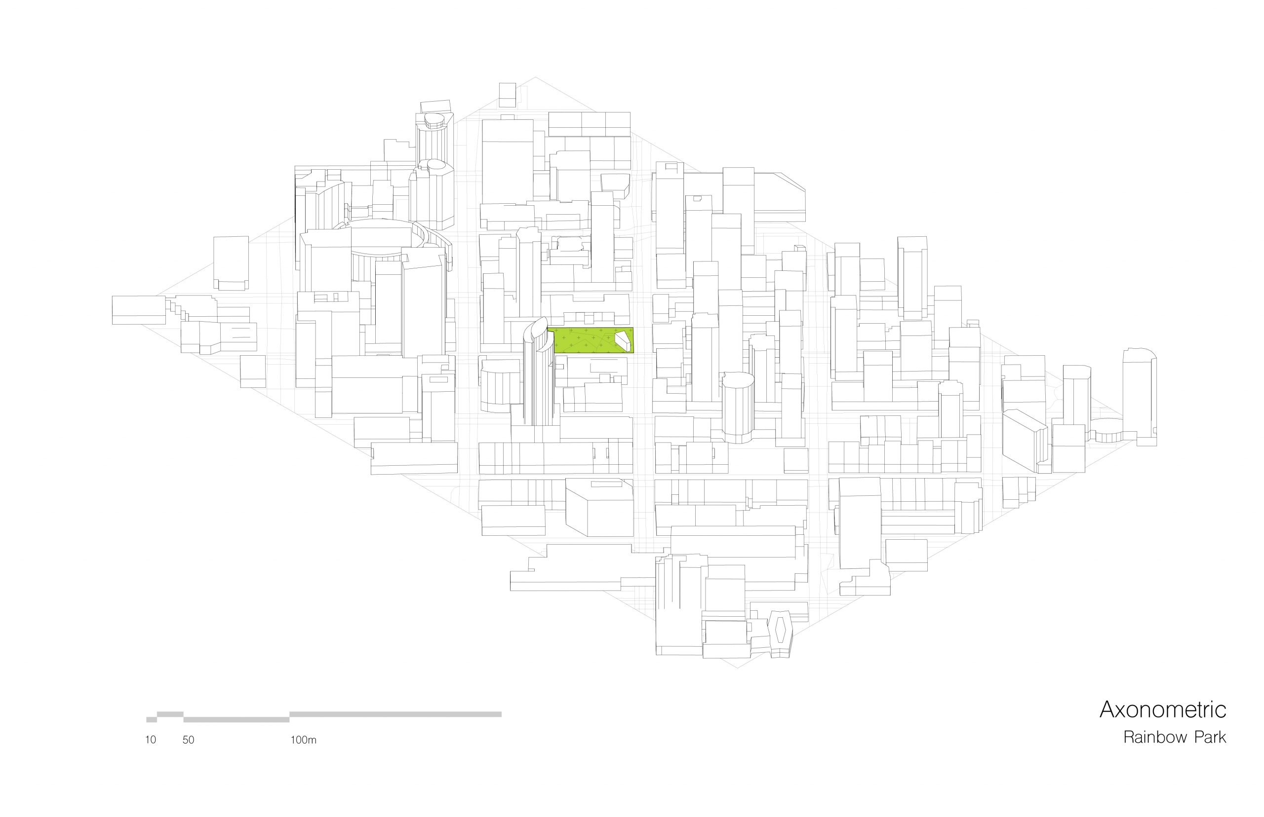
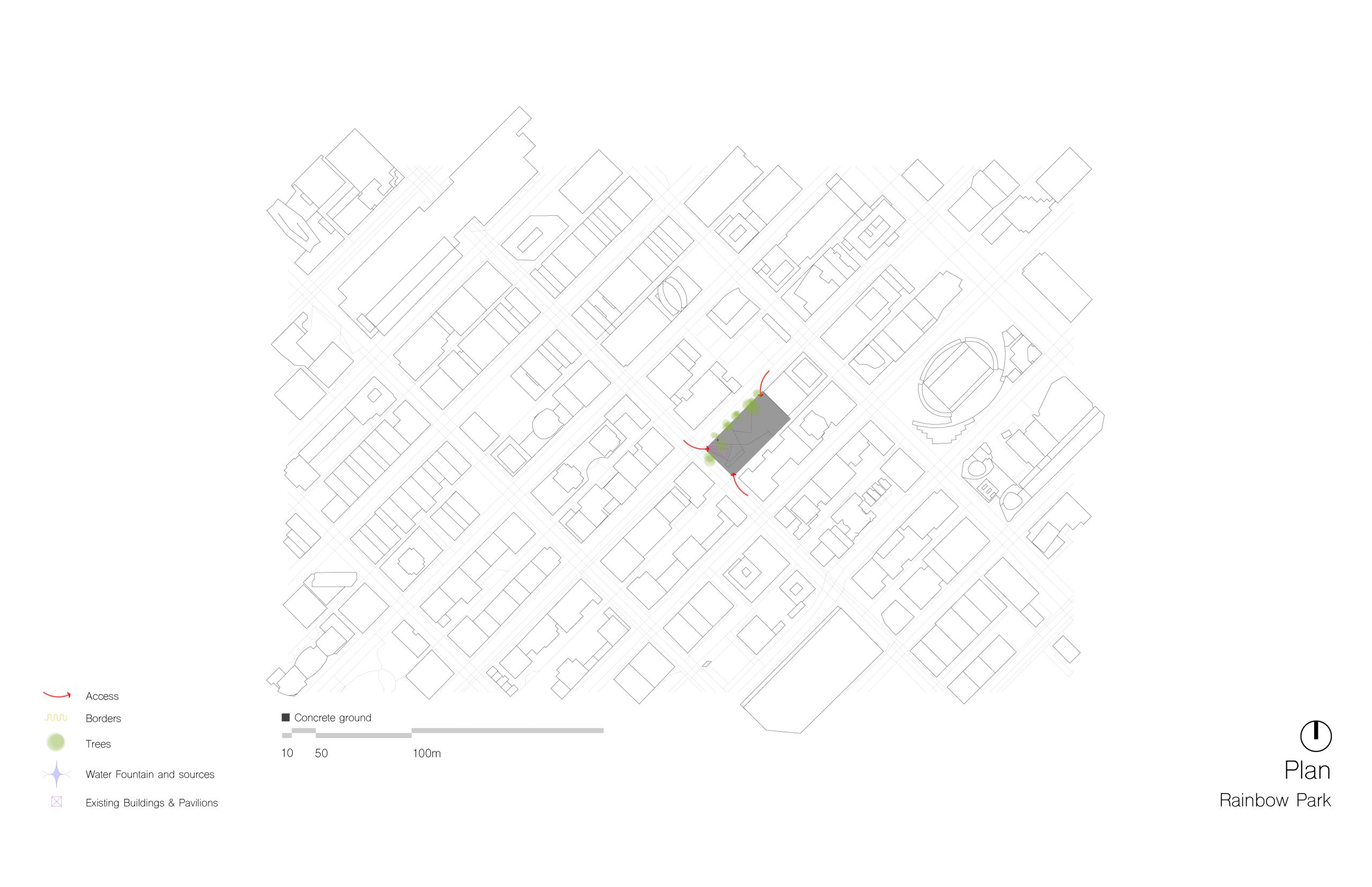
Rainbow Park (Downtown)
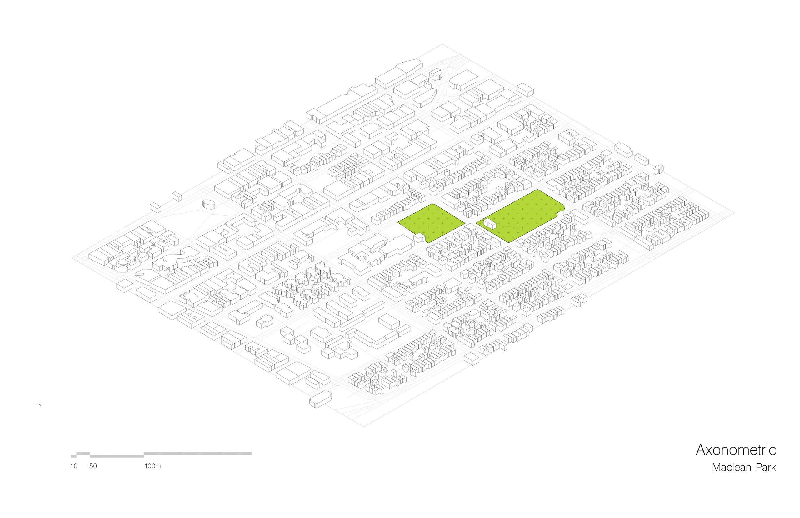
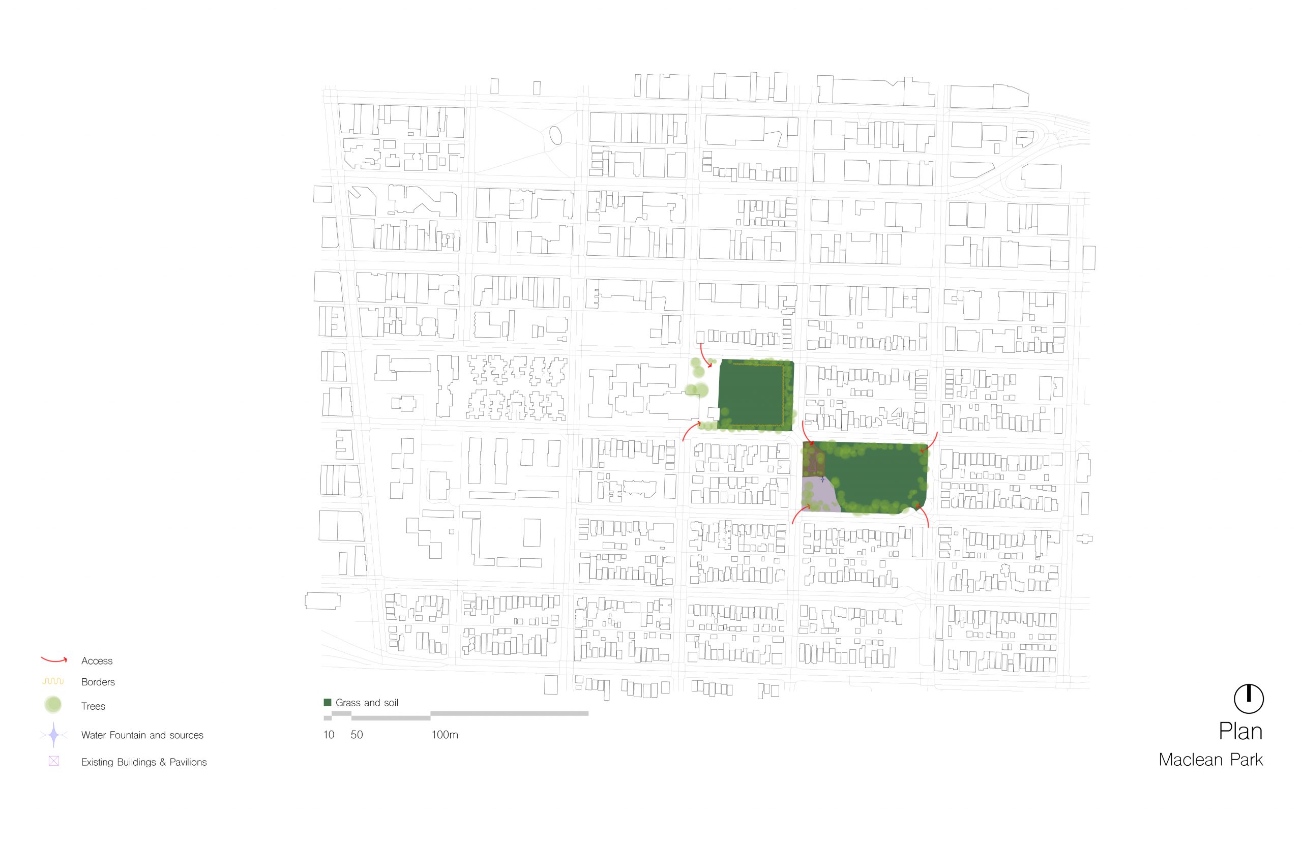
Maclean Park (Strathcona)
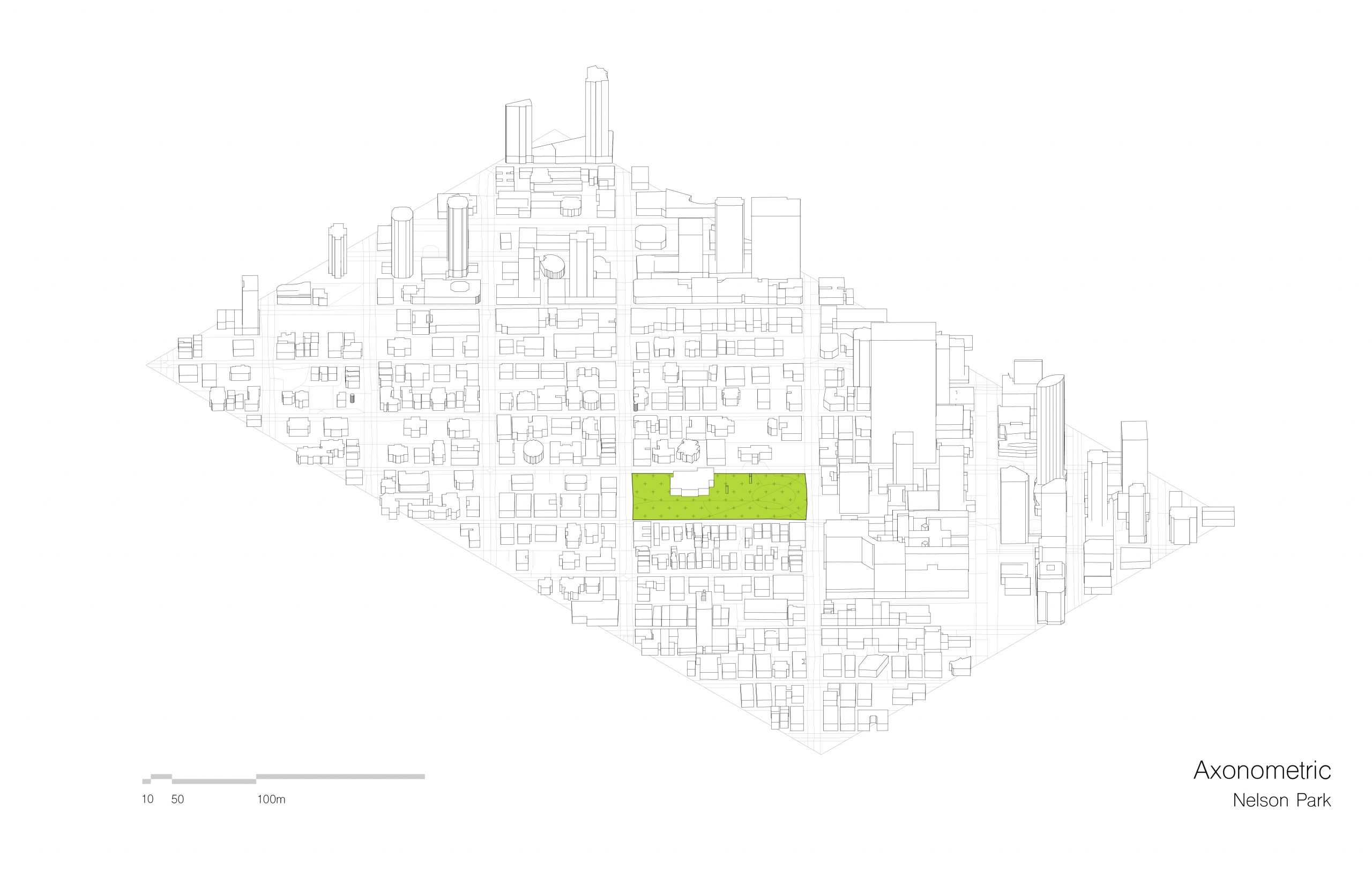
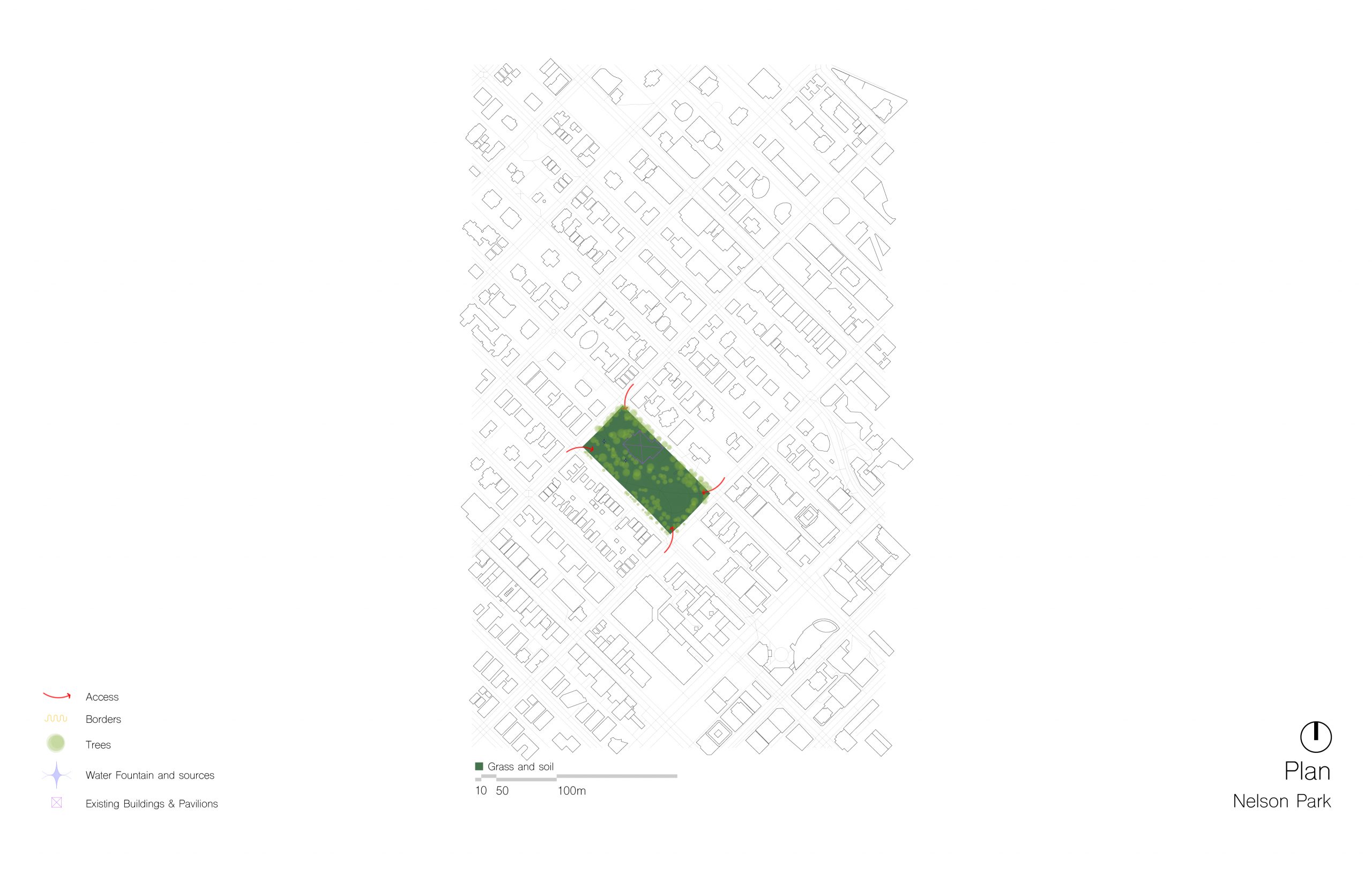
Nelson Park (Davie Village)
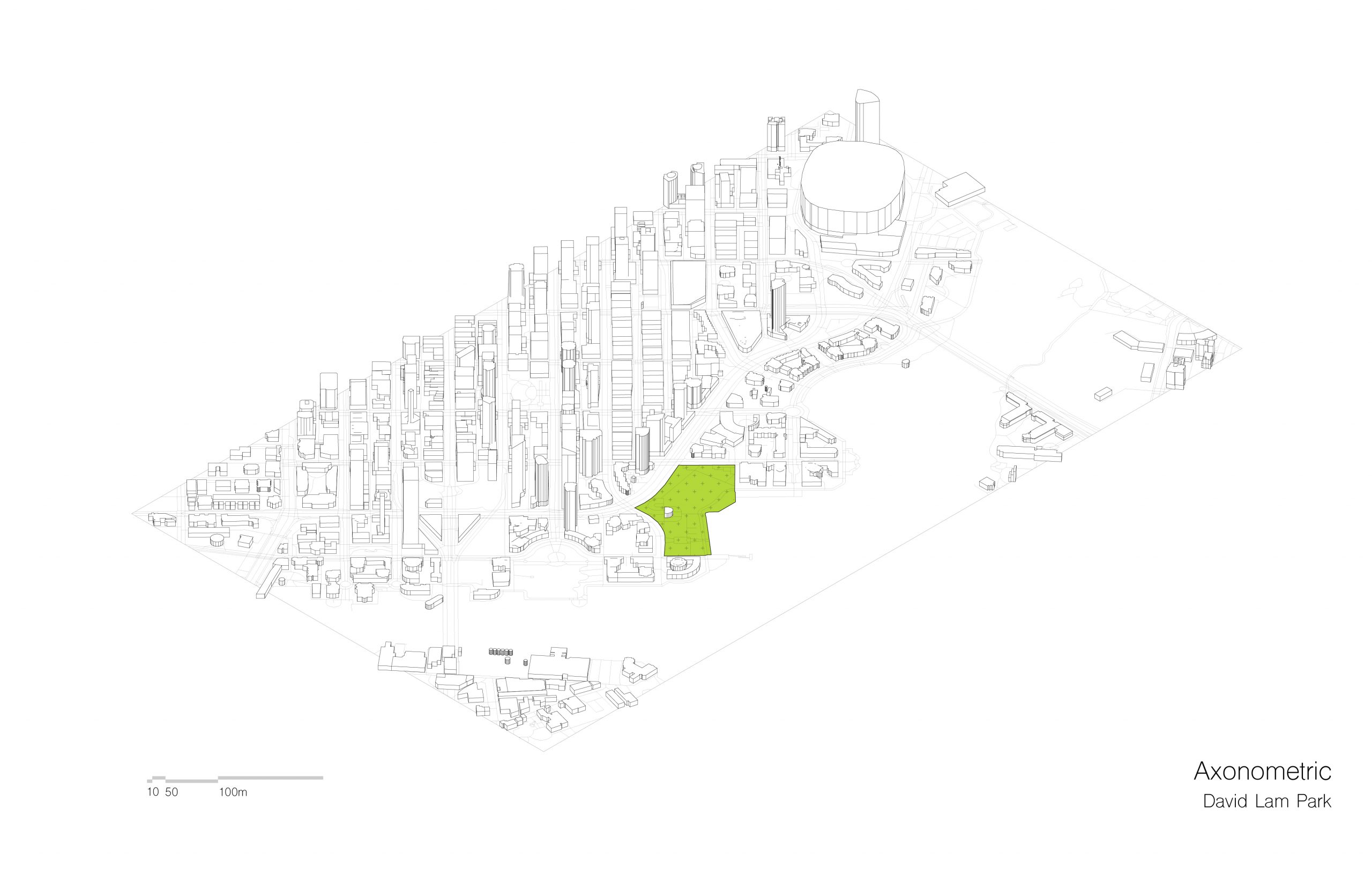
David Lam Park (Downtown)
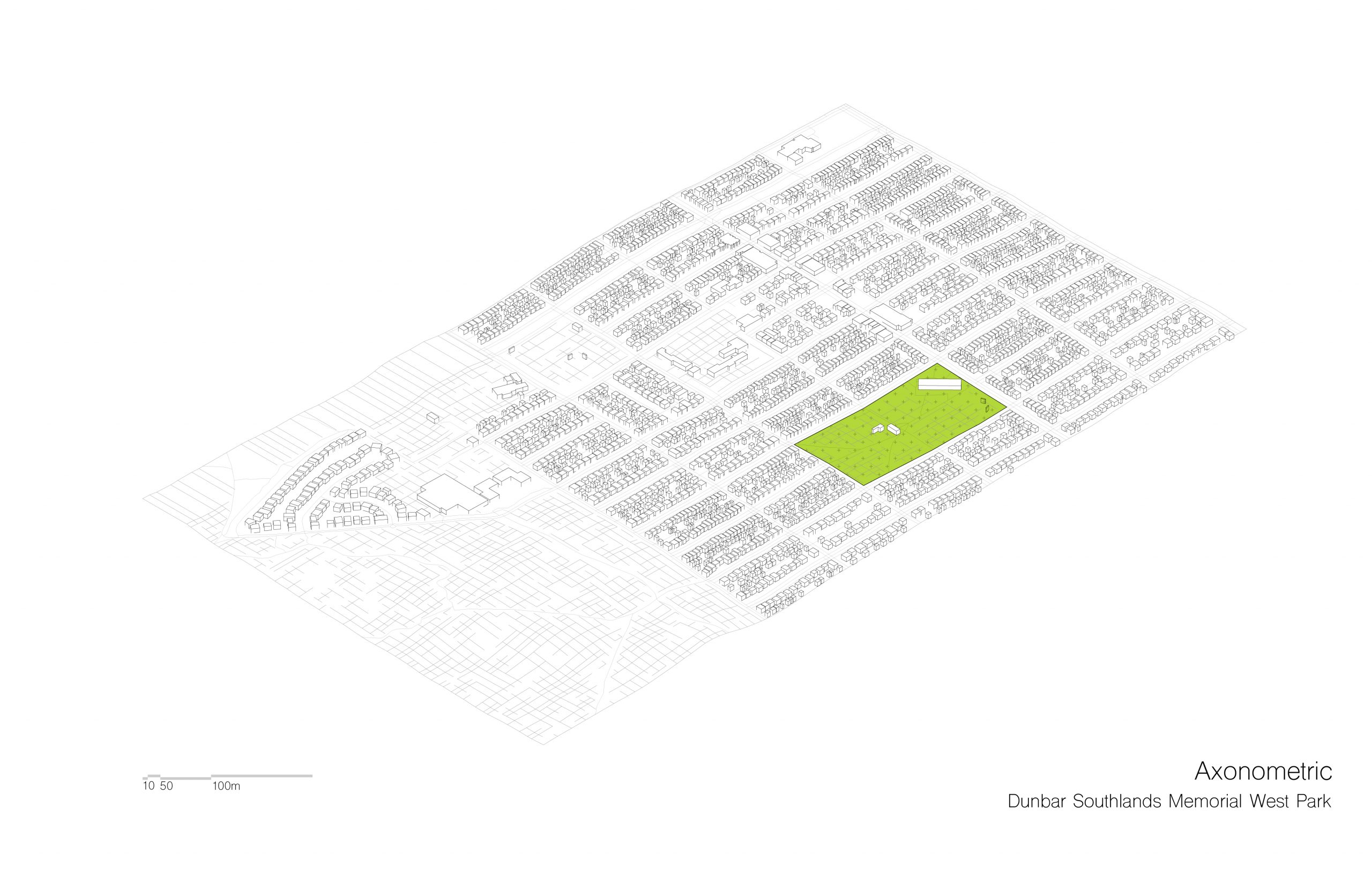
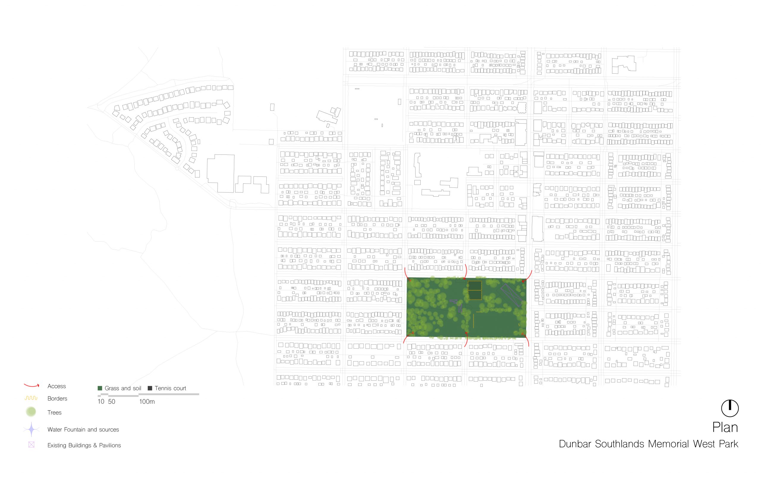
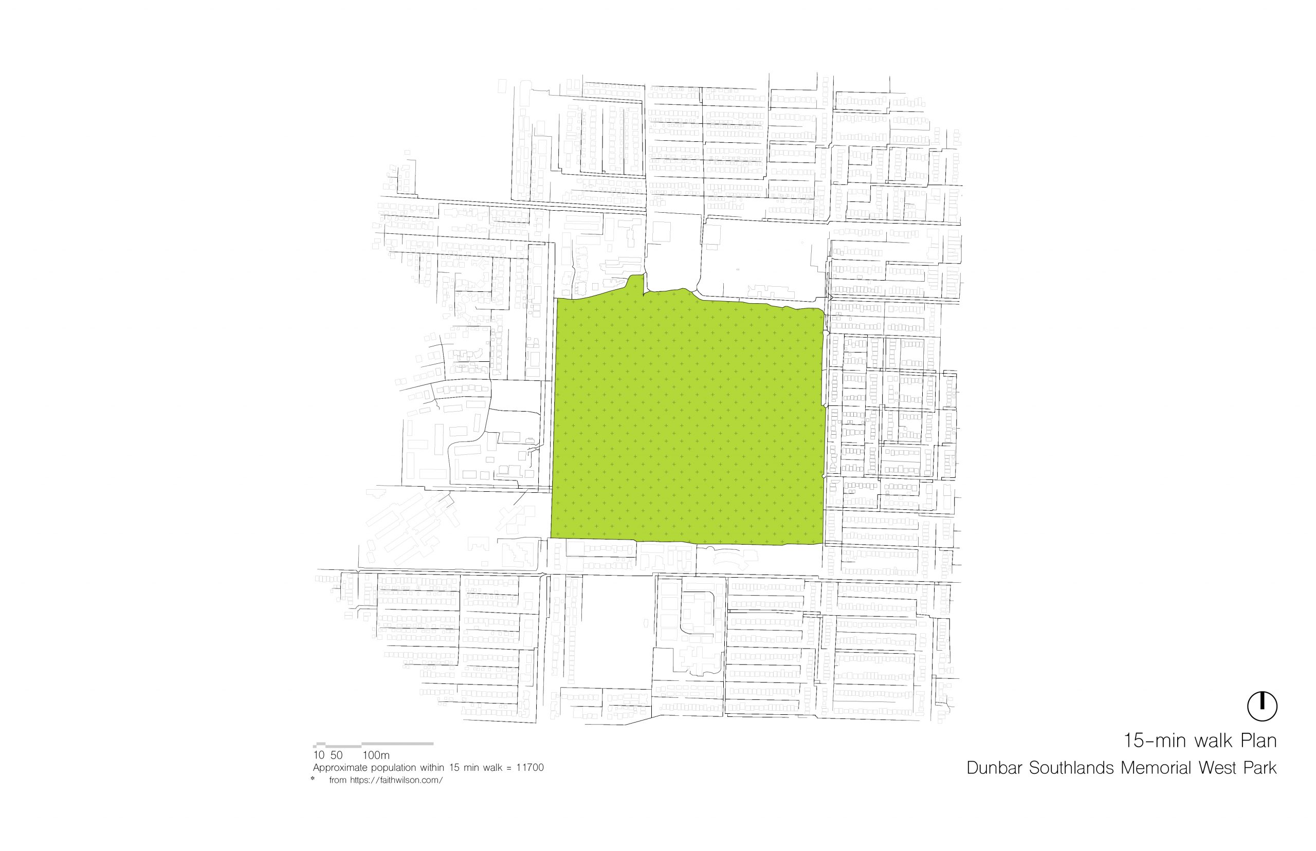
Dunbar Southlands Memorial West Park (Dunbar-Southlands)
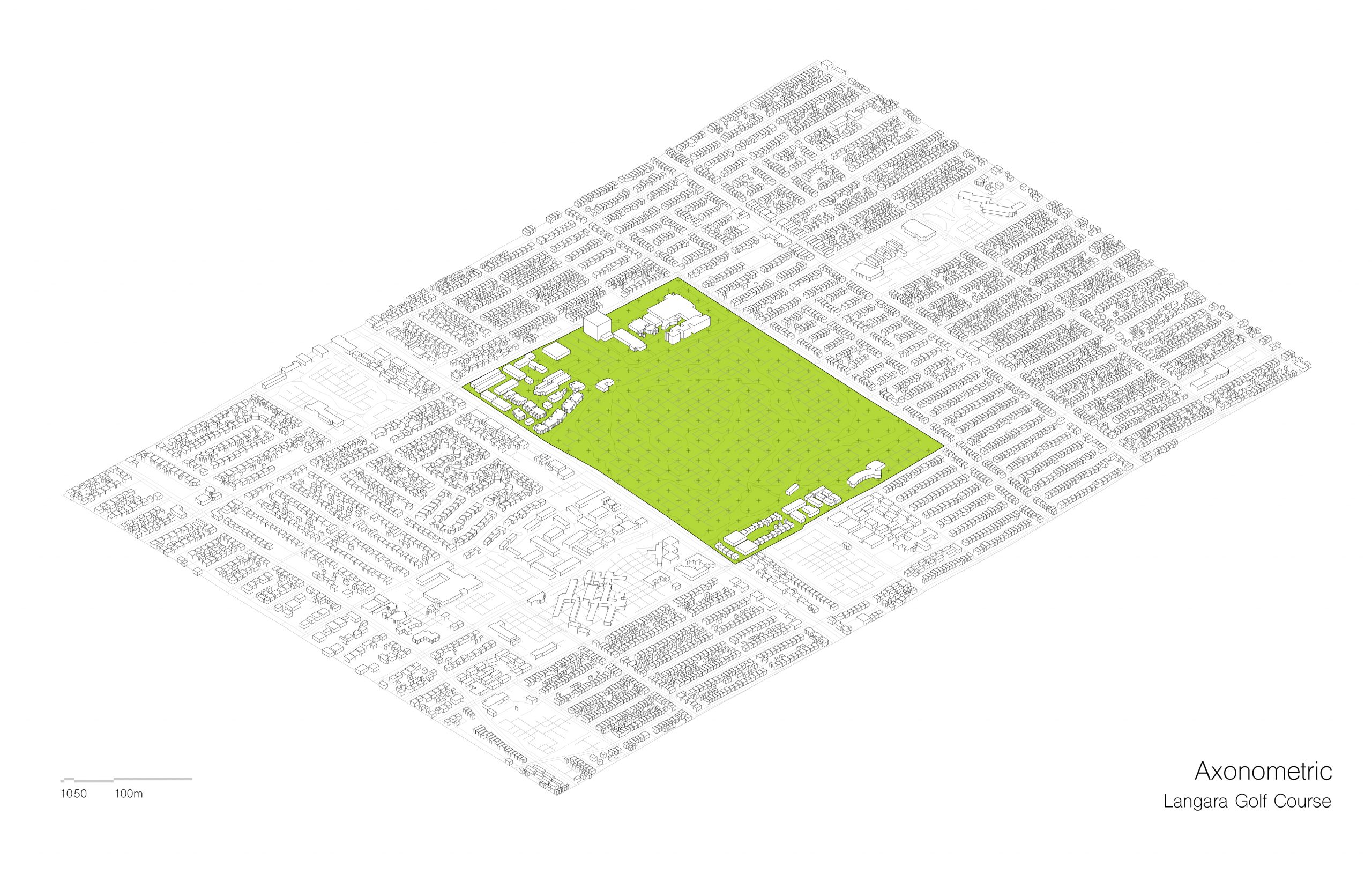
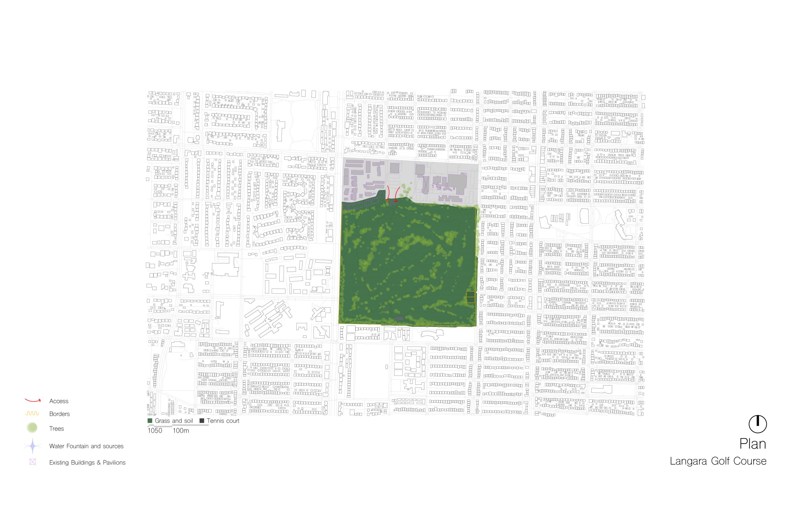
Langara Golf Course (South Vancouver)
Park Features and Accessibility
Vancouver’s aspiration for ‘a park within a 15 min walk’ serves as a large-scale landscape and urban design goal to increase the liveability and walkability of the city as well as its green networl. It inadvertently plays into Earthquake mitigation and open space refuge post disaster. Before building criteria and suggestions for park shelter design, we used LiDAR and GIS info to compile the existing amenities of the selected open spaces. By examining the terrain and accessibility of the parks we are able to predict the ease and viability for a park to be transformed into a public disaster response zone.

Building facades and open space
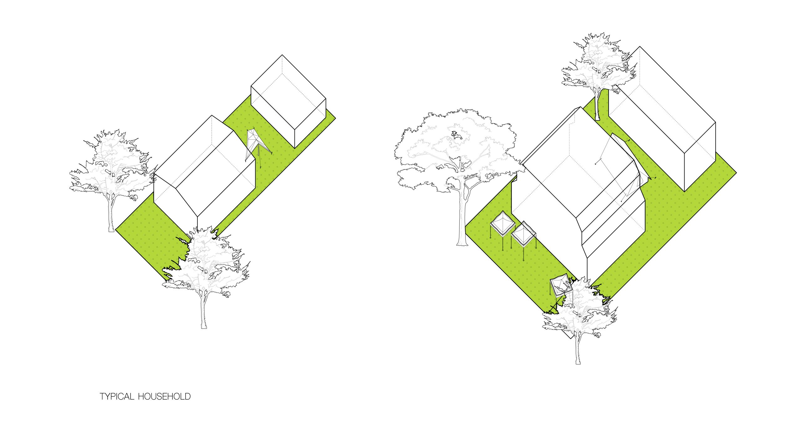
During an earthquake facades and balconies are highly susceptible to ground motion and have a high potential to fall down onto the ground below. We charted and compared the average relationship from low to high rise buildings with balconies, suburbs and Vancouver specials to various streetscapes and adjacent parks, the elevations aim to show a correlation to vertical debris on the urban landscape. Through examining bylaws, we have illustrated the required distance for a lawn, average suburb home, backyard and laneway based on zoning requirements. A collapse of laneway houses could unfortunately cut off ease of access through alleyways.
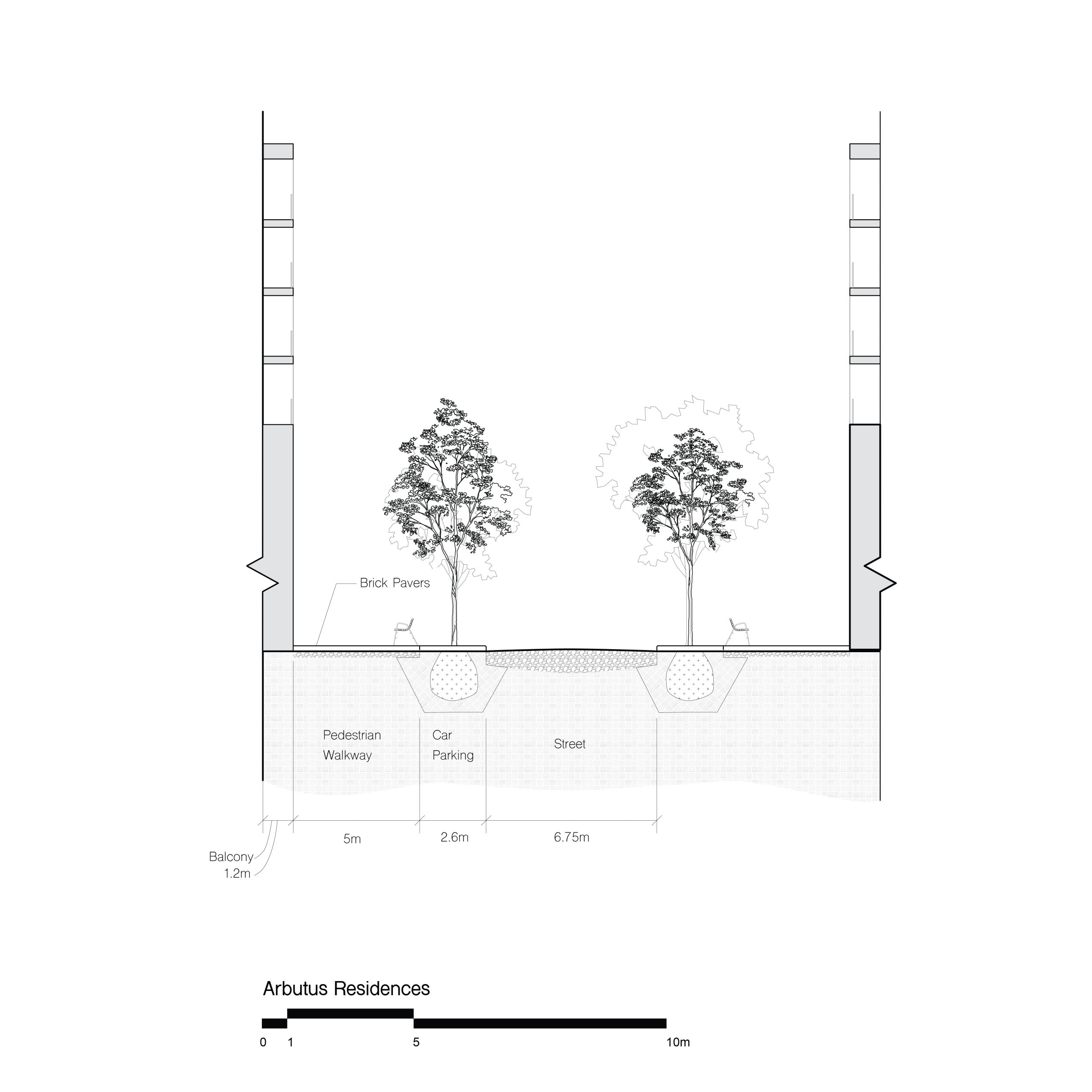
With a few examples in downtown where a mid to high rise building is directly adjacent to an open space, it is hard to approximate the horizontal distance from the debris and dust. The legal width of a street may provide enough of a distance between dust shot up into the air but this is totally dependent on what falls and the height of a building that collapses from the earthquake.
Neighborhood Typologies
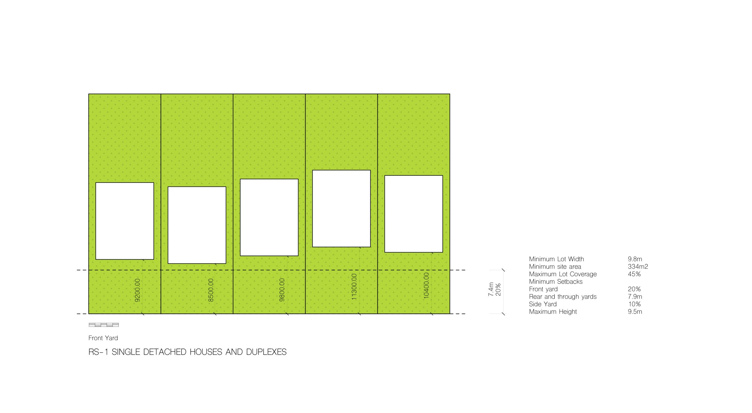
The typologies for buildings are sectioned into low rise (Vancouver special), mid-rise, and high-rise, and can be applied to the parks based on the neighborhood in which they reside. Vancouver’s by-laws regulate the distance of streets, sidewalks, lawns, typical building lots and alleyways.
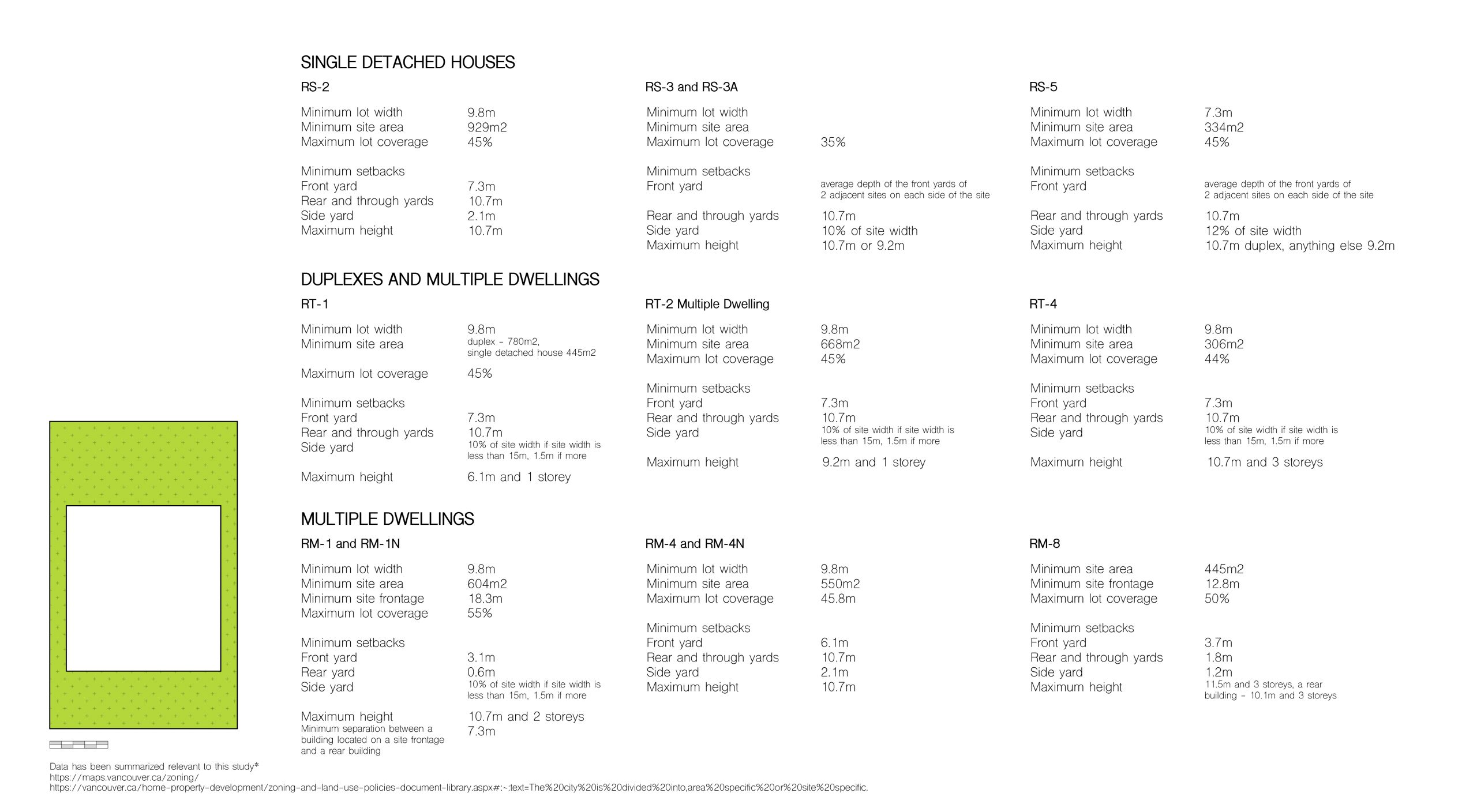
A summarized data of different zoning requirement in the City of Vancouver. It articulates how much open space surrounds a typical building in Vancouver.
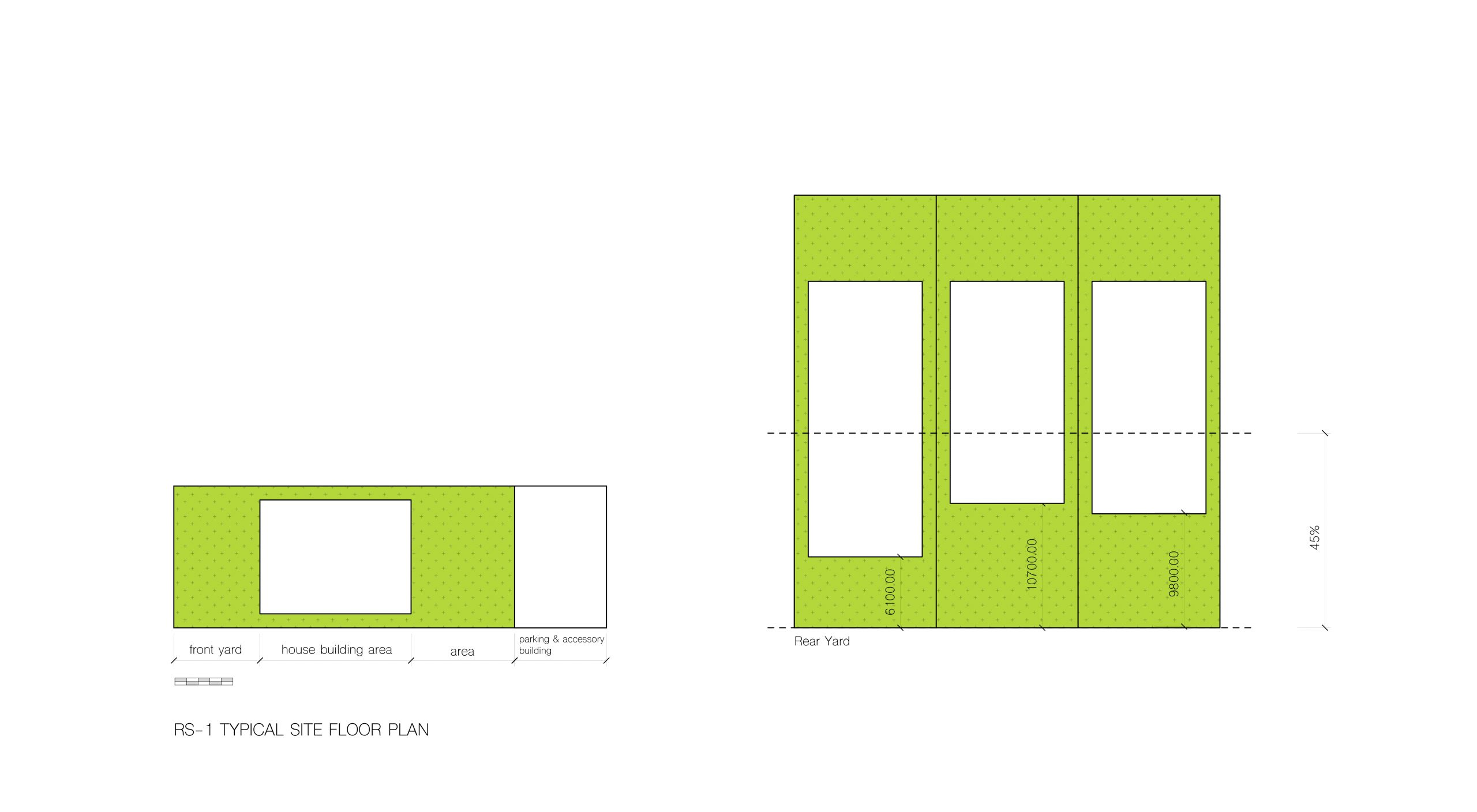
Zooming into RS-1, we see the minimum front yard space.
Zooming into RS-1, we see the minimum rear yard space.
With the typical zoning dimensions we envisioned how tents could be set up immediately after an earthquake. Front and rear yards could play an integral role in post-earthquake residence.
Walkable Distance (15mins)
Using data from various studies on the average walking distance, this diagram may help understand the varying difference between what the City of Vancouver deems “a park within 15 minutes”. These diagrams also serve as an estimate of the average number of people these case study parks will serve during an earthquake event.
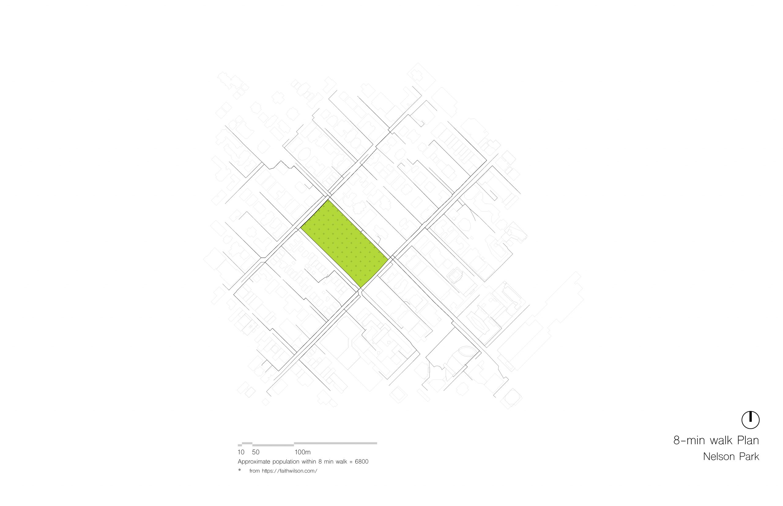
Nelson Park, 8 minute walking distance.
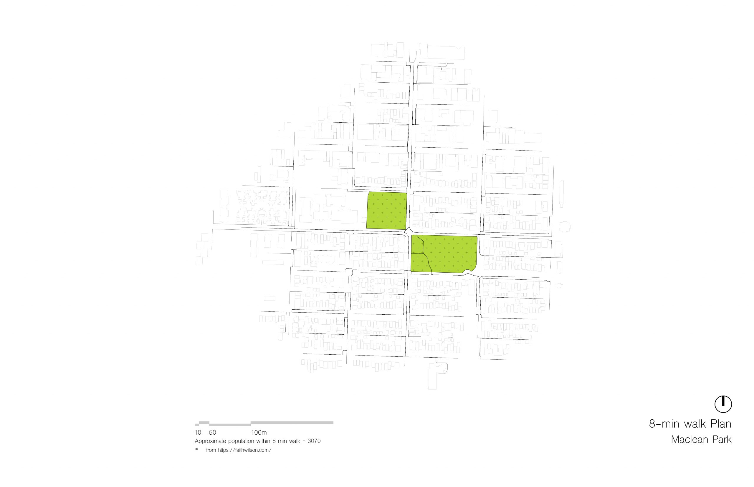
Maclean Park, 8 minute walking distance.
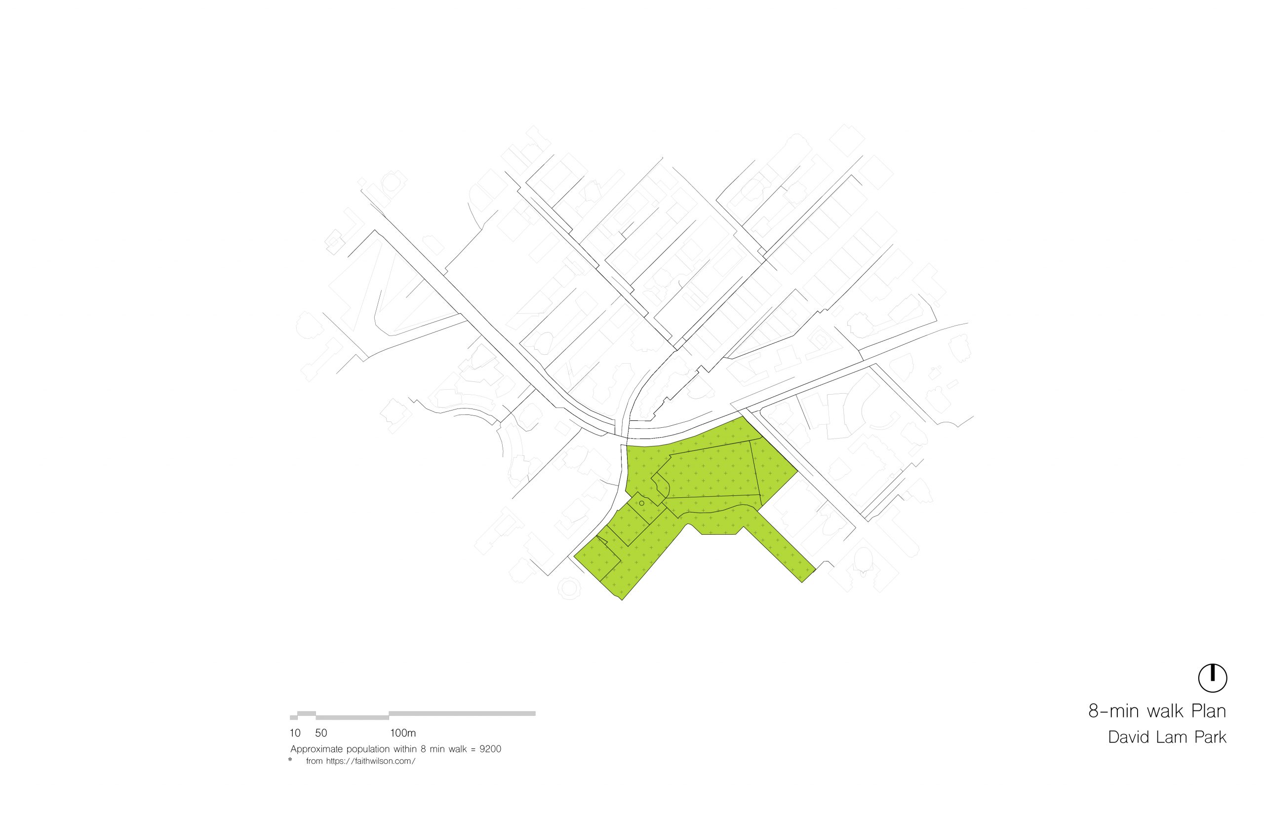
David Lam, 8 minute walking distance

David Lam, 15 minute walking distance (bottom)
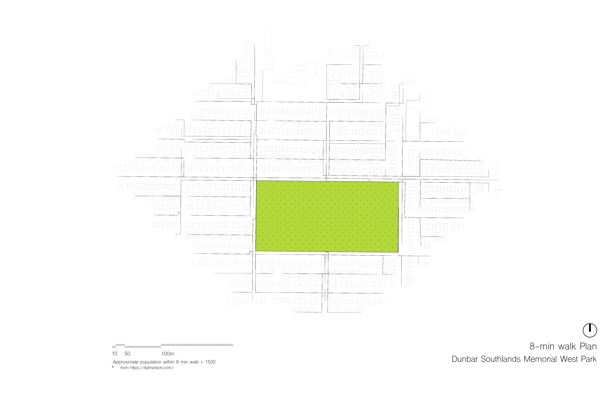
Memorial West Park, 8 minute walking distance (top)
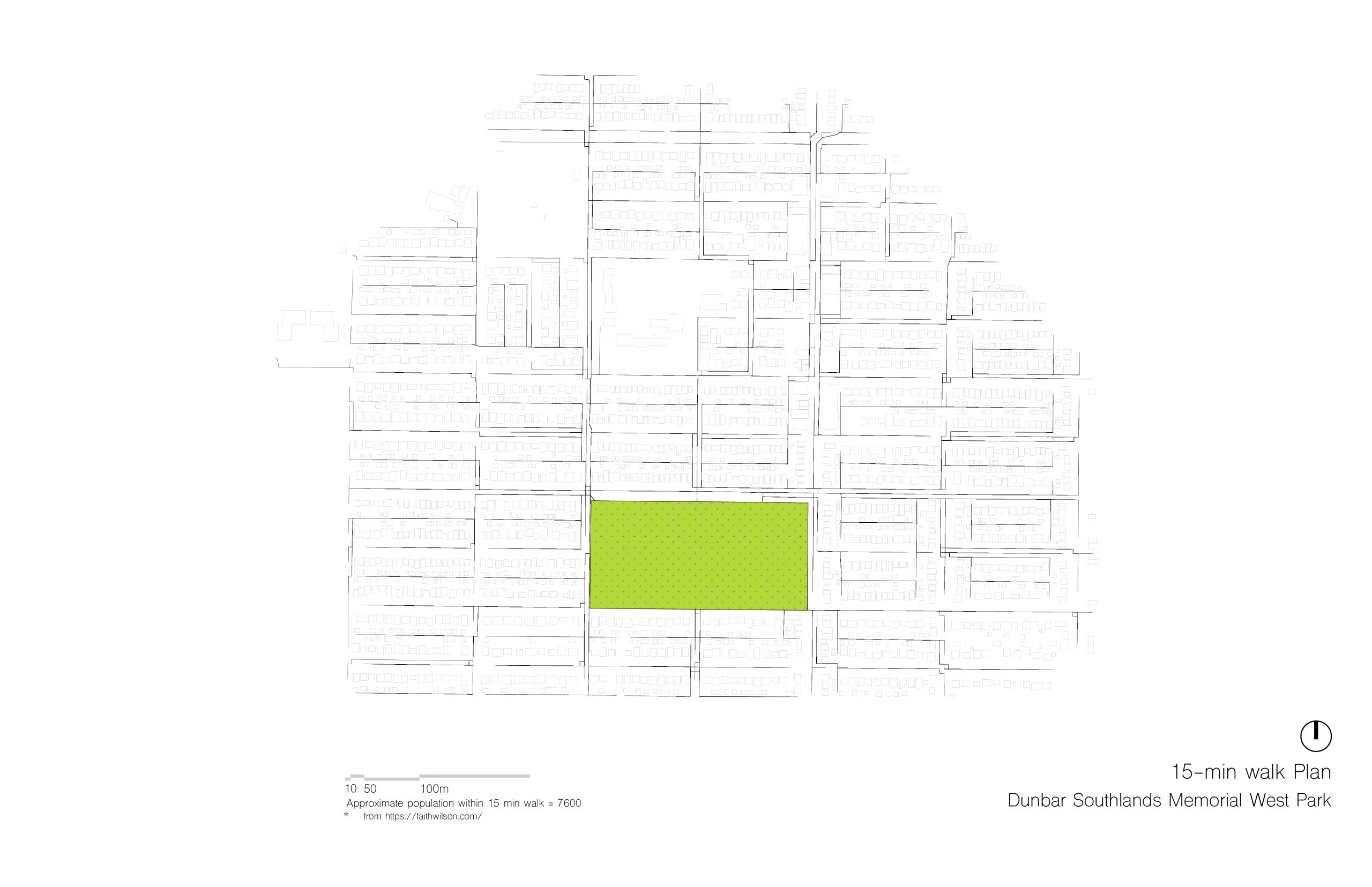
Memorial West Park, 15 minute walking distance (bottom)
Langara Golf Course, 15 minute walking distance.