Planning for a Tsunami
The objective of this class project was to produce a map that evaluates areas in the City of Vancouver (including University Endowment Lands) that are most at risk from potential Tsunami attacks. Outcome of this project are as follow:
- Performed basic geographic analysis by using ArcToolbox functions on ArcGIS to extract data information on regions and facilities affected by a potential tsunami.
- Gained knowledge on high risk areas, infrastructures and land use in the City of Vancouver through combing different Tsunami risk assessment data layers onto one map and highlight concerning neighbourhoods.
- Analysed tabular datasets and calculated statistics of the City’s land use, roads and important facilities that would in danger under a possible tsunami event.
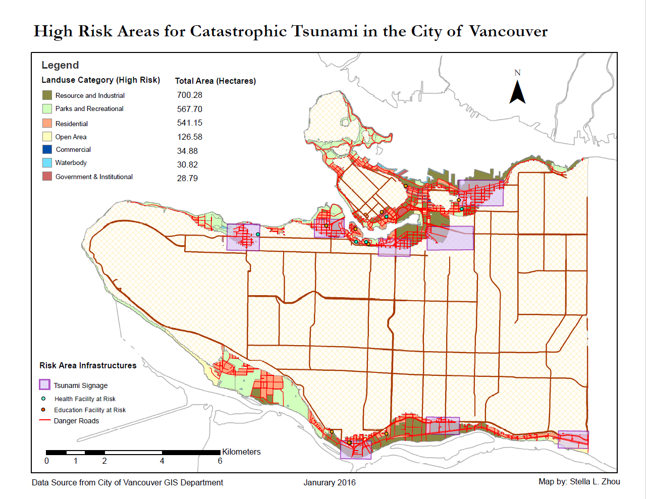
Based on statistical calculation, the total area of the City of Vancouver (including University Endowment Lands) that would be at risk during a potential Tsunami event is approximately 2030.21 hectares, which is around 13.5% of the total assessed land area. High risk areas are highlighted on the map for future Tsunami signal installation.
The major Health and Education facilities that would be at risk during a potential Tsunami are as follow:
- Emily Carr Institute of Art & Design
- Institute of Indigenous Government
- Henry Hudson Elementary
- False Creek Elementary
- Francis Xavier
- Vancouver Montessori School
- John’s International
- Heritage 3R’s School
- Anthony of Padua
- Ecole Rose Des Vents
- False Creek Residence
- Villa Cathay Care home
- Coast West Community Home
- Broadway Pentecostal Lodge
- Yaletown House Society