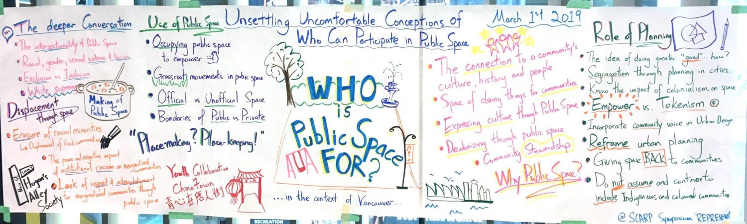
This section collects some of the infographic and interactive maps I have create for school projects and for non-profit organizations. Infographics and interactive maps are great ways to visually communicate certain topics in an interesting and effective way. It is engaging and can even be designed to be highly interactive and informative. Utilizing these during community engagement sessions and public open houses can allow members of the public better understand complex planning issues in a visually impactful way.
I enjoy creating infographics and I often use Adboe Illustrator and InDeisgn to produce the final products. For Interactive maps, I use CartoDB and ArcGIS to achieve my goals.
Please click on each drop down tab to check the projects.
