In 2016, the City of Vancouver purchased the Arbutus Corridor from the Canadian Pacific Railway (CPR) Company to create a Greenway that serves as the north-south transportation corridor that will meaningfully connect people, parks, and places from False Creek to the Fraser River. This Greenway project also aligns with Vancouver’s Healthy City Strategy Action Plan (2014) on providing safe, active, and accessible ways of getting around to help increase physical activity levels. The Greenway is currently going through some major changes and the city has recently released a design strategy that would continue to shape the Greenway’s structural characteristics in the coming years. As a crosscutting north-south 9 km corridor, many people will be affected by its transformation.
I have previously worked as a research and project assistant at the Cities, Health and Active Transportation Research Lab (CHATR) lead by Dr. Megan Winters. The lab has a focus on transportation equity, healthy cities and how the built environment may impact people’s health and well-being. I was part of their INTErventions, Research, and Action in Cities Team (INTERACT) and supported the data collection, project management and research analysis of their Arbutus Greenway Study. During my time as a lab member, I have completed the following tasks:
Support the data collection, project management and research process for the INTErventions, Research, and Action in Cities Team (INTERACT)’s Arbutus Greenway (AGW) Health Impact Study:
-Researched and evaluated the health impact of the AGW and how it can affect social connectedness
-Utilized GIS applications to create maps for data visualization and geospatial data analysis
-Helped with the recruitment and monitoring of over 300 INTERACT participants
-Delivered phone interviews and assisted participants in completing their online health survey
Assisted in other research studies and experimental projects as a CHATR lab member:
-Provided research support on Policy Action for Healthy Cities through doing health related policy analysis
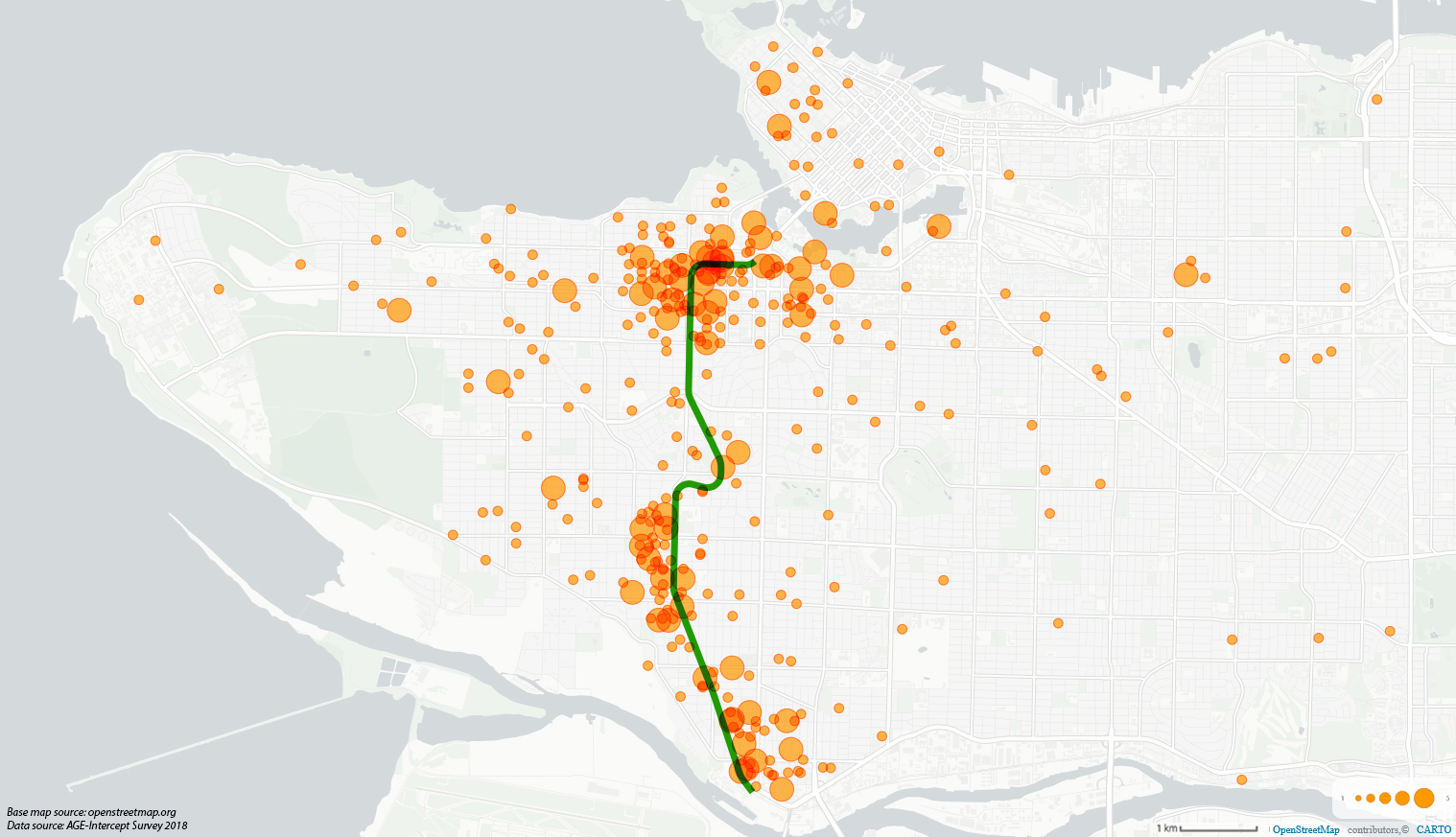
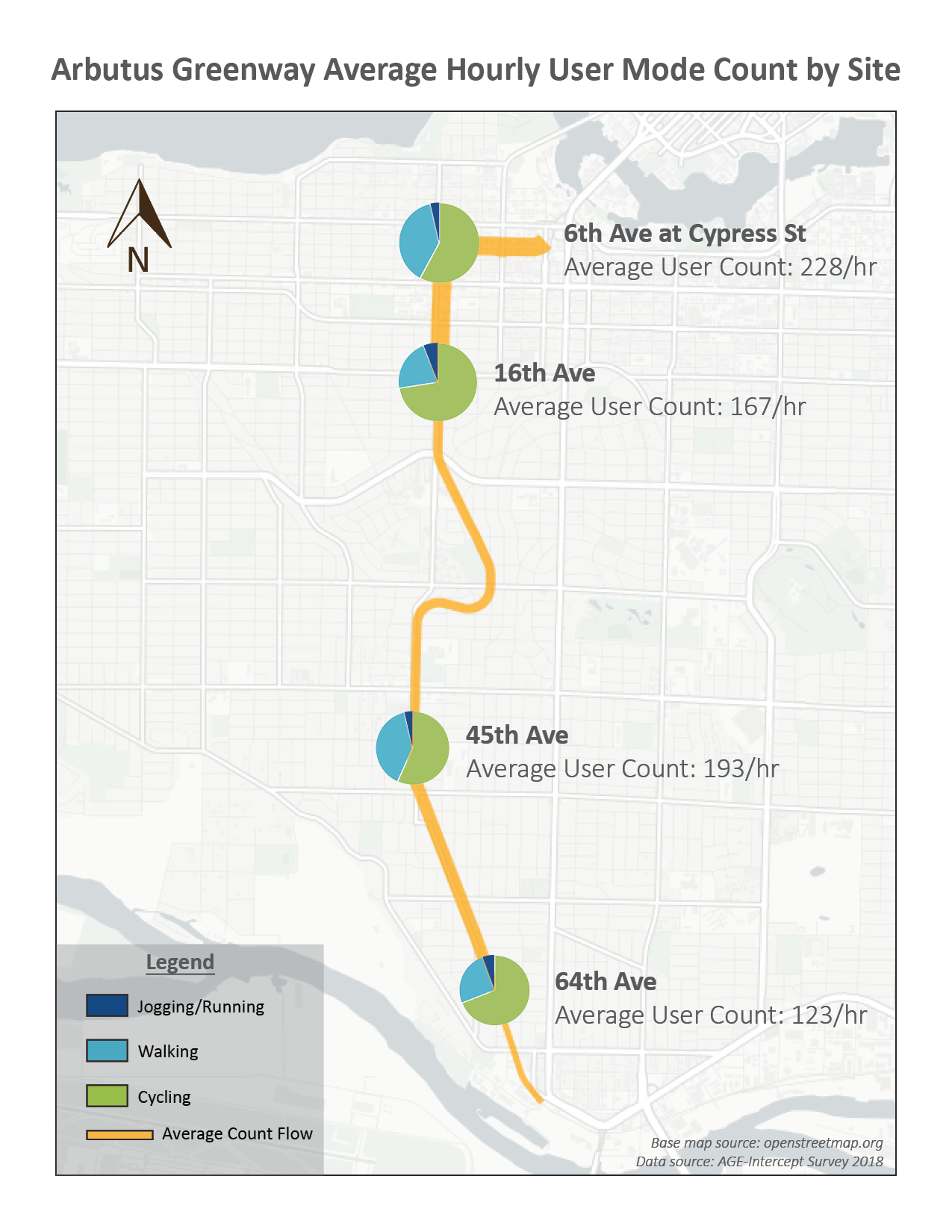
-Collected field data, conducted over 60 intercept surveys and created GIS maps for the 2018 Arbutus Greenway Evaluation (AGE) Report done by the Centre for Hip Health and Mobility (CHHM)
-Created an inforgraphic for BikeMaps on cyclist collision at roundabouts in the City of Vancouver
I also conducted a self-directed research project focusing on analyzing and understanding social connectedness along the Arbutus Greenway. The final report can be read here: “Connecting through the Arbutus Greenway: A Planning Analysis on Social Connectedness in Vancouver”.
Below are examples of some GIS analysis maps I created for their 2018 AGE report: