GIS Analysis: A Flood Vulnerability Assessment of Major Municipalities in Miami-Dade County
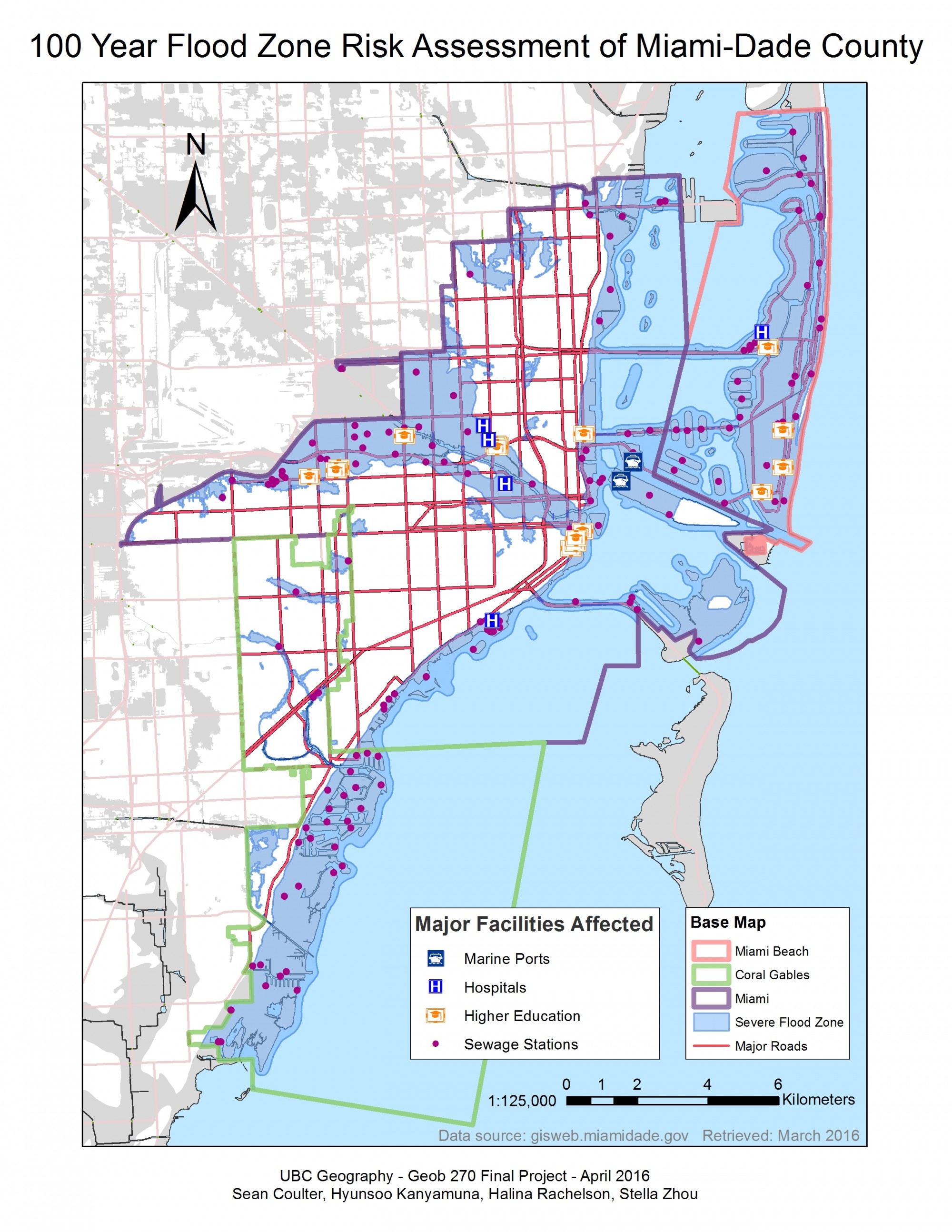
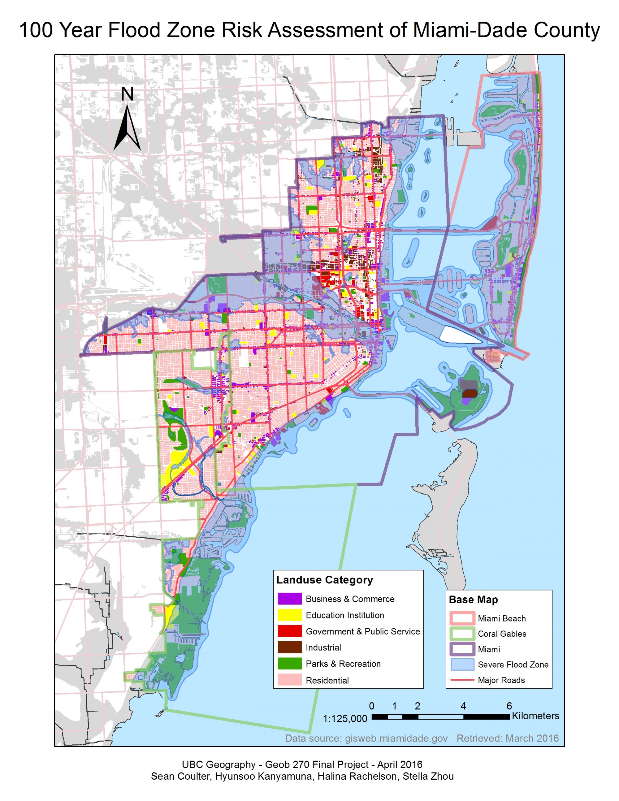
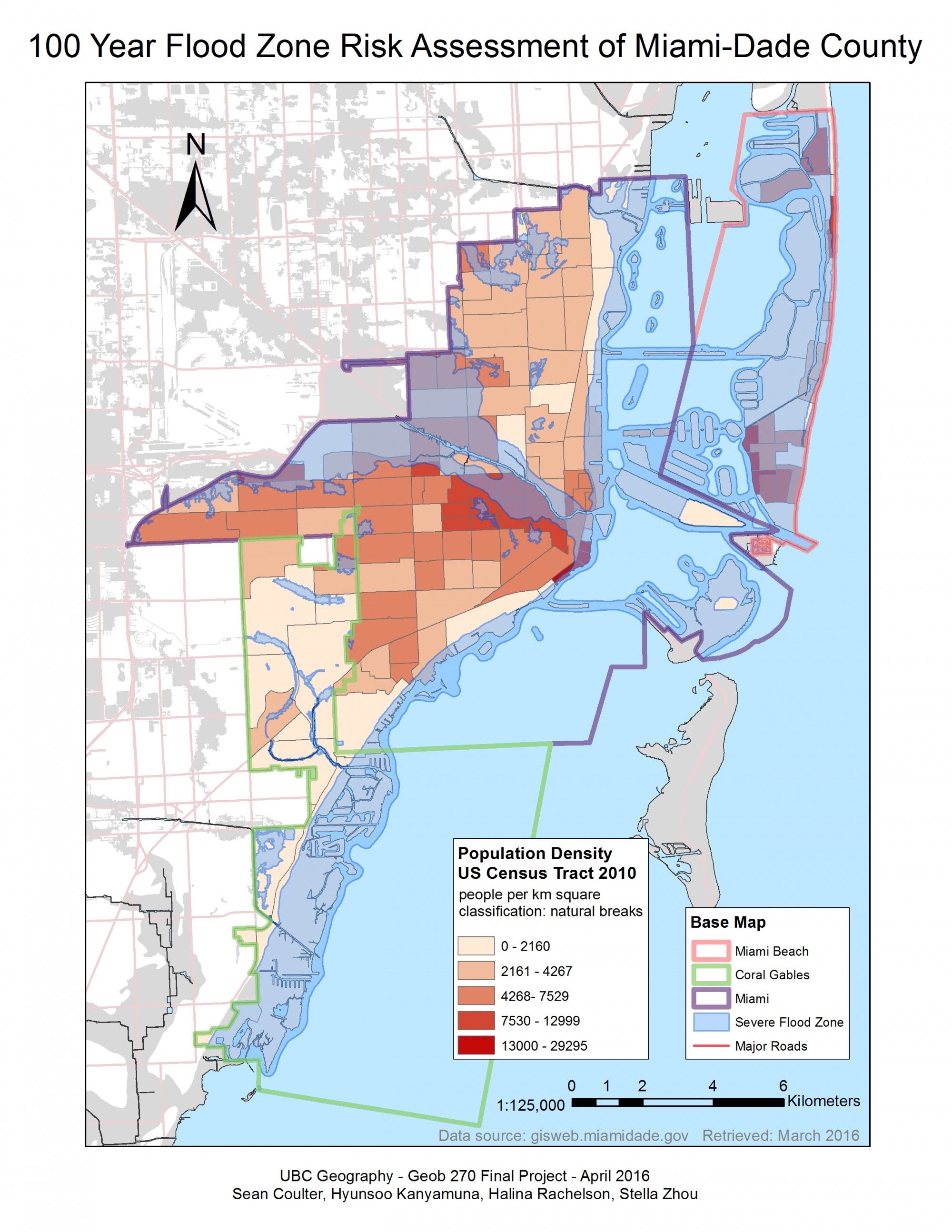
It has been established that climate change will impact sea level height and increase the possibility of severe flooding events in the coming decades. This group project is a flood risk assessment on three major municipalities of Miami-Dade County in Florida, United State. The goal is to identify which flood hazard areas in these municipalities are most vulnerable and at high risk if a “100-year-flood” occurs. According to Federal Emergency Management Agency (FEMA), ‘flood hazard’ areas are defined as the areas that will be inundated by a flood event having a 1-percent chance of being equaled or exceeded in any given year. Therefore, what would the economic and social lost be in these flood hazard areas and how can the city reduce the impact? Through our analysis, we determined that Miami Beach and Downtown Miami are the most endangered area due to the high population density, economic value and major infrastructures within the region. Final Report of this project can be found here.