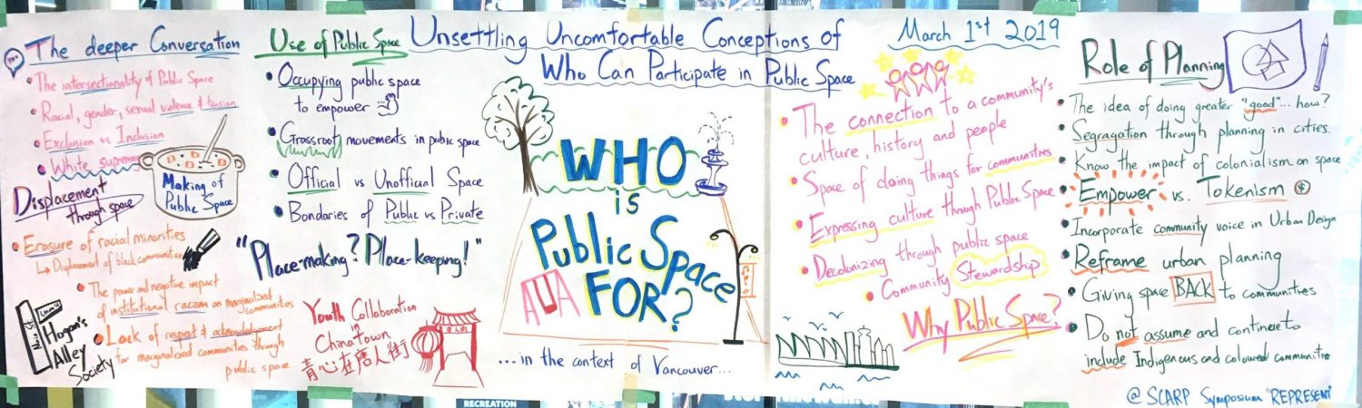
This is an interactive map created for the Vancouver Public Space Network, with the last update being March 2018 (Version 3.0). Please view the map in full screen for the best viewing experience. A Executive Summary of the map’s first version can be found here.