For this assignment I chose to answer question 3 which prompted me to examine the comment Judge McEachern made at the trial of Delgamuukw v. the Queen, “We’ll call this the map that roared”, as well as Matthew Sparke’s analysis of the aforementioned comment. Sparke positions the geographic conflict between Canadian Settlers and Indigenous Peoples as that of two groups who share the same land but have different ways of relating to the world and the land which both groups live on. The innately is not a problem, but when one group, the settlers, controls much of the legal and political aspects relating to law and geography, a power imbalance which leads to the creation an asymmetrical conflict. The resolution to this conflict favors the Settlers, since they are the ones that act as the “referees” between the two disputing sides. Additionally due to the difference between Western Colonial and Indigenous understandings of geography, Indigenous geographic claims are delegitimized, in political and legislative contexts. A conceptualization of these issues and the conflict that has been created by them can be represented by the phrase “the map that roared”, as the crux of this conflict is interplayed through the physical map, as well as the circumstances (the court case) of Canadian law which forces Indigenous Peoples to have to prove their rights to lands which they have occupied first, to a political body consisting almost entirely by settlers.
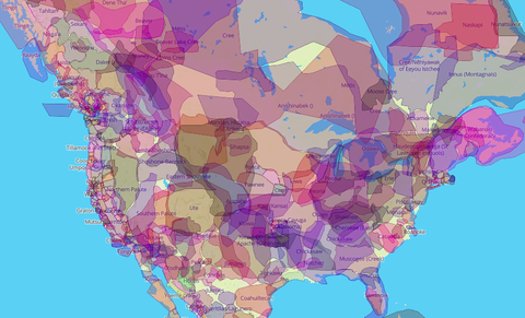
While Judge McEachern, spoke these words with a diminishing intent, they were transformed into a symbol of “resistance in the First Nations’ remapping of the land” (468). This refusal to allow language to marginalize and reformation of such language into an expression of the challenge to the colonial injustices by the Gitxsan and Wet’suwet’en people. This particular case, not only has particular relevance to contemporary news, as the Wet’suwet’en land defenders have currently been protesting the construction of a pipeline which was implemented without the consent of the hereditary chiefs. The use of colonial land designations is not just a problem among the Gitxsan and Wet’suwet’en people. Settler-colonial legislated geography has been used to marginalize First Nations and other Indigenous Peoples throughout Canada. This is exemplified by Shoal Lake 40, which, despite living next to the main fresh water source for Winnipeg, had no access to safe, fresh water. Additionally, due to an aqueduct that was constructed by the Canadian government the community at Shoal Lake 40, had no safe or easy way to exit the now island. As of 2019, a road called, “Freedom Road” has been built enabling those who lived on Shoal Lake 40 to come and go from their community. This is another example of ideas relating to Sparke’s analysis of “the map that roared”. It is an issue that is crucial to the identity and survival of the Indigenous community in conflict. Additionally, their ability to inhabit their territory was diminished and otherwise ignored by the Settler-Colonial policies of Canadian governance. Both the communities at Shoal Lake 40 and the Gitxsan and Wet’suwet’en lands have to continually challenge the geographic designations of the Canadian Government, and the outcomes and discussion related challenges are what will shape this period of Canadian history and the relations between Indigenous People and Canadian settlers for generations to come.
Works Cited
Hi Sophie,
I was excited to see that you had answered the same question that I had as I wanted to compare our understanding and outlooks. I absolutely agree that this concept of cartography is essentially that either party can be looking at the same identical piece of land, and have completely different views of it. Consequently, the indigenous and the European settlers had different maps. In this case, Judge McEachern believed one map to be more correct than an other from a personal point of bias.
I appreciated how you related the Map that Roared to the ongoing current protests of the Wet’suwet’en land defenders. I have a question for you. How do you think the public as well as those within the court room would have reacted if the Judge had been of indigenous background and had indirectly made his decisions based on so?
I really enjoyed reading your blog post. Thank you for sharing!
Alex
Hi Alex,
It is interesting that you and I selected the same question. I hope you have found an effective comparison in my writing. I assume for your question that you are referring to the Judge McEachern case. Systemically speaking, in the current composition of the federal court, 2.4 % have self reported to be Indigenous. That means that even such a possibility is significantly more slim. I think if it were possible an Indigenous judge would probably have approached the matter more respectfully, and not used diminishing language like “the map that roared”. Additionally, I think that the absence of Indigenous people in Canada’s lawmaking framework is one reason that there have been so many conflicts where settlers have impeded on land rights, and where Indigenous concerns have been ignored.
Hi Sophie, thanks for your post, it was very impactful and helped me better understand and, organize in my mind, the content of the readings. It really sounds like settlers just walked into indigenous land, operated under some kind of structure and so somehow expected indigenous people would operate under their rules too. But once the structure(rules of law, mapping of territory, ownership of territory, etc.) had remained for a while, it must of became harder and harder to change. The settler’s reliance and faith in that structure, including of indigenous people being subjected to it, solidified… And indigenous people did not share common language with settler’s in the beginning so did they even understand what was happening or how much of a threat this imposed law was to their rights?
Hi Gaby,
I think that in addition to the Eurocentric assumptions which prioritized their worldview above other populations, that there is a level of clear choice in re-enforcing the structure on the part of settlers. By claiming that the way of the settlers was the only correct way to claim land, settlers can justify taking land which according to convention does not belong to them. To answer your question, I would assume that in order to know for certain you would need to examine primary sources from indigenous people at the time, although perhaps that perspective is also present in stories.
Hi Sophie!
It was really interesting to see your blog post about two different parties looking at one piece of land! I recall that I learned about a similar incident with Africa as the Europeans divided the continent without the opinions of the native tribes that were living in Africa.
My question for you is that would you think it would have made a difference to the world right now if the settlers put into account the boundaries of the Natives when they decided to structuralize the place? What would the world look if that happened?
Hi Joseph,
As a student of Political Science, this is a question I find myself considering often. The ability to self determine the boundaries of a nation, and for those boundaries to be recognized as being valid within the International system is one that has been taken away from colonized peoples, often for strategic purposes. As such it is hard to imagine what a world would look like. Yet I would imagine that for Indigenous people the ability to determine their own boundaries would have resulted in it having been more difficult for settlers to unjustly claim their land.