Introduction to Cartography and Adobe Illustrator
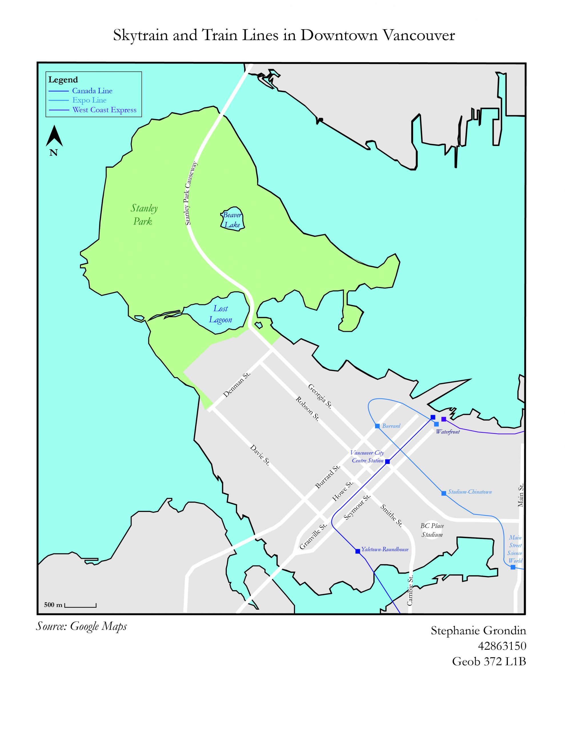 Skytrain and Train Lines in Downtown Vancouver
First Time Using Adobe Illustrator
My first lab of the term! In this lab, the class was introduced to Illustrator for the first time. I previously have used Adobe Photoshop for a Visual Arts course, so the tools and function of the software was somewhat familiar to me, but I still have a lot to learn.
In this lab we were tasked to hand draw and trace (using the pen tool) a Special Purpose map of Downtown Vancouver. It was quite time consuming and a great test of patience. Along with a general reference map of Vancouver, the special purpose I chose was to highlight the transit system of the Skytrain, Canada Line and WestCoast Express (train).
What I learned:
- How to use the pen and ellipse tool to create point, line and area symbols, and learning to curve lines and text.
Improvements for the future (takeaways):
- Only water features, source line, and projections (not included in this lab) are italicized.