Lettering on Reference Map of British Columbia
Cities by Population Size in British Columbia
Lettering in Illustrator
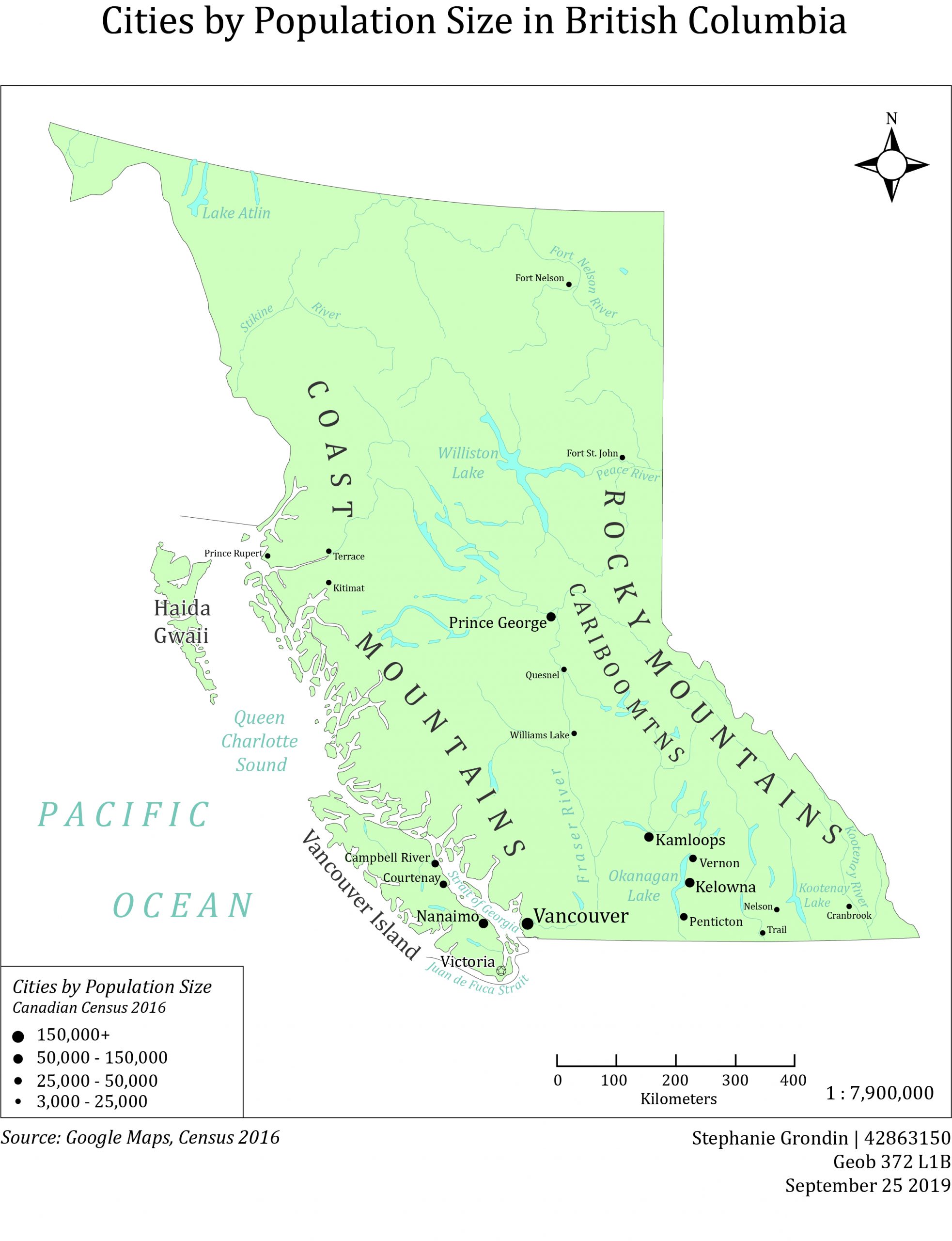
In the third lab I designed a reference map of British Columbia, including 18 cities and towns sized proportionally by population size. Using visual hierarchy for text, area features (mountain ranges, ocean, lakes) were spaced and text was sized larger for bigger features and vice versa for smaller ones.
The biggest challenge for this lab included making all the text fit in the space without text overlapping and looking crowded.
What I learned:
- I applied the skills I learned in Illustrator from the previous two labs all simultaneously to create the reference map.
- There will be many versions created before having a satisfactory outcome (there is over five drafts and many changes made before submitting my final product).
Improvements for the future (takeaways):
- The TA told me in lab that I had done a perfect job with my map! My personal highlight of the term 🙂
- I can include names of boarding countries and provinces to make it look less like a floating island, but it is not necessary.
- Text size could have been a bit larger for the smallest towns.