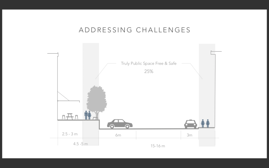
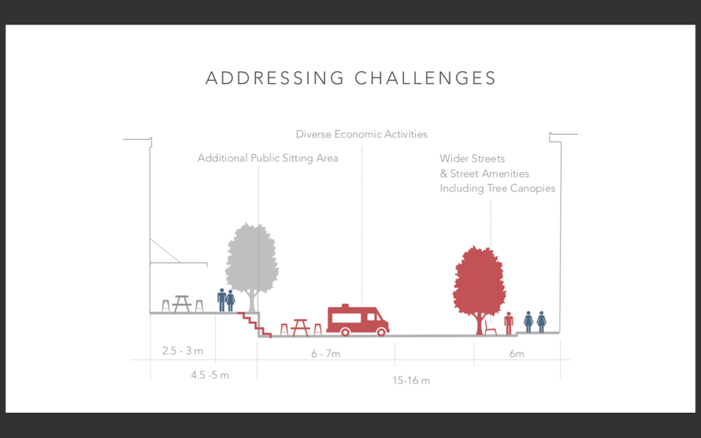
Analyzing Yaletown’s Mainland Street Public Life
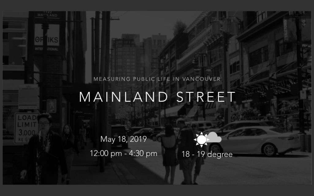
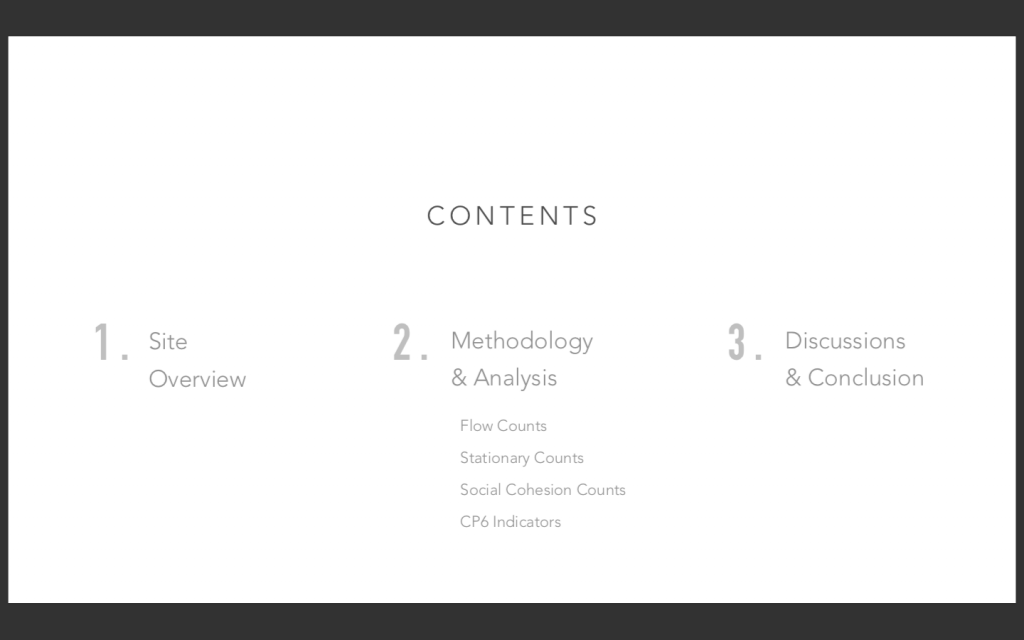
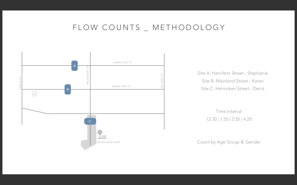
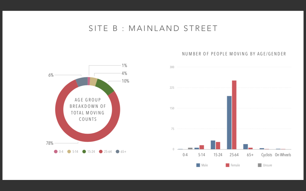
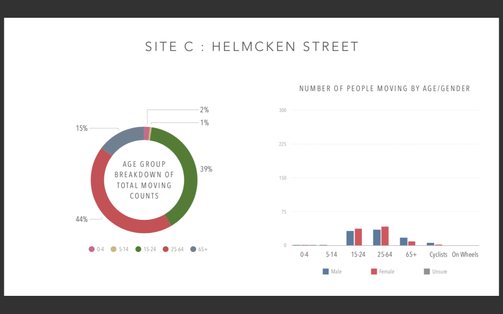
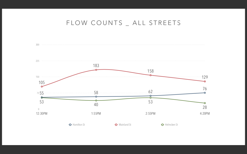
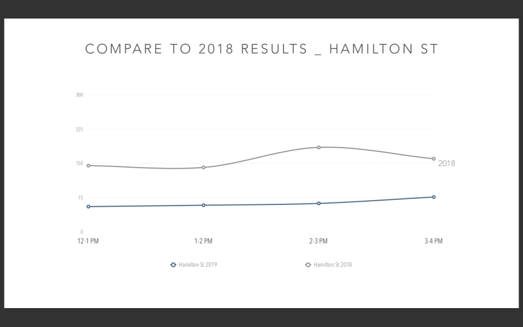
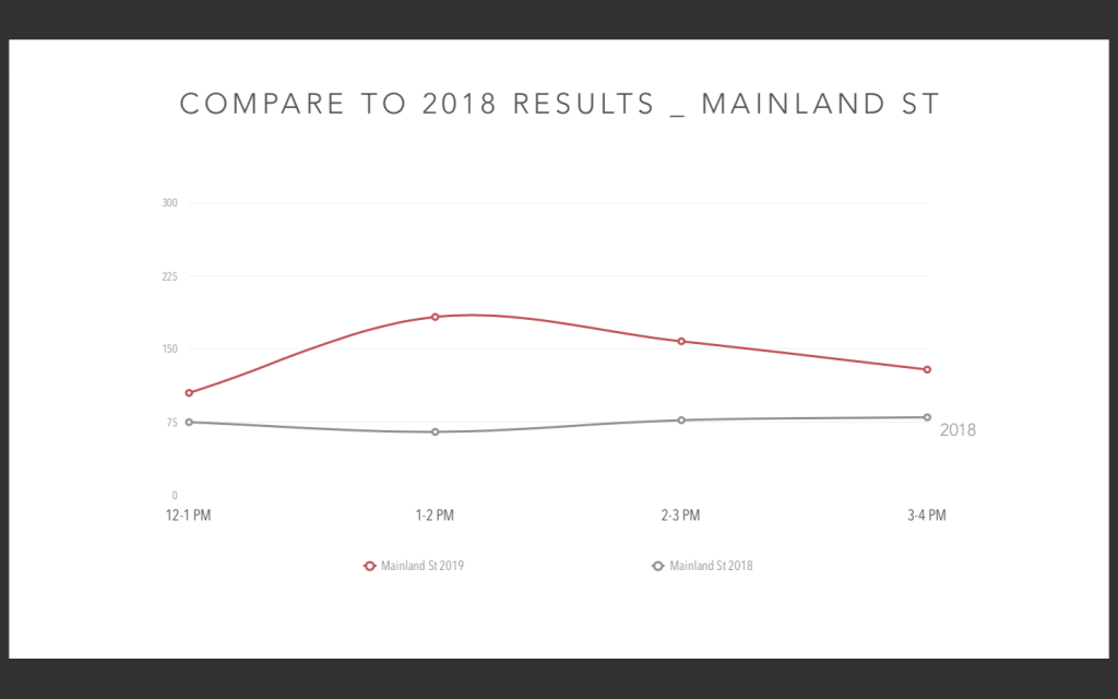
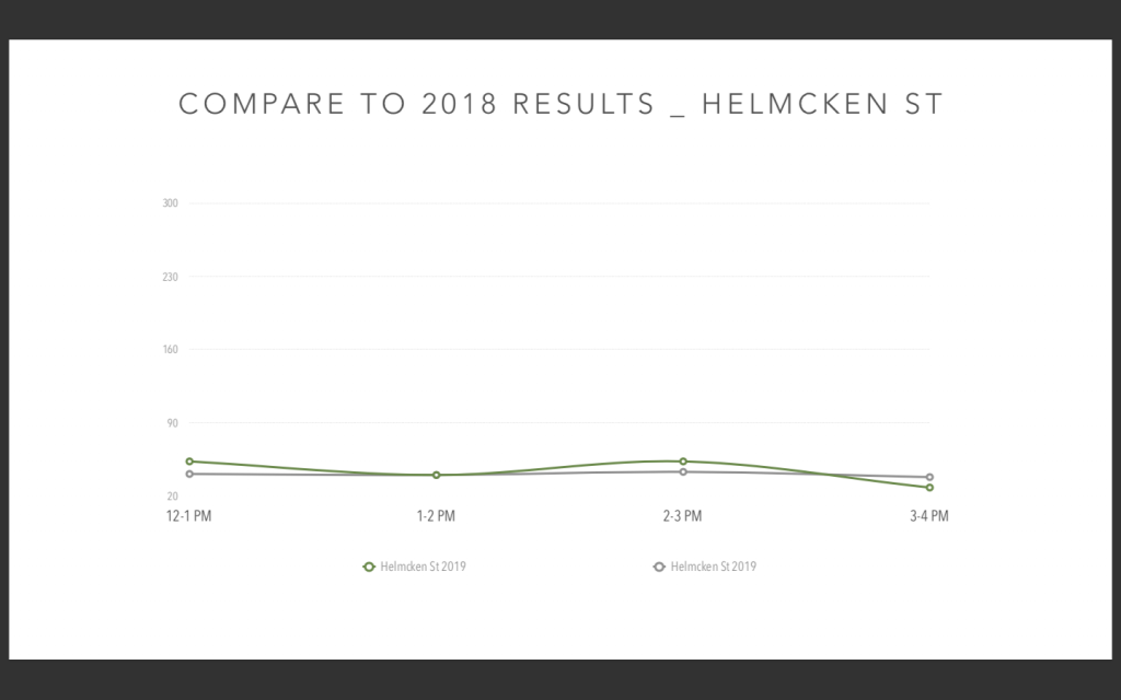
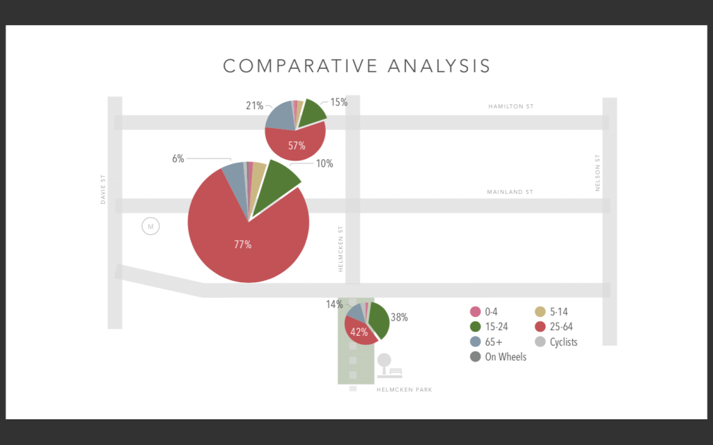
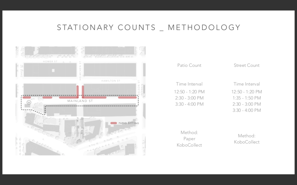
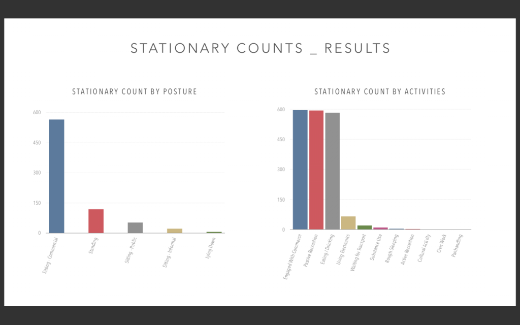
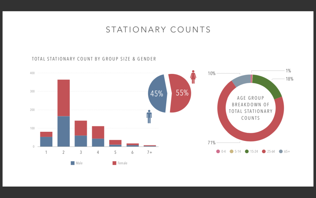
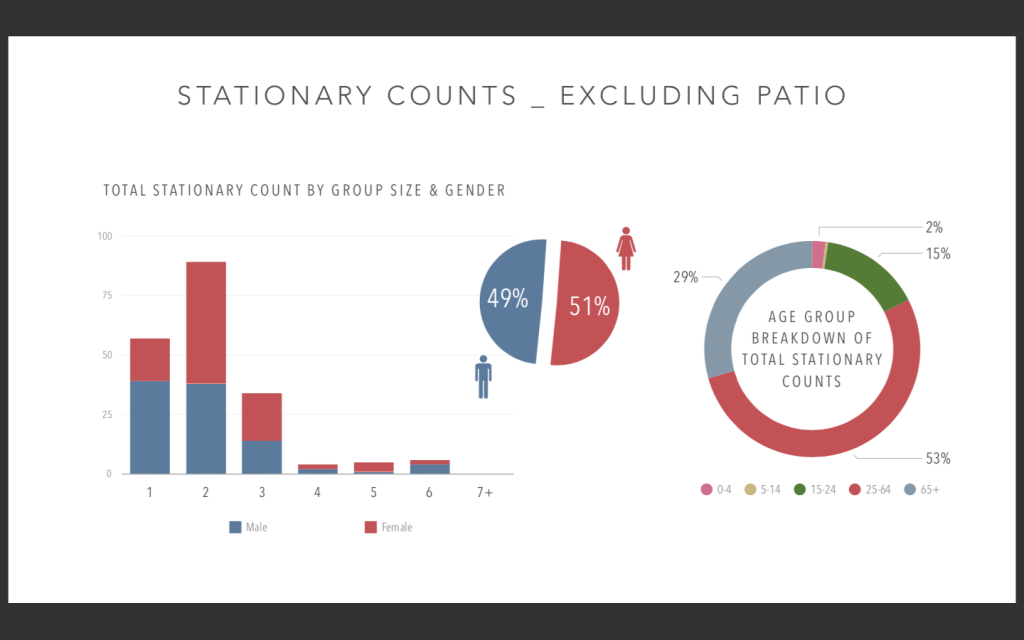
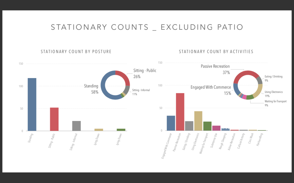
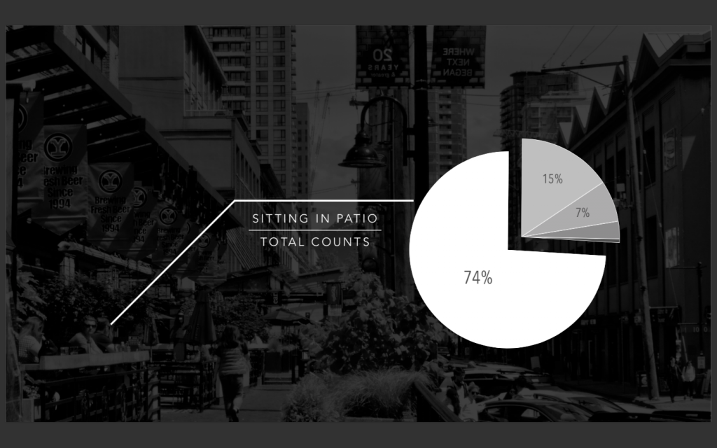
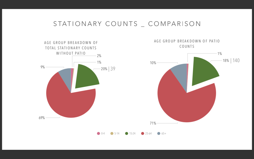
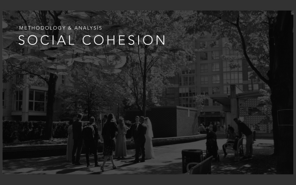
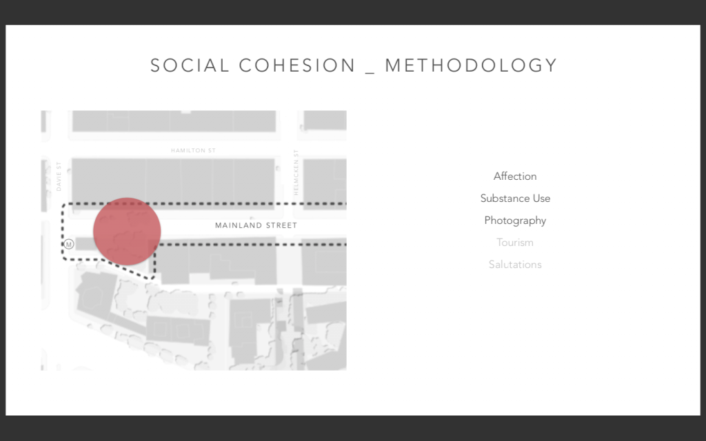
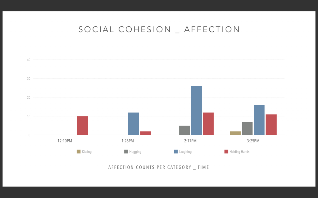
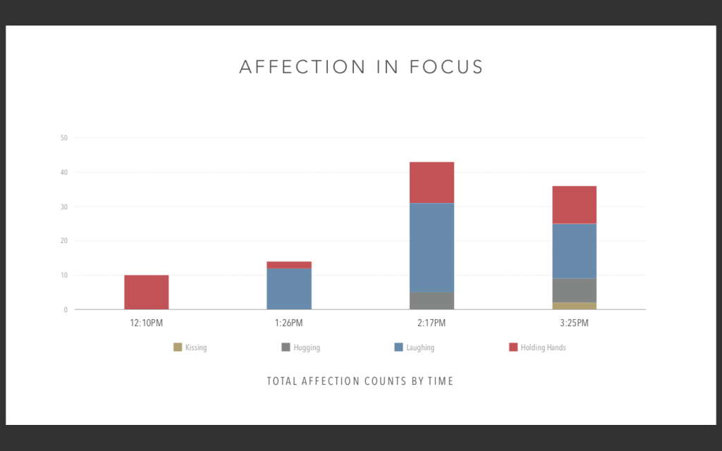
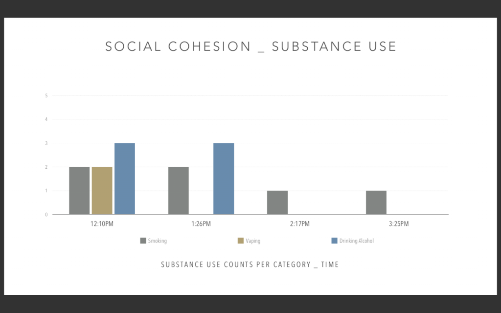
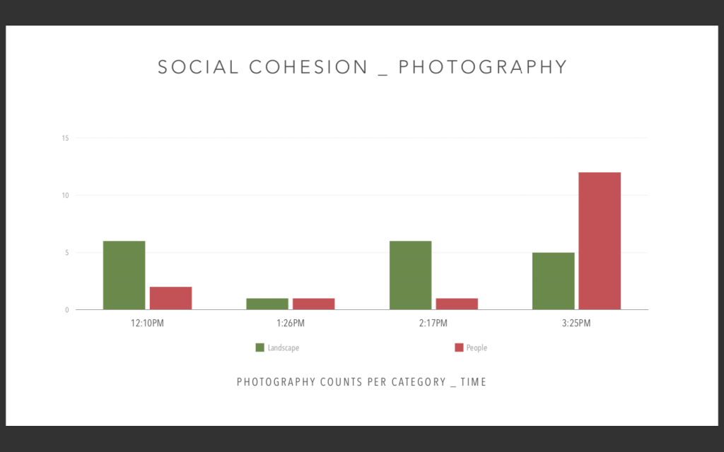
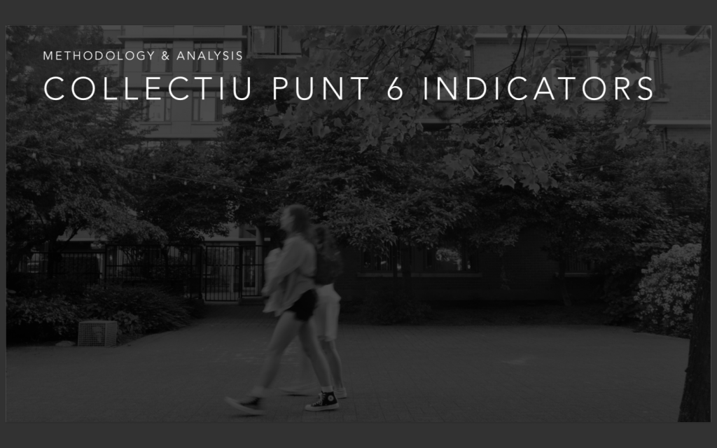
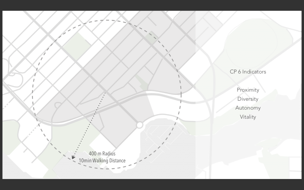
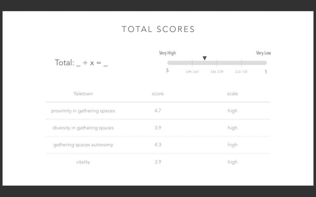
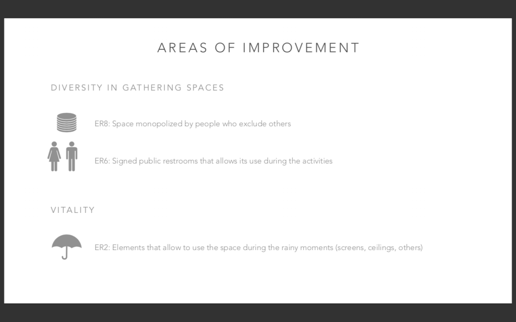
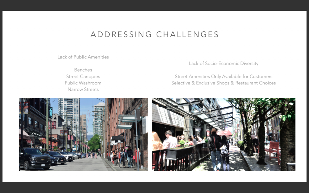
In this assignment, our group of 3 was tasked to conduct original research with the objective of studying public life over a duration of 4 hours on May 18, 2019. We used Gelh’s data sheets from the City of Vancouver (used in the Gelh’s Public Space and Public Life Study) to collect Flow Data, Stationary Counts, and Social Cohesion. An additional study method called CP6 indicators was used to determine a score from 1-5 on the livability of the 400m radius around our given site.
This was considered a warm up before conducting 16 hours of research in Barcelona, to work out any difficulties or problem solve if any challenges arose. This assignment also gave us a unique perspective on Vancouver’s public space and was also used to compare Vancouver to Barcelona later on in the course.
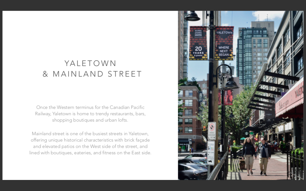
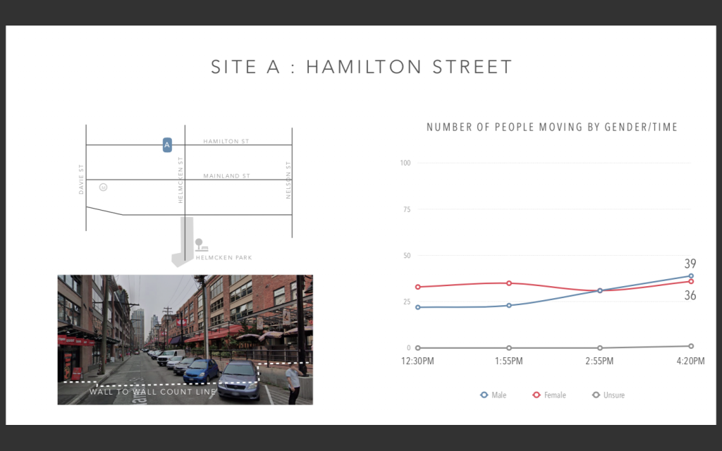
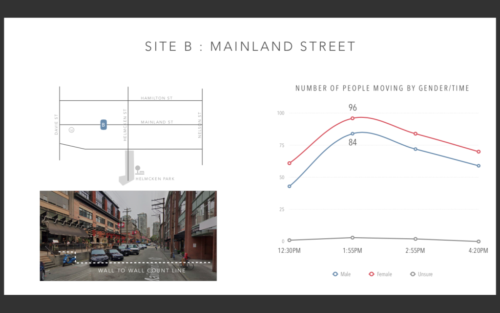
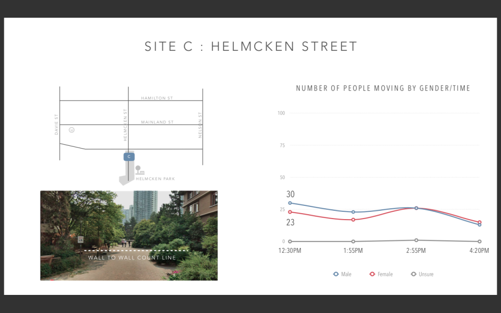
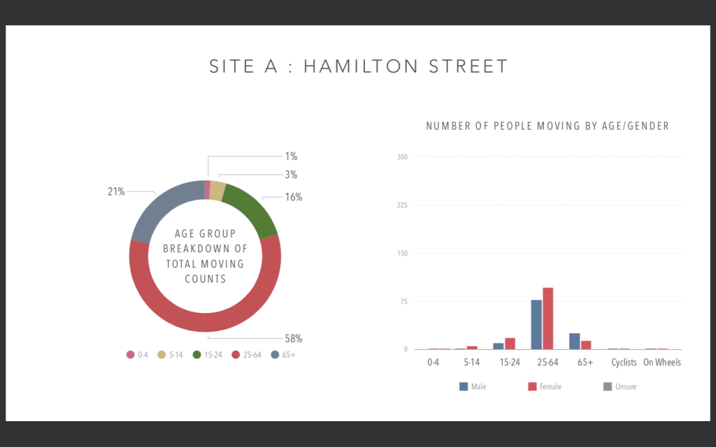
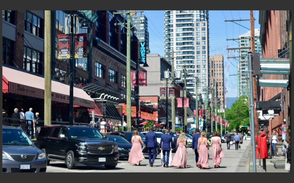
Below are the presentation slides from our presentation to our classmates in Vancouver. We used Apple Keynote to make the presentation, which has a beautiful user interface for charts and graphics. Photos were taken by my group partner Karen.
Vancouver Mainland Presentation Slides