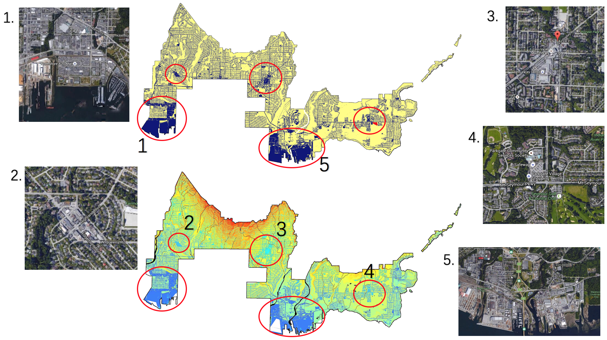
Referring to the mutual parts in both parts, there area 5 areas identified as risk areas.
In both maps, area 1 and 5 area tagged as of high risk owing to their low elevation and industrial land use. Th soil type in District of North Vancouver is quite sandy, which means a relatively low water holding capacity. Since soils are with low capacity to maintain the stormwater, extra water will enter the nearby watershed through groundwater. Thus, apart from the runoff accumulation on impervious area, flooding will also be regarded as a potential risk. Area 1 includes a mall portion of Lynn Creek while area 5 contains more of the Seymour River. From map of stormwater drainage system, it’s obvious that those 2 areas are equipped with less sewers, which means a lack of efficient methods to solve the stormwater. From this perspective, government should build more sewers in dark blue areas(1 and 5) to mitigate the level to stormwater accumulation.
Area 4 is a field that has been aggregated, the accumulation of stormwater at the site will cause erosion. However There is a large golf club in the neighborhood, which reduces the risk of stormwater accumulation to a large extend.
Area 2 and 3 are commercial area with large shopping malls, thus there will be spacious parking lots attached. In sunny days, gasoline left by cars gradually accumulates on parking lots and will be picked up by runoff into groundwater. As there is abundant sewers on site to help release the pressure of stormwater accumulation, the possibility of rainwater detention in such areas will be pretty low, but the pollution to underground water will be a main concern. Measures should be taken by government to treat the pollution on various sizes of parking lots.