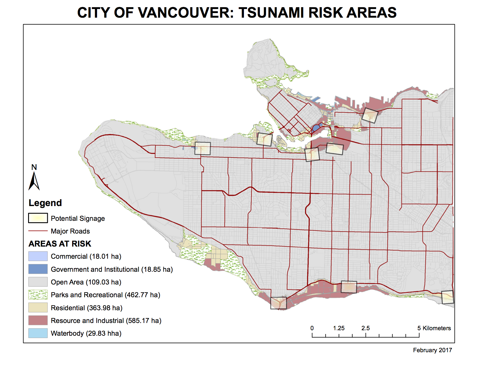
The tsunami risk area was created by isolating areas of Greater Vancouver that fulfilled both of the following requirements:
- Within 1 kilometer of the ocean
- Below 10 meters in elevation
Educational and health facilities that fall within this risk area include:
- Emily Carr Institute of Art and Design
- Henry Hudson Elementary
- False Creek Elementary
- St. Anthony of Padua
- École Rose-Des-Vents
- False Creek Residences
- Villa Cathay Care Home
- Broadway Pentecostal Lodge
- Yaletown House Society
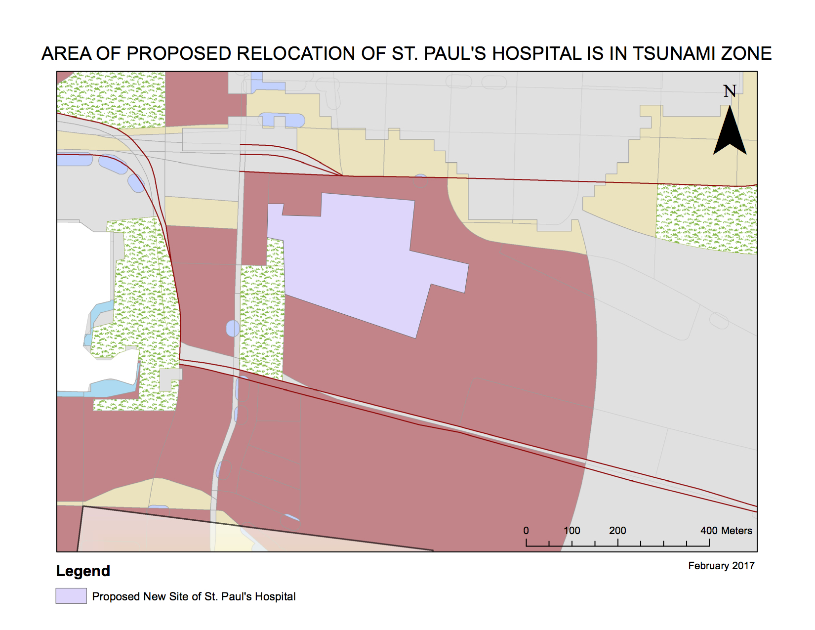
Additionally, St. Paul’s Hospital has been designated to relocate. (Further information regarding this project can be found here: http://vancouver.ca/home-property-development/new-st-pauls.aspx)

However, the area of the proposed site falls within the tsunami hazard risk area identified on the map (marked in colour; St. Paul’s would fall within the zone of “Resource and Industrial Areas at Risk”.) Due to this unmitigated risk, it may be prudent to revisit and reconsider the proposal for this relocation.
Accomplishment Statement
Through the completion of this lab, I have learned critical GIS functions such as the creation of a buffer zone, and how to clip data to a certain working area. I have learned to query data, and select data by their attributes, in order to reach a more complex level in data manipulation and use. I have also learned about the basics of creating maps – these were my first maps ever produced. This lab was very applicable to a real-life situation in identifying existing buildings that would be affected by the reach of a tsunami.
