In this lab, my job was to prepare a map of the City of Vancouver tsunami risk areas thinking of possible future sea level rise or extreme weather due to climate change that may affect our city. In my map, I have highlighted the neighbourhoods within the city as well as the areas of land use that will be affected.
Through my analysis, I determined that 15.3% of the City of Vancouver’s area is in danger. I found this percentage by:
- Reclassify the areas below 15 metres elevation that would be affected by a tsunami or sea level rise
- Performed a buffer analysis of areas 1 kilometre from the shore of Vancouver
- Used the intersect tool to combine these two layers and related them with the general City of Vancouver layer to show the danger zones in the city. In order to get a percentage of the area that is under danger, I found the area of the danger zones in the layer’s attribute table and then divided it by the total area of the city.
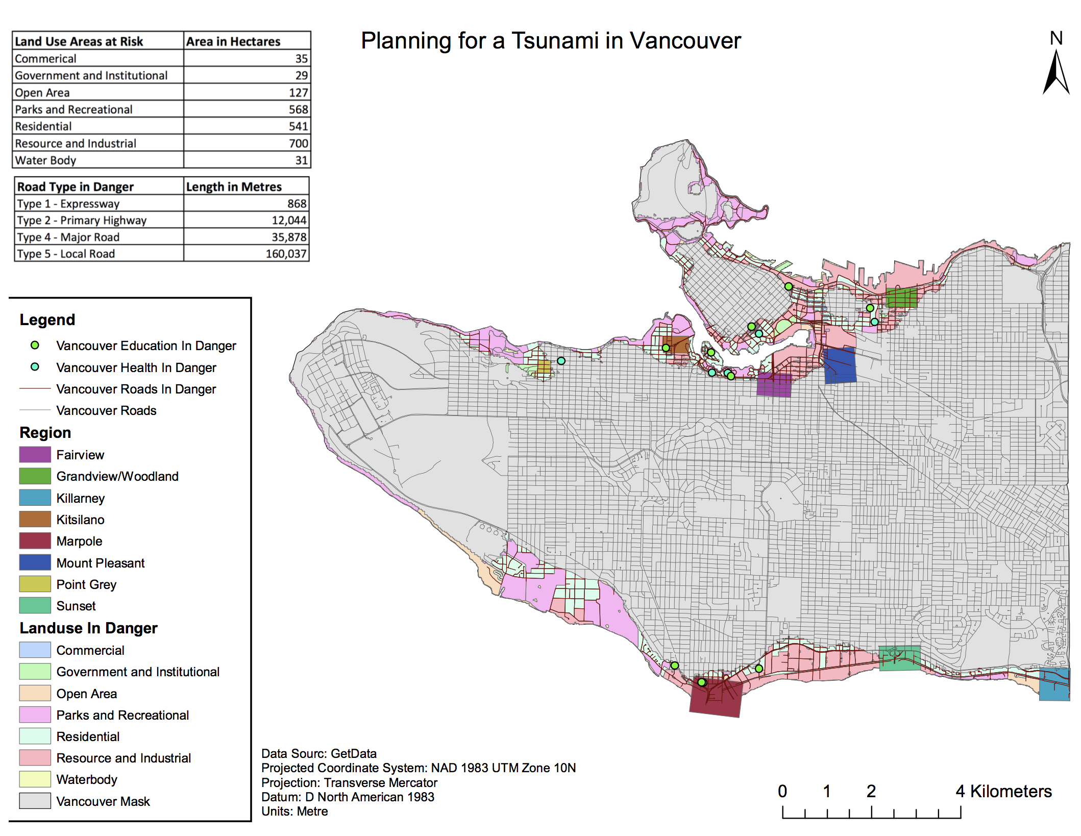
In my analysis to determine the danger zones of the City of Vancouver I identified the health and educational facilities that are within the risk area. I used the Select by Location function to display all the health and educational facilities within the Vancouver Danger Layer and then extracted that data to create a new layer to see the facilities in danger. I then used the attribute table to find the specific names of these facilities.
The Health Care facilities at risk are:
- False Creek Residence
- Villa Cathay Care Home
- Coast West Community Home
- Broadway Pentecostal Lodge
- Yaletown House Society
The Educational facilities at risk are:
- Emily Carr Institute of Art and Design (ECIAD)
- Institute of Indigenous Government
- Henry Hudson Elementary
- False Creek Elementary
- St Francis Xavier
- Vancouver Montessori School
- John’s International
- Heritage 3R’s School
- Anthony of Padua
- Ecole Rose Des Vents
Here are a few of the main skills that I have obtained while working with ArcGIS for this lab and in this course:
- Calculated areas of risk in the City of Vancouver through tables to identify areas, health and educational facilities and land use types affected by a tsunami
- Identified improperly referenced and misaligned data and fixed the problem by changing coordinate systems of certain data sets
- Created a high-quality map performing geographic analysis accompanied by standard map elements