
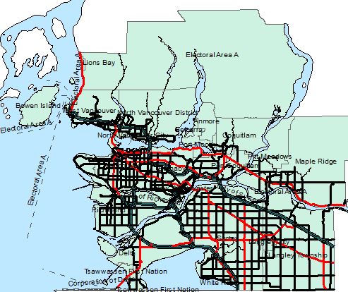
Figure 1. Screenshot of road, water and administrative boundary layers after clipping to study area.
The majority of our data that was collected from outside the Geography servers were not at the scale of our study. Areas that were out of the Metro Vancouver area were clipped out by selecting relevant cities/municipalities in the attribute table to form AdminBoundary (Figure 1), which include:
- Vancouver
- Burnaby
- North and West Vancouver
- Bowen Island
- Port Moody
- Coquitlam
- Pitt Meadows
- Maple Ridge
- Surrey
- Langley
- White Rock
- Tsawwassen
- Delta
- Richmond
Roads and water features were also at the provincial scale. Using the extent of the AdminBoundary, the roads and water features were clipped during an edit session by using the Intersect tool.