
Although our data was province wide we needed to narrow the area we were analyzing, as we did not have the computational power to analyze the entire province. To choose our area we conducted a kernel density analysis of the wildlife collisions for the entire province. We decided to focus on the southern half of the province because collision density wasn’t high in the north and as well as there were significant gaps in the data where Jasper National Park and Banff National Park reside.
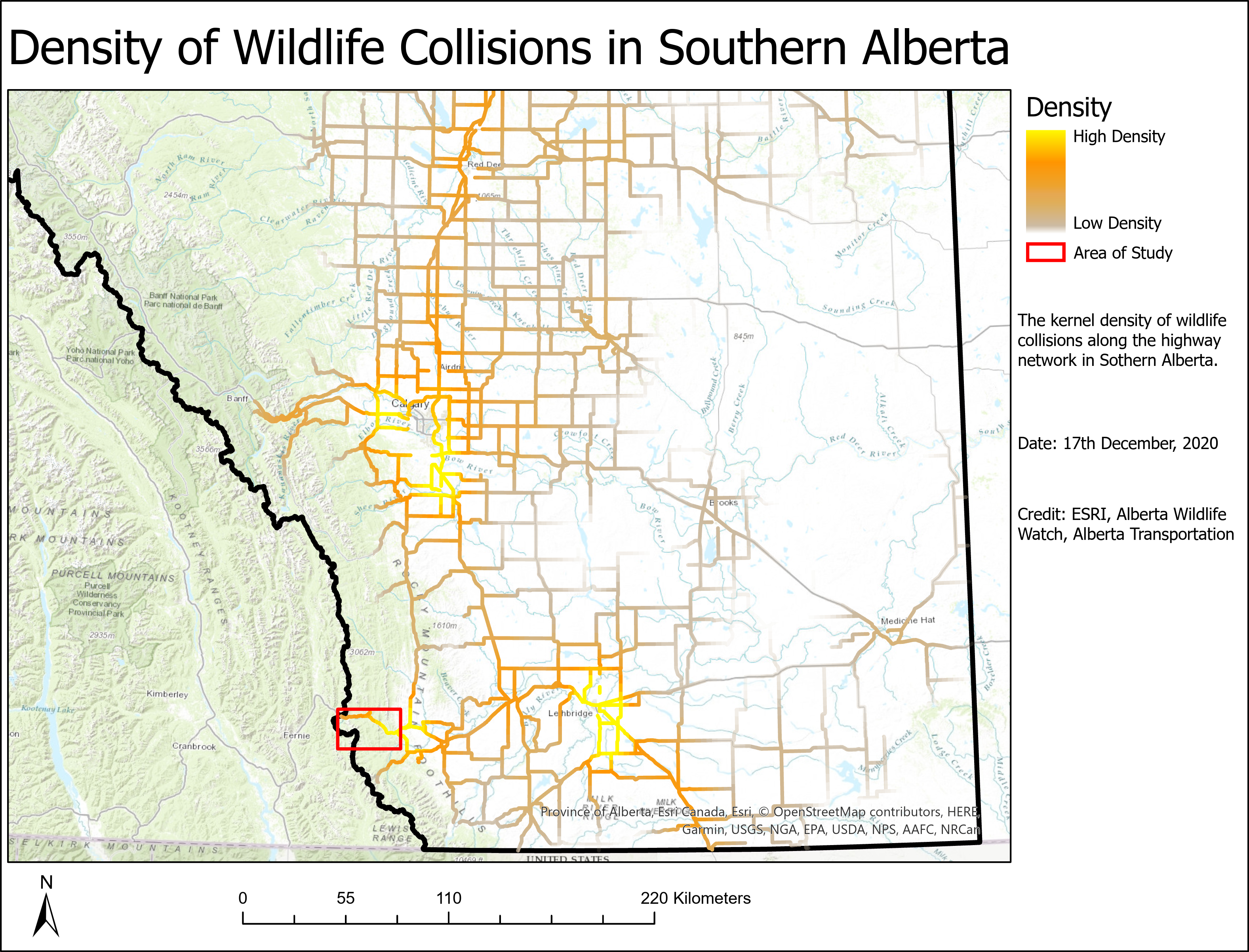
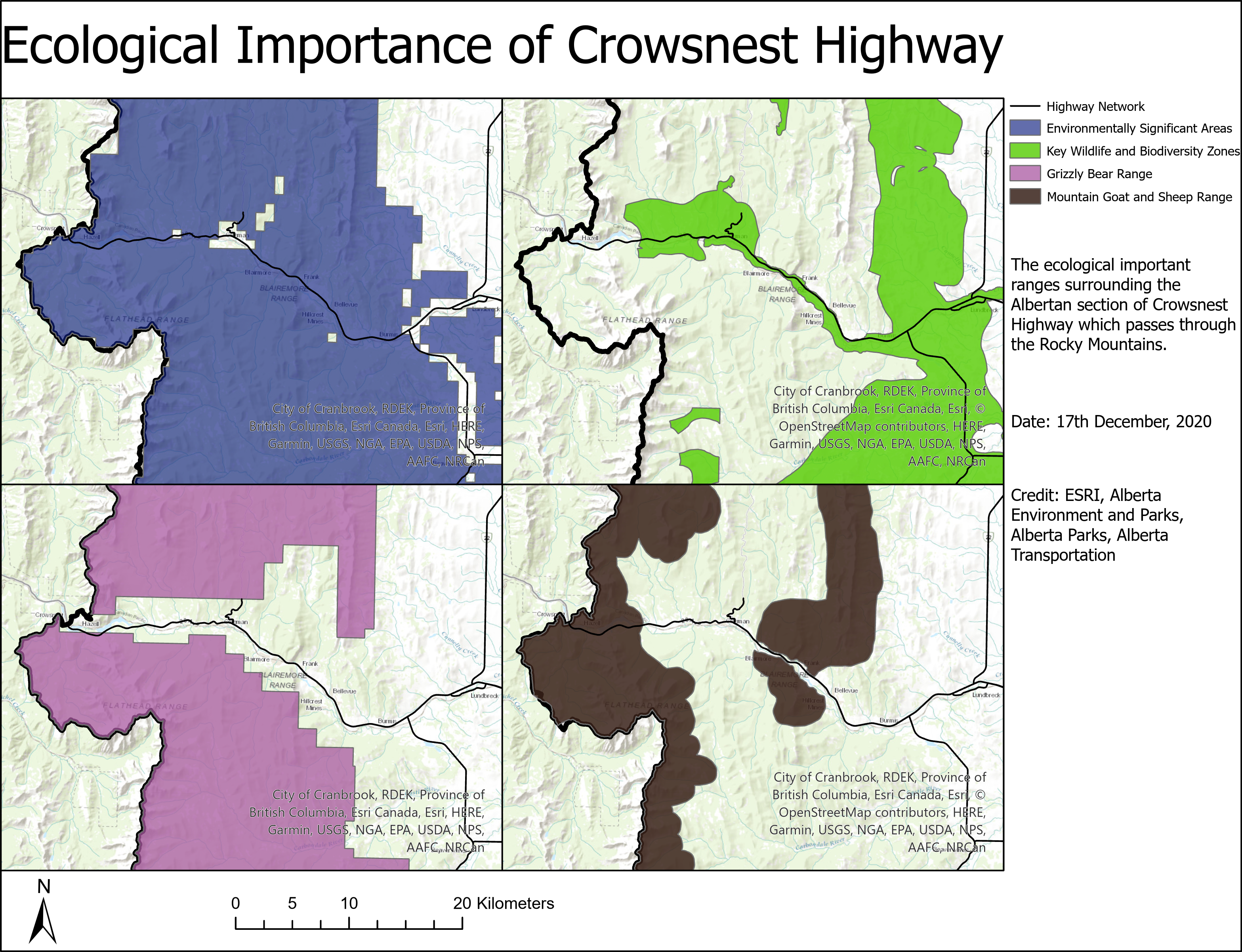
From this map we found that there were various areas with high density of collisions. From the various areas we chose the section of Crowsnest Highway that travels through the Rocky Mountains. This is because the area overlaps with grizzly bear range, mountain goat and sheep range, environmentally significant areas, and key wildlife and biodiversity zones. Furthermore, because the road is a highway through a major inter-provincial mountain pass, there is a relatively high traffic.
Choosing this area also meant that we could use the attributes of the Banff crossing locations as a guide to find the proposed crossing locations. Since the location is in the same mountain range as Banff and is home to the same species, the crossings would need to be similar to the ones in Banff. If we had chosen an area outside of the Rocky Mountains, the needs of the species using the crossings, and the landscape would be vastly different so we wouldn’t be able to use the Banff wildlife crossings to guide our analysis.