
Cartogram
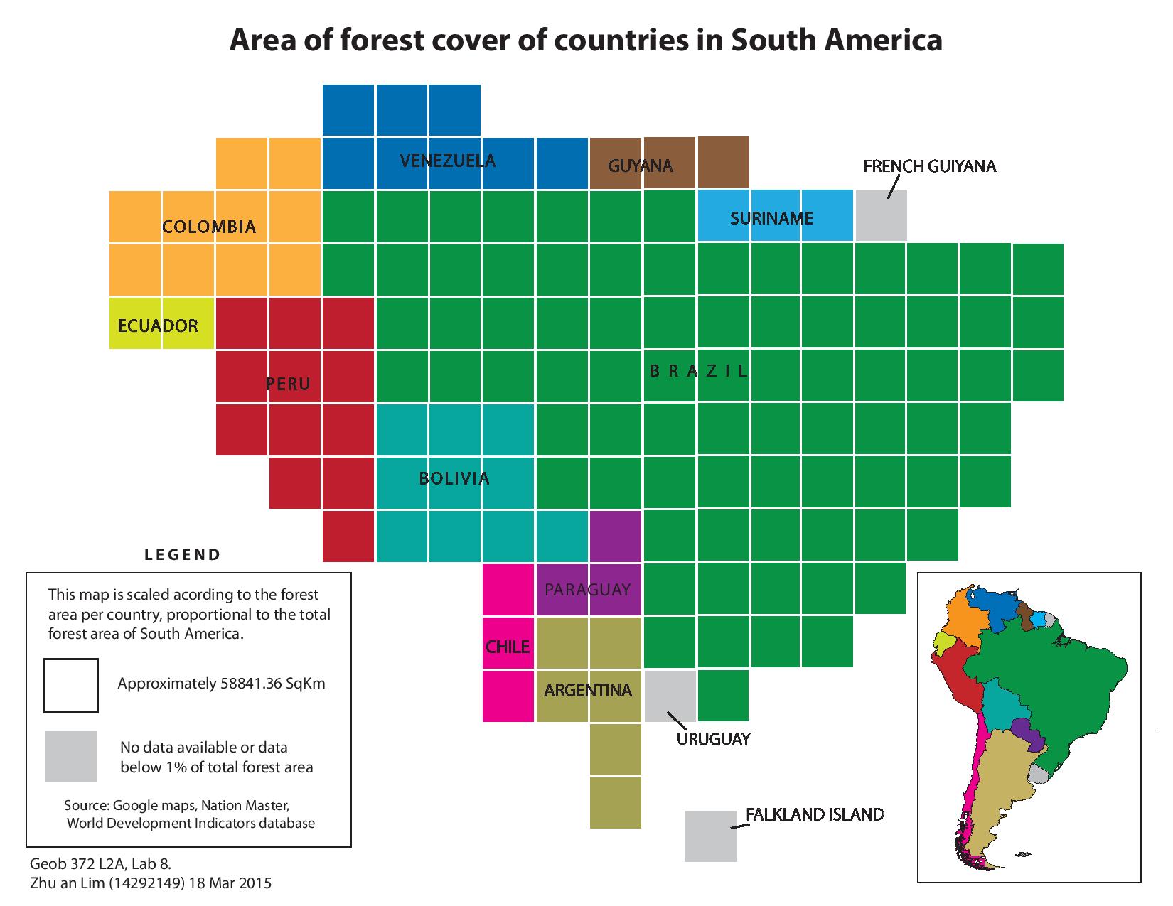
A Cartogram is a type of map that is usually used for showing or representing specific attributes (e.g. forest cover, population size, etc.) to different spatial units (e.g. countries, census divisions, continents, etc.). The areas are usually scaled in terms of grid cells, where individual cells represent a specific value. Therefore, a Cartogram is usually very useful when we are comparing a specific attribute over a geographic region.
The map i created represents the forest cover of countries in South America, and it shows that Brazil has the largest extent of forest cover compared to other countries in South America. The purpose of the inset map is usually to provide the readers a better understanding of the actual geography of the study area, as the shape of the Cartogram is usually distorted, and proportional to the attribute of the different area units.