The IDRISI Land change modeler enables the analyst to determine the changes in land cover and land use in an area. This is very useful when assessing the changes in land use such as urban development and planning.
(Case study)
Report on land cover change in Central Massachusetts (CMA)
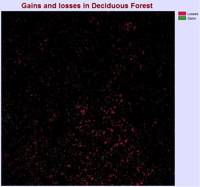
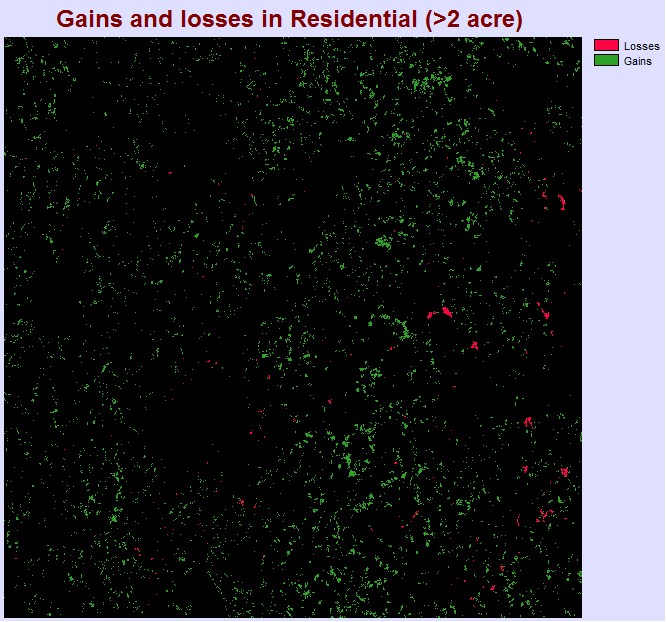
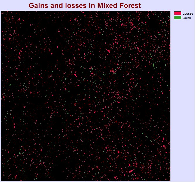
After analyzing the change in land cover in Central Massachusetts (CMA) using the land change modeler tool in IDRISI, it is evident that there has been a significant change in the types of land cover in the CMA region. Looking at fig. 1c, it is evident that there have been a substantial increase in urban development in the region, with the gains in residential area that are more than 2acres significantly higher than the losses. This suggest that there is an expansion of the urban areas in CMA, with increasing number of residential lands and houses. The gain in residential land cover is the highest amongst the other types of land cover. When compared to the changes in Mixed and Deciduous forest, the different is obvious. Both types of forest have experience a higher net loss than the residential class. There is a great decline and change in the two types of forest, with mixed forest having higher losses. This suggest that activities such as logging, clearing of forest is occur within the region, which causes a decline in forest cover.
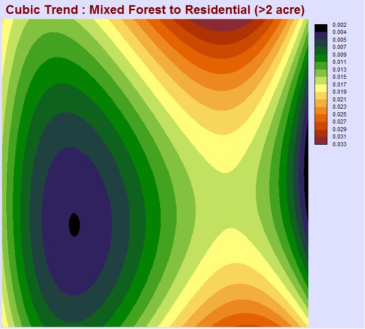
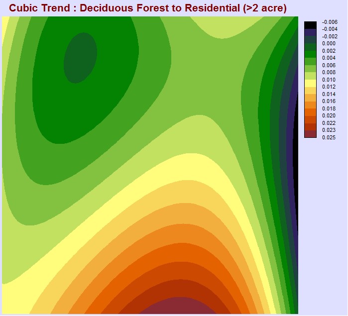
In order to associate the change in land cover and attribute the loss of forest cover to the development of urban areas, I produced spatial trend maps to indicate the relationship between the transitions between different classes of land cover. We can see that there are areas where the loss of forest cover is highly correlated to the gain in residential area. This is especially so for the top right corner of the image, as well as the bottom (right) corner. This tells us that in these areas, the loss of mixed and deciduous forest is most likely due to urban development, which results in the change in land cover. The west area of the image shows that there is less of a correlation between the residential and the two types of forest. The same is true for the extreme right of the image. This suggest that the transition from mixed and deciduous forest cover to residential area is less intense in those areas. Therefore, the loss of forest cover may be attributed to other forms of development and changes, such as the change to croplands, pasture, etc.
The transition from croplands to residential area is quite similar to mixed and deciduous forest, with a strong correlation at the top and bottom right region of the image. Overall, I would say that the losses in both deciduous and (especially) mixed forest appear to account for the gains in residential area primarily in the north and south region of the image. The gains in the west region may be attributed to other forms of land cover changes, such as the conversion of croplands and pasture.