The steps for a supervised classification includes Class definition > Signature development > Classification > accuracy assessment
This method requires more knowledge on the study area such as the different land features, in order for the analyst to identify meaning names for the different classes. Usually, it also depends on what features or classes are the analyst interested in (e.g. forest, clear cut, etc.).
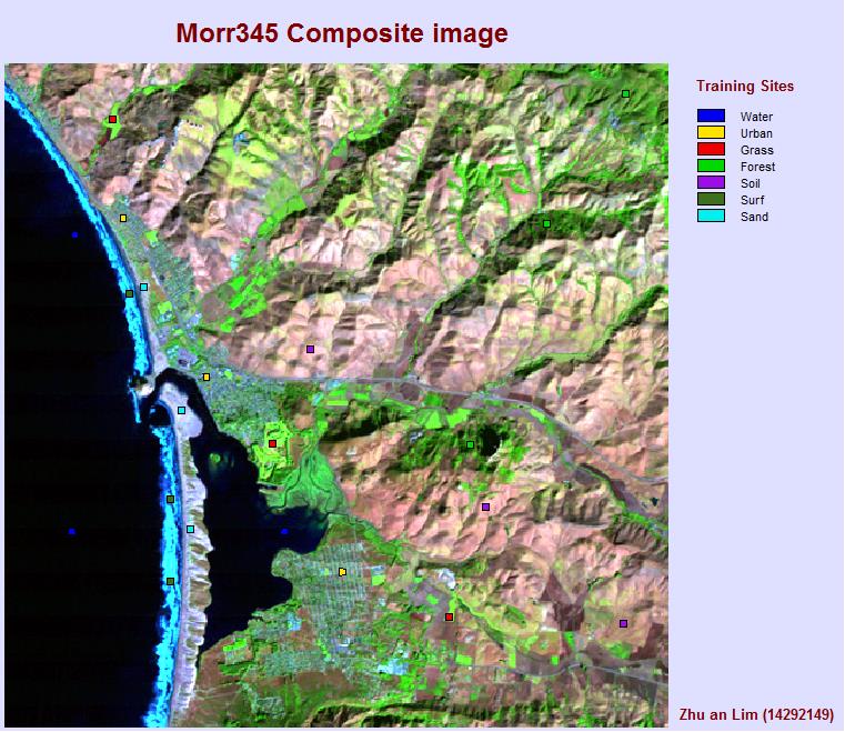
The analyst will create training sites based on the difference in spectral response of different features in the image. This is best done with a composite image that provides a good contrast between the features. The training sites are then used as a guideline for the different software in IDRISI that does the supervised classification.
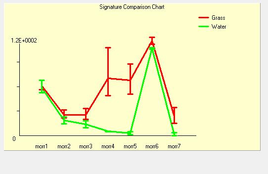
It is important to determine if the spectral response between different classes are distinguishable in the different bands used.
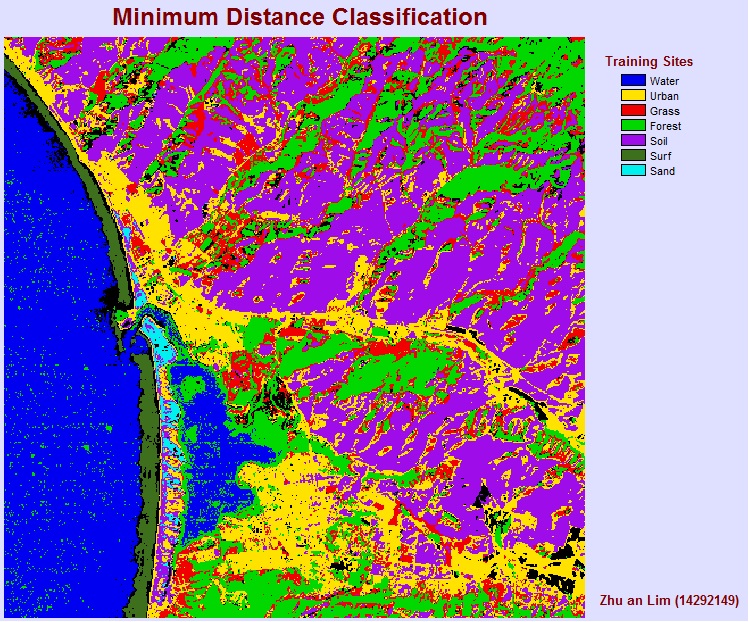
Minimum distance classification: This method is mathematically simple and computationally efficient. In this classifier, the pixel is allocated to the class to which it has the closest mean, but it is insensitive to different degrees of variance or covariance in the spectral response of training pixels. You can specify a threshold —how close a pixel’s DNs must be before it can be assigned to a group. The larger (wider) the threshold, the ‘fuzzier’ or less precise the results will be (but fewer pixels will remain unclassified).
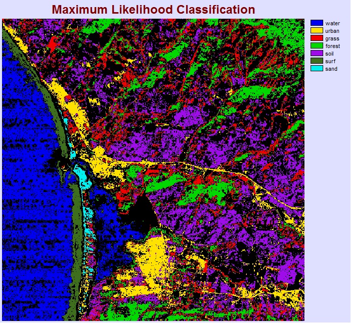
Maximum Likelihood classification: This classifier quantitatively evaluates both the variance (internal variability in a band) and covariance (the similarity between bands) of training class pixels and assumes a normal distribution for training classes. This classifier has been most widely used in remote sensing. This method typically produces an accurate classification, but assumes the most about how the data (the DNs summarized from the training sites) is distributed. Similar to MinDist, this method allows a threshold determined by the analyst. The maximum likelihood method takes into account the mean and the standard deviation (variability) of the DNs associated with each land cover class (and the variability in the DNs associated with each training site between the different bands).
What is de units of measure of the reflectance graphics at IDRISI ?