There are two main components of the basemap:
The Digital Elevation Model
The Digital Elevation Model (DEM) was created from a Triangulated Irregular Network (TIN) obtained from Squamish Open Data. I used the 3D Analyst Conversion toolset to convert the TIN into a 10m resolution raster file, which was then clipped to the Squamish Boundary obtained from Squamish Open Data. A 10m resolution was chosen to best capture and represent the variations in slope, which is an important parameter in these analysis. After creating the DEM and Hillshade layers, we used the Spatial Analyst Surface toolset to develop a raster layer of the slopes. This is displayed in Figure 1: Slope Angles in the District of Squamish. The risk of slope movement increases as the slope increases.
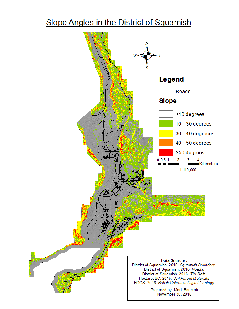
Figure 1: Slope Angles in the District of Squamish
The Surficial Materials Map
The Surficial Materials Map is needed to assign the engineering properties to the different surface material. This map was created using two data sources; HectaresBC Surficial Material and the BC Ministry of Energy, Mines, and Petroleum Resources'(Ministry of Energy and Mines) Bedrock Geology Map. These two maps contained polygons of the different units, which I first clipped to the Squamish Boundary. The HectaresBC Surficial Material map represents the soil materials and the regions covered by bedrock, while the Ministry of Energy and Mines map shows the different bedrock geologies. I performed a union of the two maps, then reclassified all the polygons with a surficial material listed as bedrock with their representative bedrock geology. This produced Figure 2: Surficial Geology in the District of Squamish.
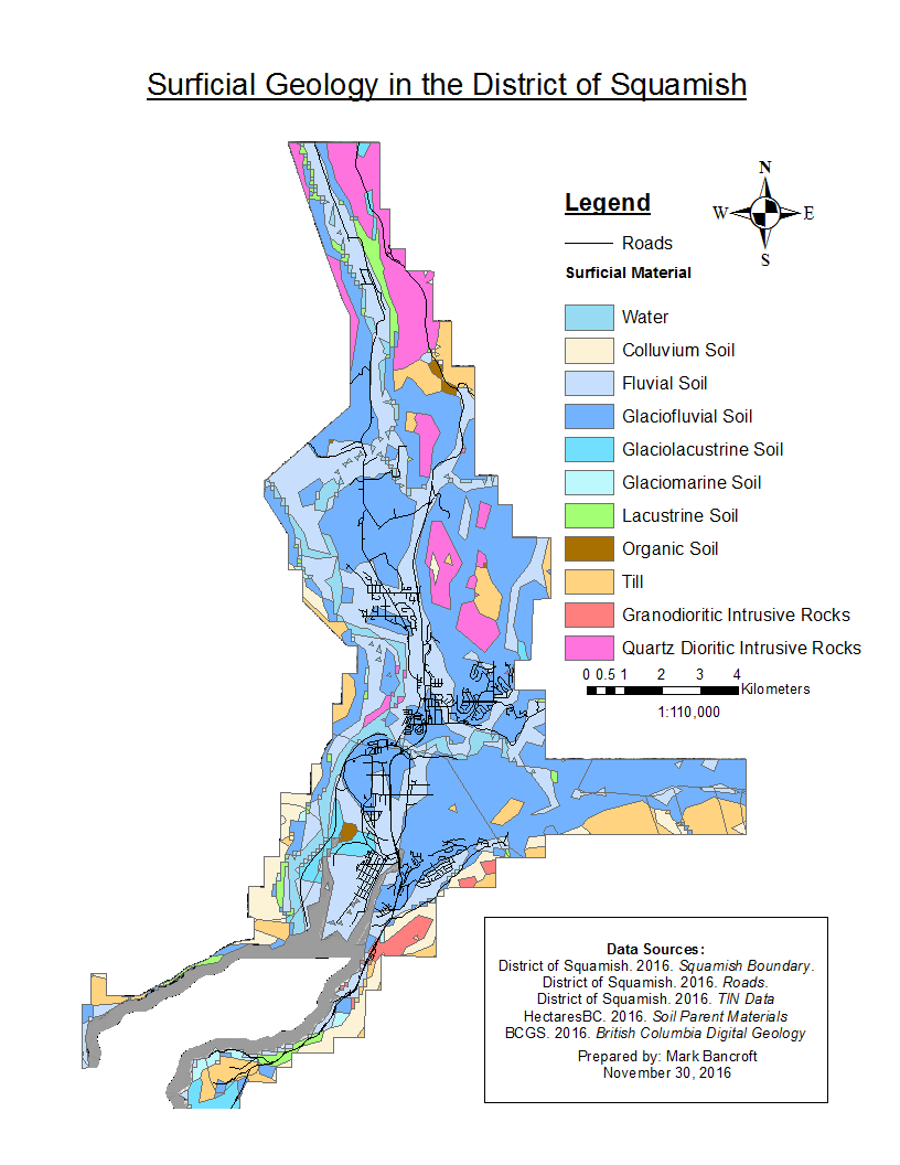
Figure 2: Surficial Geology in the District of Squamish.
I then added the following attributes to the different surface materials based off my research on representative parameters of soil and rock. We used the Query function the Water polygons from our analysis.
Table 1: Representative Parameters of Soil and Rock
| Material | Friction Angle (º) | Cohesion (kPa) | Unit Weight (kN/m3) | Transmissivity (m2/d |
|---|---|---|---|---|
| Water | 0 | 0 | 9.8 | N/A |
| Colluvium Soil | 34 | 17 | 16 | 43 |
| Fluvial Soil | 35 | 0 | 18 | 17 |
| Glaciofluvial Soil | 40 | 0 | 18 | 43 |
| Glaciolacustrine Soil | 20 | 0 | 18 | 17 |
| Glaciomarine Soil | 35 | 0 | 14 | 43 |
| Lacustrine Soil | 20 | 0 | 18 | 43 |
| Organic Soil | 10 | 0 | 10 | 2 |
| Till | 43 | 24 | 21 | 0 |
| Granodioritic Intrusive Rock | 30 | 25,000 | 26 | 0 |
| Quartz Dioritic Intrusive Rock | 24 | 70,000 | 45 | 0 |
Transmissivity was assumed to equal 0 for bedrock, and T = Km for soils, where T is the Transmissivity, K is the Hydraulic Conductivity, and m is the thickness, which was assumed to equal 1m.
After assigning these properties to the different materials a 10m resolution raster layer was created for each property.