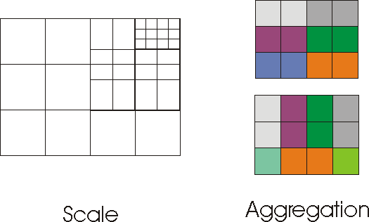
The Modifiable Areal Unit Problem (MAUP) is observed whenever data is geographically-modified,either by changing the scale at which we look at the data (e.g., dissemination areas versus census tracts vs cities) or by changing how we aggregate the spatial units (e.g., grouping dissemination areas into census tracts, or grouping them into neighbourhoods). The figure below illustrates these two modifications.
Note in the aggregation example how the individual cells can be grouped into clusters of two, either horizontally (top figure) or vertically (bottom figure).
