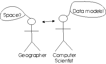
 In this lecture we’ll consider how space is most commonly conceptualized in GIScience (e.g., fields and objects/entities) and how those concepts are implemented as GIS data models (and the advantages and disadvantages of the two fundamental models of space–grids or rasters and vectors); basically, how is geography represented in a GISystem?
In this short paper (scroll down for text!) Antony Galton provides a theoretical review of the conceptualization of objects and fields, while in GIS Basics: Chapter 4 (Data models for GIS; links below) the discussion is centred around the implementation of models of space in a computer. You could say that Galton presents the GIScience perspective while Chapter 4 presents the GISystems perspective.
It is important to recognize that your conceptual view of the world should be independent of the programmatic view of the world. That is, how we conceptualize things should not be constrained a priori by how things are represented in the computer.
Learning Objectives
- Understand the concepts of fields and objects and their fundamental significance in GIScience;
- Know what raster and vector representation entails, and how these GISystems data structures affect many GIS principles, techniques, and applications;
- Understand the need to undertake GIS data modeling
- Recognize that GIS data modeling is both an art (e.g., the conceptualization) and a science (e.g., identifying appropriate topological structures) when building representations of real-world phenomena in GIS;
- Be able to describe geographic data models and discuss their importance in GIS;
- Understand key topology concepts and why topology is useful for data validation, analysis, and editing .
Recommended Readings
Text: Chapter 3: Representing Geography
Slides from the lecture are on Canvas.
Alternative text: GIS Basics: Chapter 4 although this material is only directed at the implementation models (i.e., raster and vector), and does not discuss the conceptual models (i.e., objects and fields).
In this short note Goodchild describes both the GIScience perspective (objects and fields) and the GISystems perspective. Also, again, Antony Galton's short paper (scroll down for text!).
Chapter 2 (especially section 2.1) of the online text Geospatial Analysis also provides a thorough overview of the basic primitives of geospatial data. (If you are thinking of becoming a GIS Analyst, you should bookmark this online text.)
Chapter 4: GIS and network analysis in GIS and the Social Sciences by Dimitris Ballas, Graham Clarke, Rachel S. Franklin and Andy Newing provides a very easy to follow introduction to network analysis. (If you are a human geographer interested in GIS, you should bookmark this text.)
Here is a link to WKIDs (spatial references) that ESRI and QGIS use to identify projections. Many programs, such as QGIS, use WKIDs as the primary means of identifying the projection/coordinate system, so it useful for you to know what they are and where you can look them up.
Additional Readings (In particular, for Lab 2)
ESRI has a tutorial on how to use the Network Analyst for ArcGIS Pro. A general ESRI discussion on ways to calculate accessibility of places.
A link to the terrain tools package.
The links below all relate to Lab 2 and the MCE analysis:
Pick the more relevant overview, based on your particular interests (e.g., from a natural resources perspective or from an urban geography perspective):
- Idrisi GIS: How to use IDRISI GIS for decision making--Idrisi has extensive MCE capabilities--view the PDF to see what kinds of modeling it allows.
- Forestry and MCE: Guidelines for Applying Multi-Criteria Analysis to the Assessment of Criteria and Indicators, Source
- Planning and MCE: Multi-Criteria Analysis: A Manual - a local government (UK) perspective
My Choice My Decision - A website that enables you to calculate AHP scores (used in Lab 2); however, if you do a search on the web you can find a number of additional sites that enable you to calculate AHP scores.
Analytical Hierarchy Process: Overview
ArcGIS: About Performing Sensitivity Analysis (For ArcMap version 9.3, but still a VERY useful read).
Useful Resources
ArcGIS Resources: Discrete and Continuous Data
ArcGIS Resources: Topology in ArcGIS Pro
Object-based Spatial Databases
ArcGIS Resource: Raster Compression (lossy vs lossless?)
Some terminology:
- Wikipedia: Ontology in information science vs ontology in philosophy and related fields.
- Wikipedia: Epistemology
- Wikipedia: Tessellation
- Wikipedia: Axiom
A discussion from Stamen Design on how they created the animated maps for the Audubon Society's climate change impacts on birds report.
Keywords
fields, objects, raster, vector, network, ontology, epistemology, tessellation, raster compression (lossy vs lossless), TIN