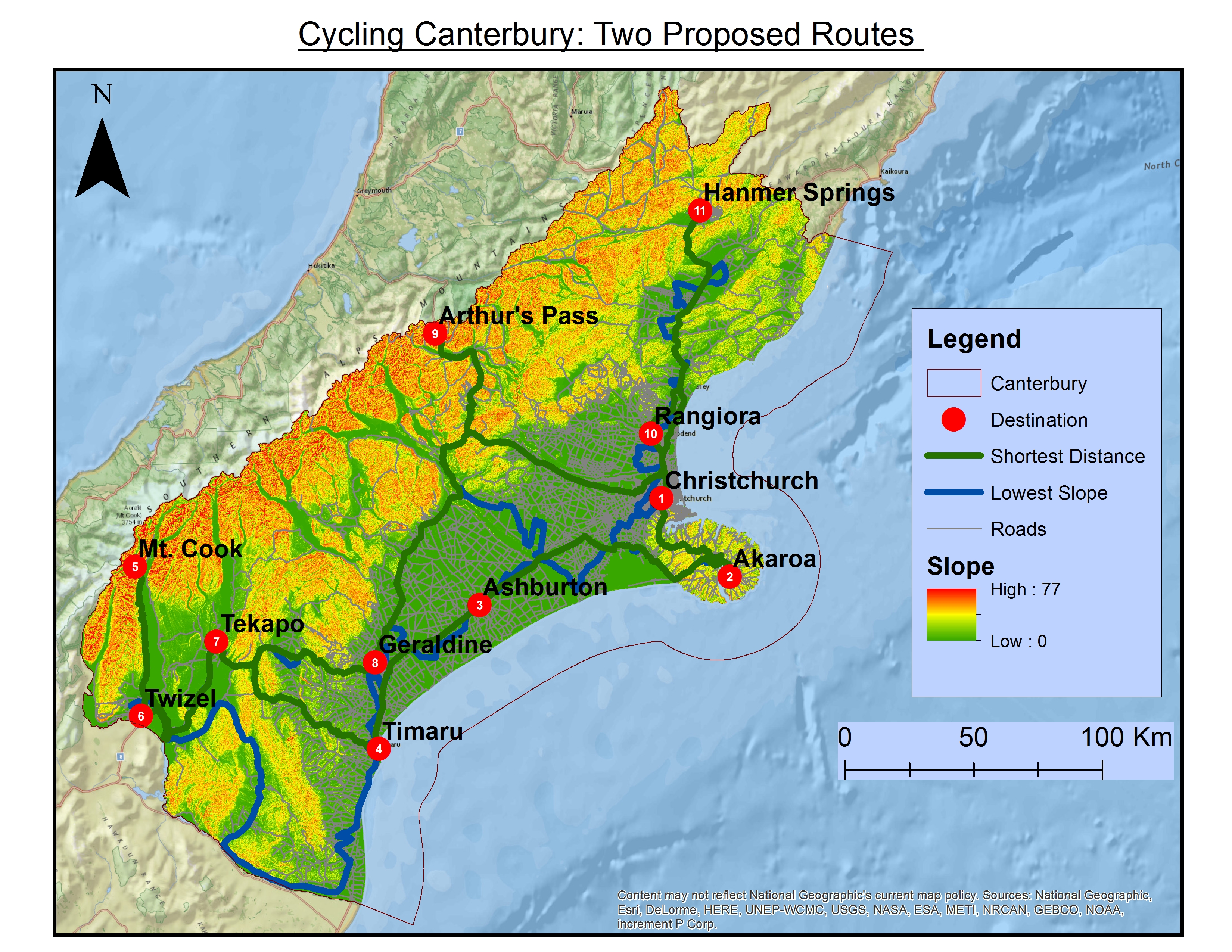
After running our Network Analysis with respect to slope and shortest distance, we produced two potential routes:
Route 1
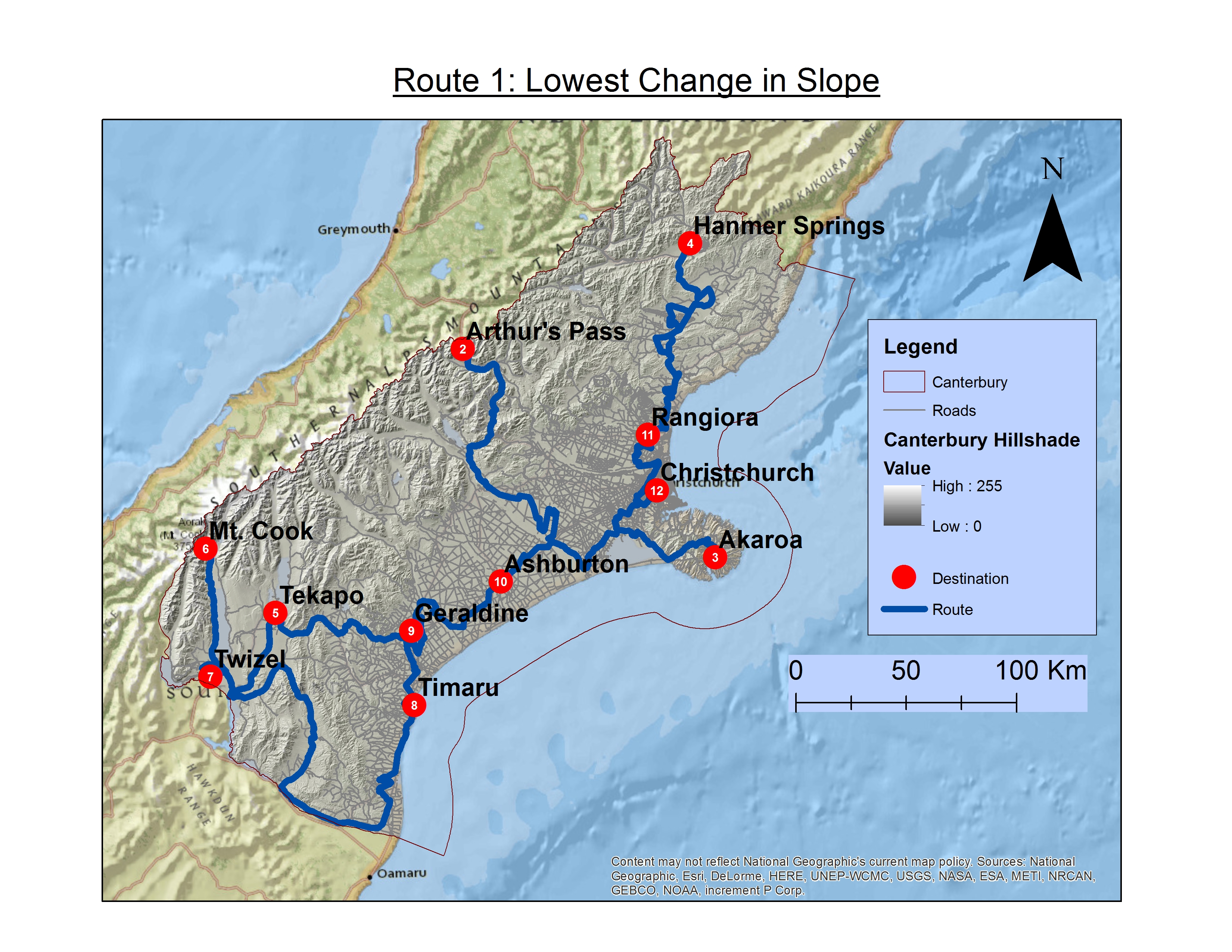
Route 1: Route one looked at the minimizing the slope of the trip between the cities. We had set the start and end point to Christchurch as that is where the biggest airport is and where the most variety of tourist attractions are. The proposed order of stops was as follows:
- Christchurch
- Arthur’s Pass
- Akaroa
- Hanmer Springs
- Tekapo
- Mt. Cook
- Twizel
- Timaru
- Geraldine
- Ashburton
- Rangiora
- Christchurch
The total distance covered in this route was 2,281 kilometers, and the total slope change count was 720. This is an incredibly low change in elevation for such a great distance crossed. To acheive such low slopes for the whole journey, entire mountain ranges were avoided, as seen most clearly in the segment of the route from Twizel to Timaru. As the only concern of this route was to minimize slope and therefore elevation change, this route placed the cities in an interesting order to someone just eye-balling the map. It also features more backtracking then our second route.
Route 2
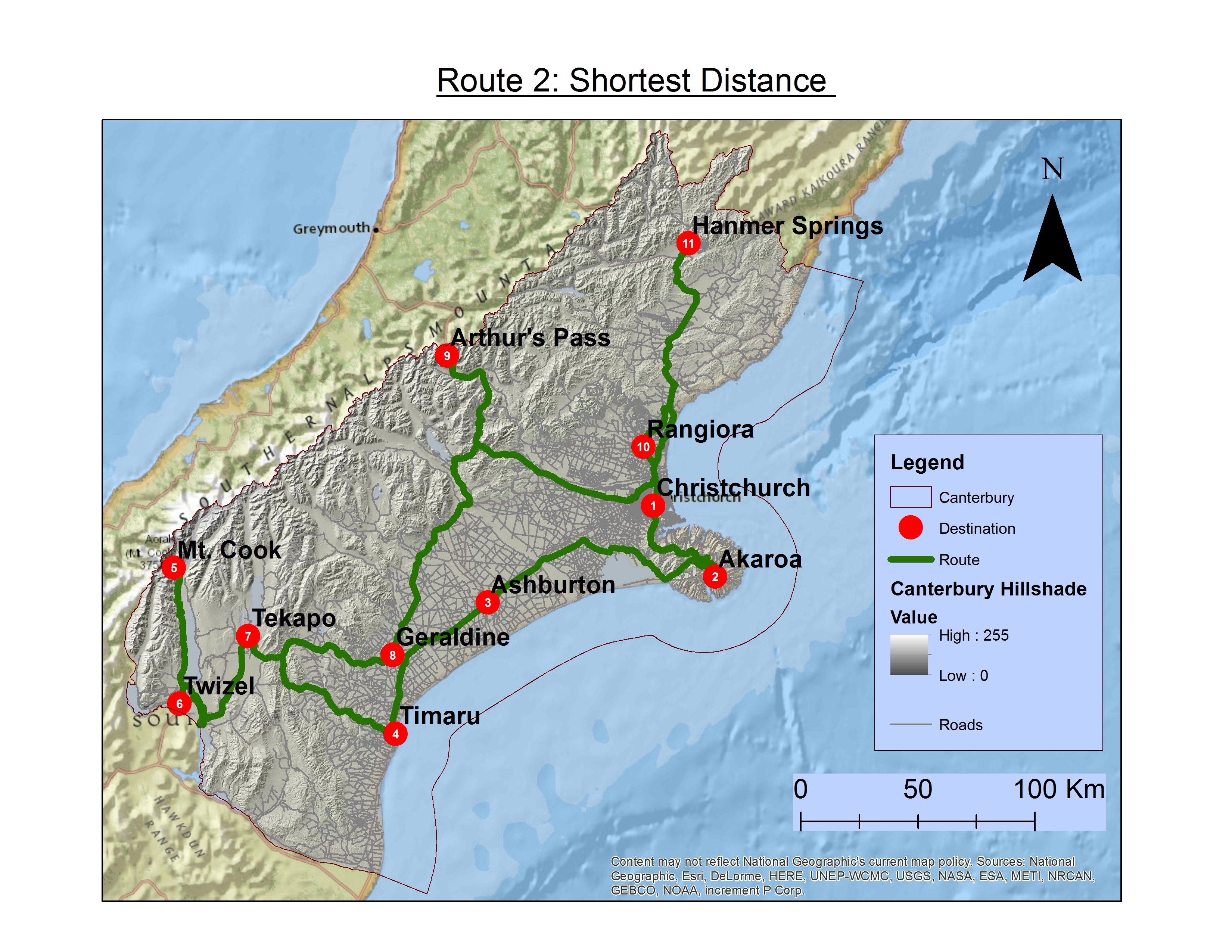
Route 2: Route two simply calculated the route with the shortest distance between the 10 stops, starting and ending again at Christchurch. The proposed order of stops was as follows:
- Christchurch
- Akaroa
- Ashburton
- Timaru
- Mt. Cook
- Twizel
- Tekapo
- Geraldine
- Arthur’s Pass
- Rangiora
- Hanmer Springs
- Christchurch
The total distance covered in this route was 1,185 kilometers. and the total slope change count was 7478. Just by looking at the map, this route made a lot more sense. The path still prefers valleys as opposed to mountains which makes sense because this is where the majority of the roads have been built. Despite this, the path does not shy away from the mountains in the south like Route 1 does.