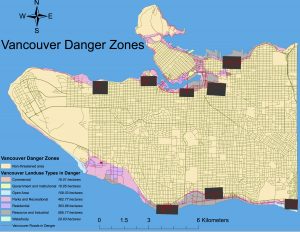
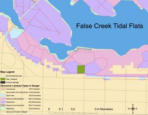
Here are my completed maps for lab 3. The first map, on the left, is a map of Vancouver in which potential areas threatened by a possible tsunami and/or storm surges are highlighted. The second map zooms in on the False Creek Tidal Flats area of Vancouver.


Education centers within Vancouver danger zones (5): Emily Carr, Henry Hudson Elementary, Flase Creek Elementary, St. Anthony of Puda, Ecole Rose Des Vents.
Health Centers within Vancouver danger zones (4): False Creek Residence, Villa Cathay Care Home, Broadway Pentecoastal LOD, Yaletown House Society.
I came up with this answer by using the select by location feature in the selection dropdown menu bar. My target layers were the health and education layers and the source layer was my Vancouver Landuse Danger layer. Once the relevant points were selected, I right clicked on the health and education layers to make separate layers out of the selections. The new site for the St. Paul’s Hospital is at risk due to the fact that it is so close to the shoreline and is located in an area that will likely be directly affected by a storm surge.
