GEOB 270 Final Project
The final project for the GEOB 270 class involved working with a group, and consisted of GIS analysis, a set of maps, a written report, and a flow chart. The following post will explain our project, “Implementing a New Fire Hall in the City of Chilliwack”. Click here for a PDF document of our entire final written report, including all maps and the flow chart.
Project Summary:
In our project, we are UBC Arts Co op students on a work term with the fire department in the City of Chilliwack. The fire department is in need of a new fire hall, as they are having difficulties responding to emergencies that are further out from the city core in a timely manner. We are tasked with the job of implementing a new fire hall, in order to increase fire safety in the region and improve response time for residents in need of emergent aid. Our main goal is to identify an appropriate location for the fire hall that will not disrupt current agricultural land use, yet allow residents to benefit from the additional fire hall. Variables we considered in creating the new fire hall included locations of current fire halls, restricted areas, densely populated areas, main transportation routes, and city parks. The data for our project was sourced from the Open Data Catalogue for the City of Chilliwack. We found 5 locations within the city boundaries of Chilliwack that may be suitable for implementation of a fire hall. We determined the most appropriate location for the fire hall to be Map 4 Figure 5, because the area is in a dense metropolitan and residential zone, close to Highway 1, and does not disrupt restricted lands.
Project Management:
The group that I worked with consisted of three of my classmates in GEOB 270. We all were very motivated and interested in applying the knowledge we had gained over the term to a project of our own.
We worked together very well throughout the entire project. We began by brainstorming for ideas, and after having difficulty retrieving data for our original idea, we decided to come up with a new one. We are all locals to the Vancouver region, and familiar with Chilliwack, so we thought this area would be interesting to study.
In terms of dividing up the work, we each had a couple tasks assignment to us, that we completed both individually and in collaboration with each other. After finishing drafts of all our individual tasks, we then conglomerated them and edited our written report together to make it cohesive. Overall this project went fairly smoothly, and we had no issues working as a team.
Interesting things we learned:
The biggest challenge that we faced with this final project was finding the data that we wanted. Initially, we came up with a project idea to propose new cell phone towers in a small town on Vancouver Island. However after much research, we could only access an interactive map of cell tower coverage, but not download it. This is why we switched our project idea to implementing new fire halls in Chilliwack instead. This process taught us about how not only finding data but also gaining permission to use data can be difficult.
We also practiced applying our knowledge of using GIS software to create the flow chart. The creation of this visual representation of our project aided my understanding of how much editing can go into a map, especially as analysis gets more complex.
Final Project products:
Written Report
A link to the full PDF of our written report.
Maps
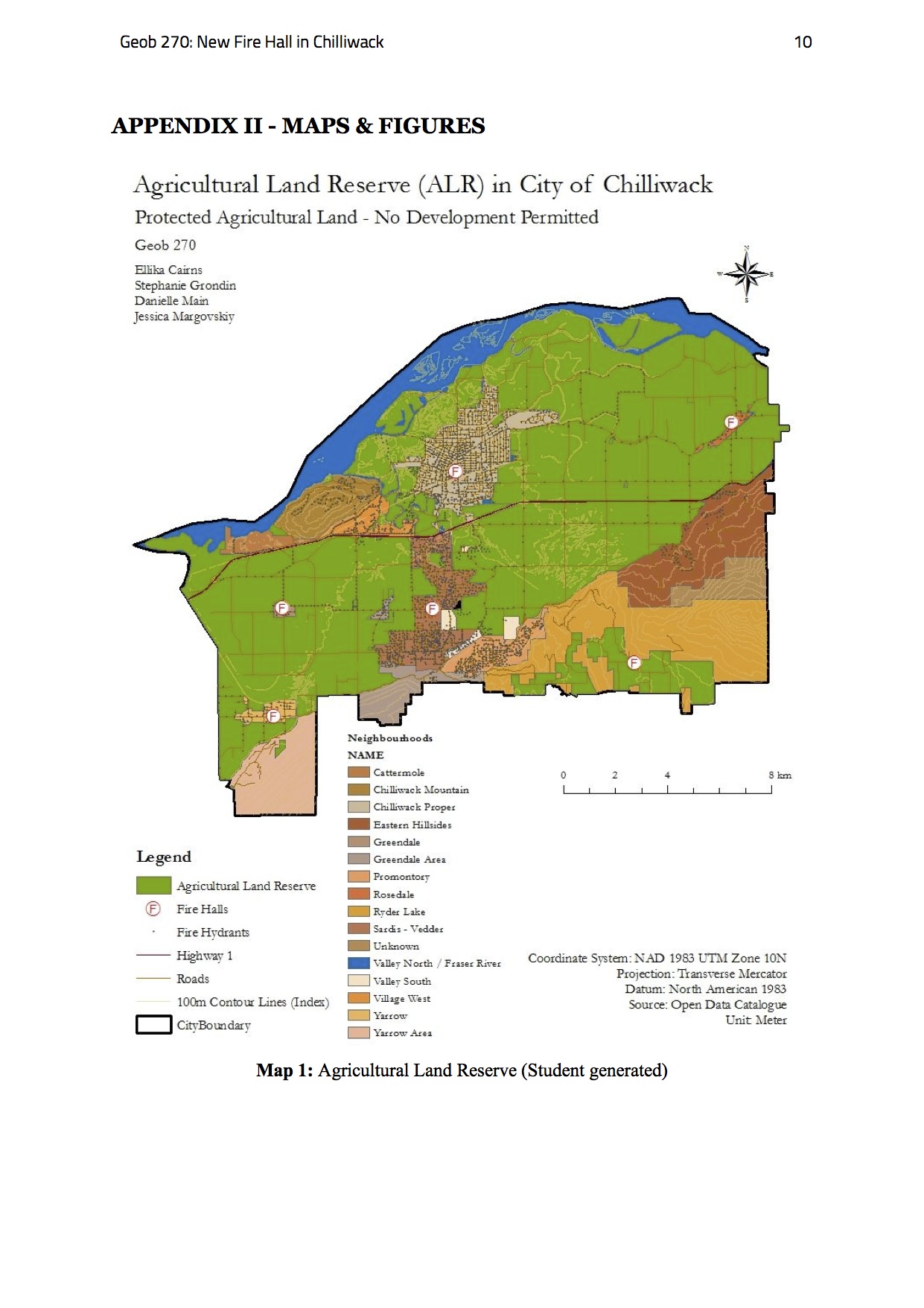
Final Project Map 1: Agricultural Land Reserve
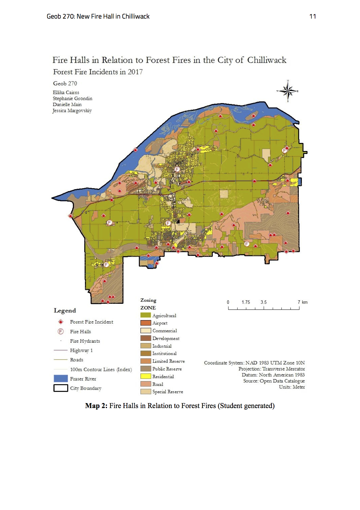
Final Project Map 2: Fire Halls in Relation to Forest Fires
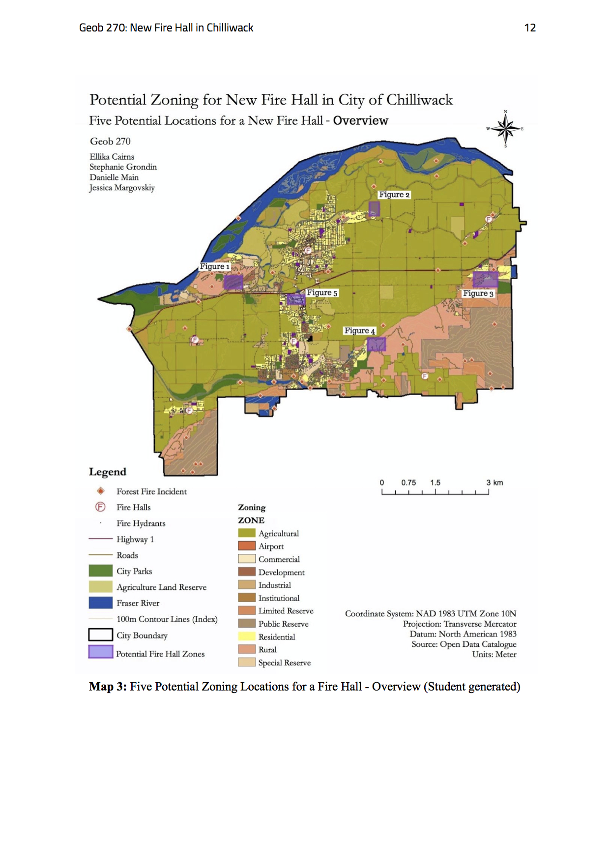
Final Project Map 3: Five Potential Zoning Locations for a Fire Hall – Overview
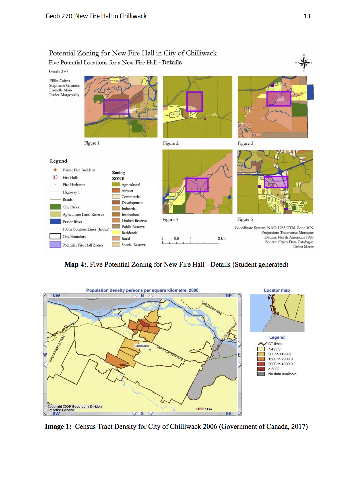
Final Project Map 4: Five Potential Zoning Locations for a Fire Hall – Details
Final Project Image 1: Census Tract Density for City of Chilliwack 2006
Flow Chart
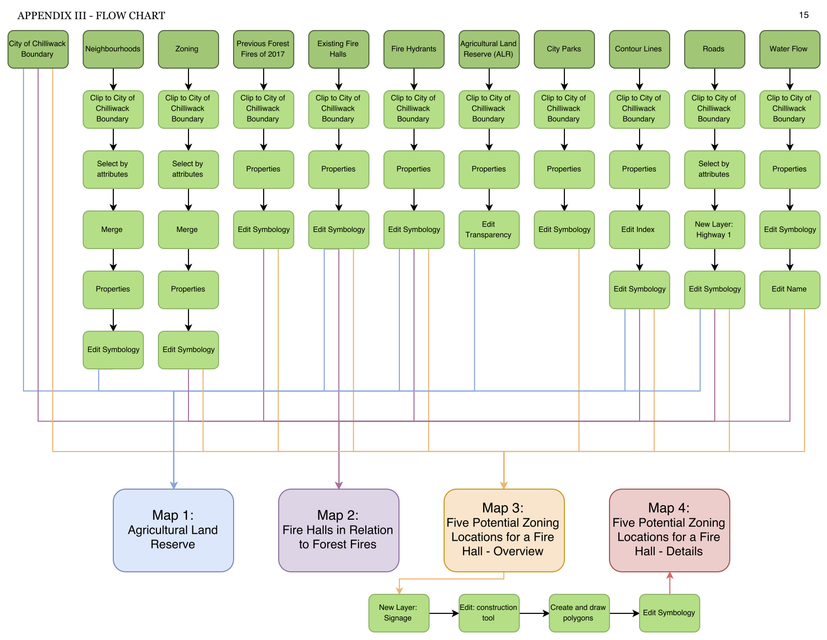
Final project: Flow Chart