Our recent lab publication: Power With
Category Archives: Uncategorized
Monitoring a Changing Watershed at Q̓welq̓welústen (Mount Meager) Fieldwork, community collaboration, and reflections from the Lillooet River watershed – ManFang Luo
I joined the Landscapes of Climate Change Lab in May 2026 as a recipient of UBC’s Work Learn International Undergraduate Research Award, working under the supervision of Professor Michele Koppes and Dr. Holly Chubb. This summer’s research centred on Q̓welq̓welústen (Mount Meager), the site of Canada’s largest landslide in recorded history, and the resulting flood risk to communities in Lil’wat territory and the Pemberton Valley.
At the beginning of July, our team headed to the Lillooet River Watershed to observe these changes firsthand, and collect data in the field. We combined drone surveying, water monitoring and sampling with knowledge shared through our collaboration with Líl’wat Nation.
What We Did and How We Did It


On June 30, we flew a LIDAR drone over the Qw’elqw’elústen landslide deposit and along the Lillooet River. We worked from a high point overlooking the valley, with a clear view down to the river and the deposit on the far side. From there, the drone collected detailed elevation data that enables us to map out the shape of the deposit, the river channels, and the surrounding terrain. It will be useful for future analysis of erosion, sediment transport, and how the landscape is changing over time.

collected water samples and measured turbidity along the Lillooet River to track water quality and sediment transport.

On July 1, we travelled along the Lillooet River and collected water samples at a series of locations from the top of Keyhole Falls to the bottom of the valley. Our goal was to understand how suspended sediment concentration changes along the river. At each site, Michele placed the turbidity sensor in the water, Holly checked the instruments and monitored the readings, while I recorded the field information. Our division of tasks helped ensure that the sensor was used consistently and data was recorded accurately.

Turbidity measurements helped us compare how cloudy the water was at different locations along the river. We also collected water samples so the results could be analyzed back at the lab. At the same time, we attached trail cameras to trees facing the river. We secured the camera, adjusted its angle, and confirmed that it had a clear view of the channel. The camera will continue taking images over time, helping us track changes in water level, colour, and flow conditions.


On July 3, we installed an ISCO automatic water sampler near the FSR bridge. The sampler uses an intake tube to draw water from the river and store it for later analysis, allowing samples to be collected automatically at the same time every day, even when we are not on site. After positioning the sampler and setting up the equipment, we tested the system to confirm that it could successfully draw water from the river. Over time, the ISCO will provide water samples that can be analyzed alongside the turbidity readings and trail-camera images to track changes in river conditions and sediment movement.


What was especially fascinating was that we co-hosted an opening ceremony with the Líl’wat Nation on July 2. This gathering provided an opportunity for us to introduce the project and explain the purpose of our research, so community members could better understand the work taking place on their territory. We were grateful for the knowledge and perspectives they shared with us, and they have shaped how we understand and carry out this work now.
One thing that stood out to me was hearing how directly people’s own knowledge connects to what we’re studying. Our project is looking at Qw’elqw’elústen (Mount Meager) and how Líl’wat oral history passed down about the mountain’s ancient eruption and the landslides that followed align with the geological records. When some of these stories came up during the ceremony, a few community members recognized them right away, saying things like “I know that story.” That moment made it clear this isn’t just about collecting information from the community, it’s about work the community already holds, in a form that long predates our research.
What stayed with me most was the reminder that the project stands on respect, communication, and genuine collaboration with the Líl’wat community.
Personal reflection
Before the fieldwork, my understanding of the watershed was shaped by maps, literature, satellite imagery, etc which is a bit abstract. I don’t think I’d really understood what “landscape change” meant until I was standing in the middle of it. Standing at the landslide deposit, walking the river channels, seeing how much the ground itself could tell us that a satellite image could never capture.
Knowing the changing of sediment, rivers and slope stability puts nearby communities at risk, making the project feel like it benefits people. That was probably the biggest shift in how I think about research: it is not just about understanding the physical processes for their own sake, but also about providing information to people who live in this watershed that they can actually use.
The season also had its own moments of chaos. On our last set of batteries, strong winds caught the drone, causing it plummet off the cliff. We drove down the mountain road, searching for a place we could reasonably climb down, and eventually found a route. Five of us scrambled bare-handed over rocks and pushed through the shrub until we reached the riverbank below. Fortunately, we found the drone, and even better, we managed to repair it. That’s the thing about fieldwork, out in nature, the unexpected is always around. We just have to adapt as it comes.
Mudeungsan Global Geopark
Patagonia 2024
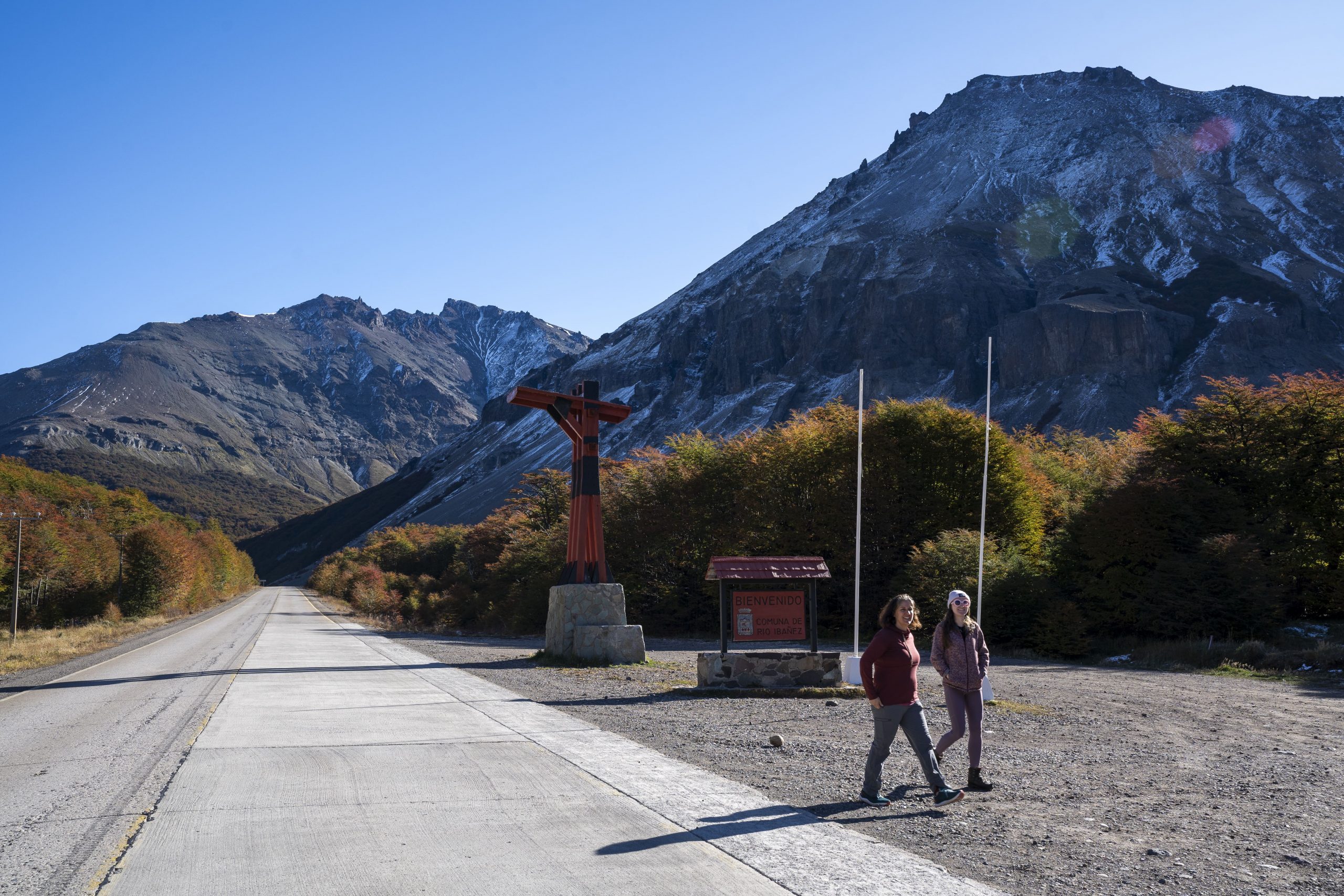
For the month of April, Michele and I embarked on an unforgettable journey across Chile, travelling from Santiago to Villa O’Higgins along the winding mountain highway of the iconic Carretera Austral. Our goal was simple, to share the outputs of my PhD project which sought to understand the Controls on the dynamics of Catastrophic Mass Movements in High Mountain Regions. I had spent four years researching how Villa Santa Lucia and Villa O’Higgins were being affected by climate change, deglaciation, and catastrophic mass movements. We wanted to meet with communities who are being affected by these complex landscape dynamics and establish relationships for future collaboration surrounding holistic hazard management in remote mountain settlements. Nestled between towering mountains and glacial rivers, Villa O’Higgins became our home base for an intensive field expedition across the Mosco watershed.
During the first two years of my PhD, I had researched the impact of climate change on the Mosco glacier range and had planned four field visits to characterise the role of deglaciation in increasing the frequency of CMM, and to determine the stability of two new glacier lakes which had formed in the paraglacial landscape. These four trips were ultimately cancelled due to Covid-19, and so the opportunity to finally visit O’Higgins was a long-awaited and emotional way to end my PhD journey.

Over the course of my PhD, I had been in contact with Martin, a local community member who manages the Mosco Hostel. Martin has lived in O’Higgins for seven years, observing the changes in the landscape caused by flooding and deglaciation, and had twice before visited the Mosco glaciers. Generous with his knowledge and expertise, we spent the first evening in Villa O’Higgins planning the route to the Mosco glacier lakes. We learned that we had to navigate through a treacherous canyon which could be impassable due to the rapidly flowing and endlessly evolving Mosco River. The constant threat of landslides and debris flows from the surrounding mountains would also cast a shadow over our trek.

Setting out the next day, we hiked 10km of winding forest and set up camp at a refugio (shephards hut) around 5km from the lakes. Ditching our heavy packs, we went to scout the Mosco River and planned our route for crossing the sinuous channels leading up to the canyon. We camped out at the refugio, and early the following day, we began our journey to the lakes. Early mornings provide cooler temperatures, which in theory meant lower glacial melt and lower discharge in the Mosco River. In a perfect world, it would be flowing underground, making the canyon more easily accessible. This was not the case.
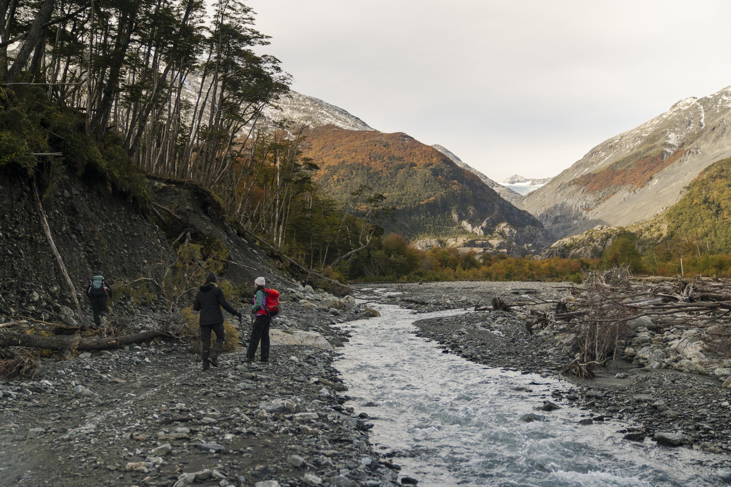
Mosco was flowing rapidly, but we crossed twice with relative ease. Moving rapidly across the alluvial fan, created by frequent landslides and debris flows running down from the surrounding mountains, we checked the first two trail cameras which had been installed by my PhD supervisor Professor Andy Russell and Dr Alejandro Dussaillant in 2021. To our surprise, these cameras were both operational, and provided two years of time lapse imagery of the landslide which created the first glacier lake. The trail cameras also yielded enormous spiders hiding in the cases secured to trees, and terror in me.
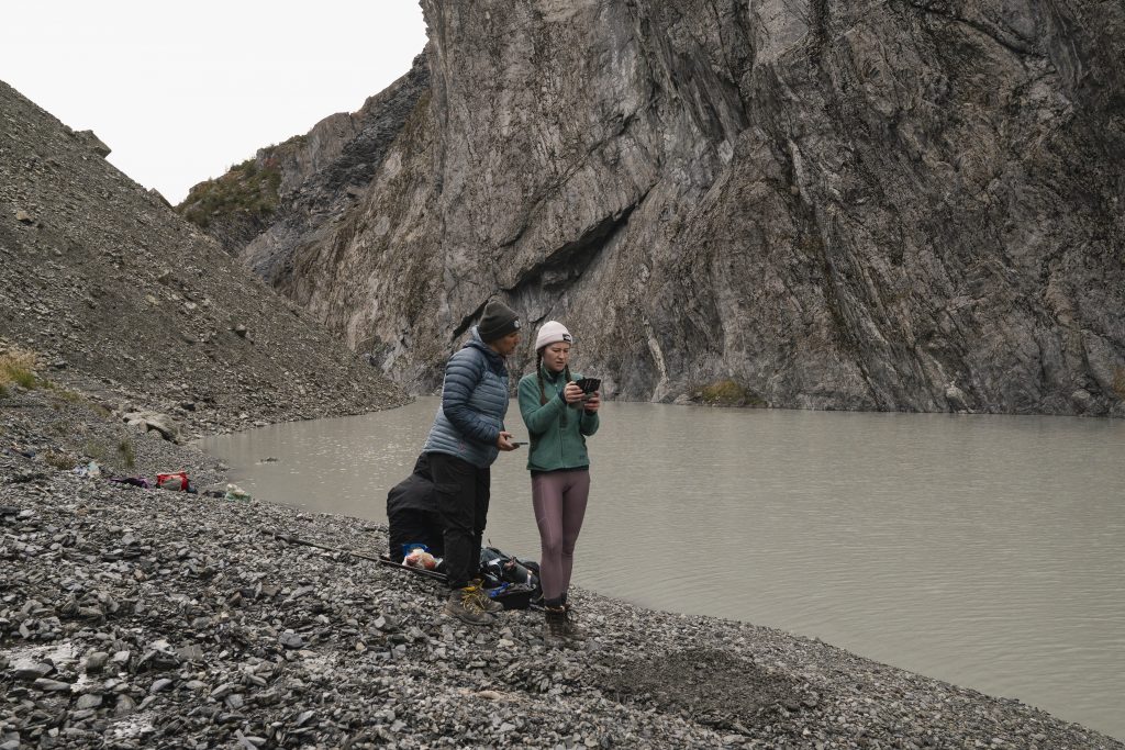
Continuing towards the lakes, we encountered fresh debris flow tracks which were likely triggered by recent rainfall. Another reminder of the dynamic landscape we were passing through, and a reminder to be vigilant about safety. We arrived at the mouth of the lake, and walked single file around its border. With every step, scree slipped and shifted beneath us, falling into the lake. As I walked forwards, I hoped that the large boulders balanced on the scree above us wouldn’t fall. They didn’t; we arrived safely on the side of the lake and began our work. Michele deployed hobo loggers, which would monitor the glacier lake level and temperature for the next 12 months. I flew the UAV, imaging the glaciers, lakes, mountain sides, and the headscarps of generations of slope failures. I would create 3D renderings of the area, using Agisoft photogrammetry software to build digital elevation models (DEM) based on the image X,Y, and Z coordinates. This DEM would be used in scenario modelling of potential inundation extents of CMM and flood events, and will also be used to quantify the changes in glacier volume, extent, as well as the size and volume of future CMM occurring across the Mosco watershed.
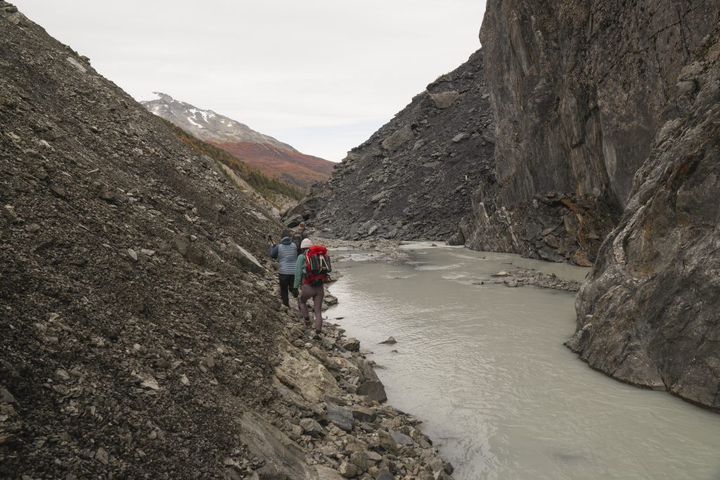
After we finished installing our monitoring equipment and surveying the glaciers, lakes and landslide deposits, we retraced our steps and left the treacherous canyon, reaching the alluvial fan and completed another UAV survey of the unstable mountain slopes surrounding the fan. Michele gathered sound recordings of the glacier streams and the sediments moving within the streams, and I took some time to speak to our guide Martin about the changes he observed in the valley since his last visit to the glacier in 2019. Tired but invigorated by the success of the day, we trekked back to Villa O’Higgins.
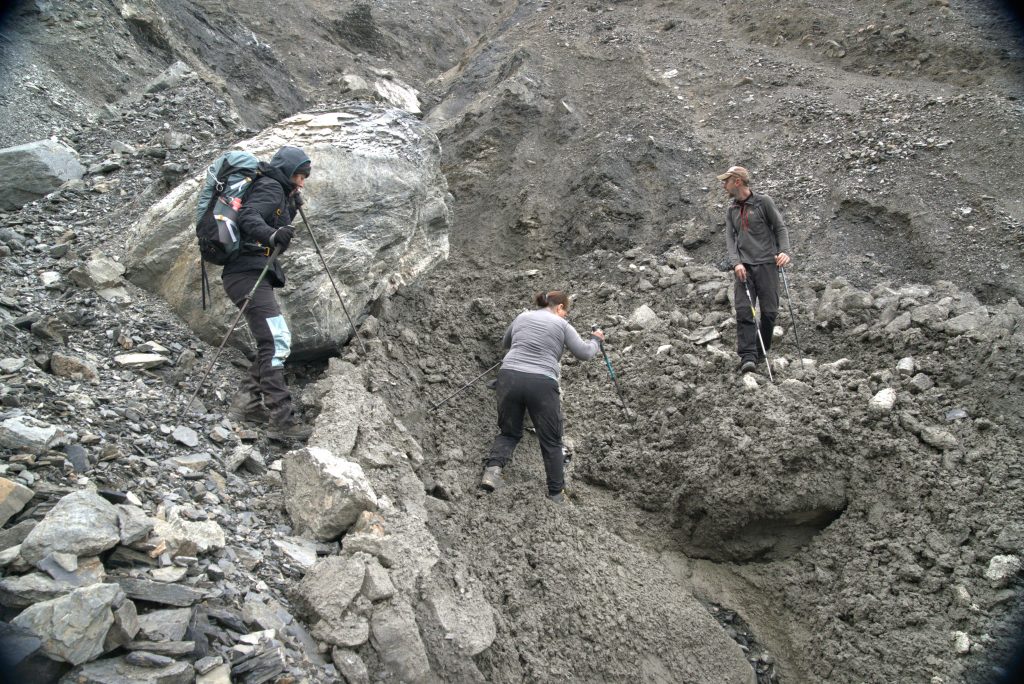
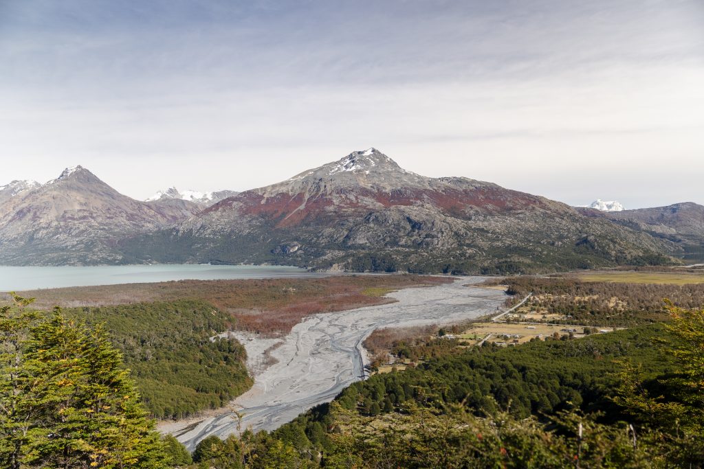
The following days in Villa O’Higgins were spent interviewing community members; three people generously gave us their time to share stories of landscape change over the course of their lives. Andrea and I delivered a presentation about my work to 30 community members, where we spoke about the changes in the glaciers, landslide histories, and future potential hazards which may impact the community. During a lively Question and Answer session, we learned about the concerns of flooding and future landslides which could impact people, houses, and future infrastructure development. We came to understand that the community concerned about the efficacy of new flood defenses which border the Mosco river. These flood walls were built by the municipality in response to an atmospheric river induced flooding event in 2019, which destroyed bridges, inundated homes, and caused two community members to permanently relocate to the other side of the river. We were encouraged that all attendees of the event thought more monitoring and research around the Mosco watershed is needed, that they want to be involved in the management of the watershed, being supportive of co-developing hazard management strategies during future visits. The community also expressed that scenario-based modelling of future flood and mass movement inundation is a priority for them, and they would welcome our support in generating this information.
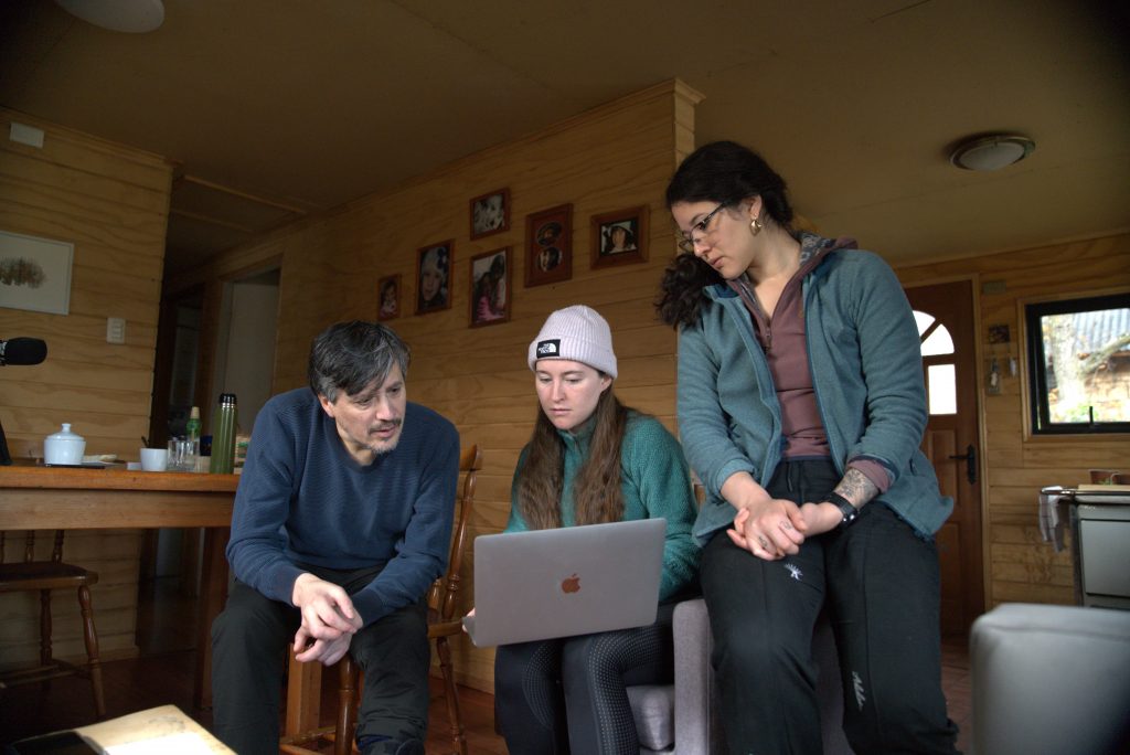

We left Villa O’Higgins after six days of learning, observing, and acquiring data. Ready for the next part of our journey, we returned to the Carretera, heading North to Villa Santa Lucia.
Living with landslides in Patagonia
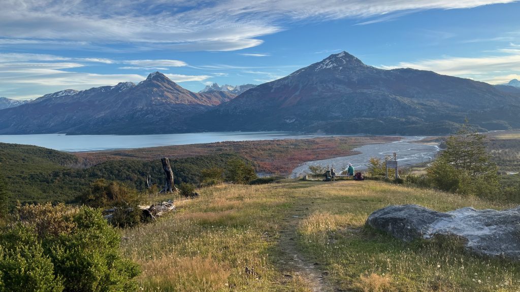
Exploring communities in the path of landslide hazards in Chilean Patagonia, April 2024