Tag Archives: Natural Hazards Dynamics in Deglaciating Landscapes

Patagonia Part 1


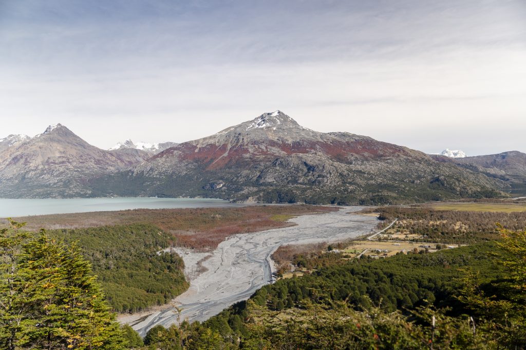
For the month of April, Michele and I embarked on an unforgettable journey across Chile, travelling from Santiago to Villa O’Higgins along the winding mountain highway of the iconic Carretera Austral. Our goal was simple, to share the outputs of my PhD project which sought to understand the Controls on the dynamics of Catastrophic Mass Movements in High Mountain Regions. I had spent four years researching how Villa Santa Lucia and Villa O’Higgins were being affected by climate change, deglaciation, and catastrophic mass movements. We wanted to meet with communities who are being affected by these complex landscape dynamics and establish relationships for future collaboration surrounding holistic hazard management in remote mountain settlements.  Nestled between towering mountains and glacial rivers, Villa O’Higgins became our home base for an intensive field expedition across the Mosco watershed.

During the first two years of my PhD, I had researched the impact of climate change on the Mosco glacier range and had planned four field visits to characterise the role of deglaciation in increasing the frequency of CMM, and to determine the stability of two new glacier lakes which had formed in the paraglacial landscape. These four trips were ultimately cancelled due to Covid-19, and so the opportunity to finally visit O’Higgins was a long-awaited and emotional way to end my PhD journey. 

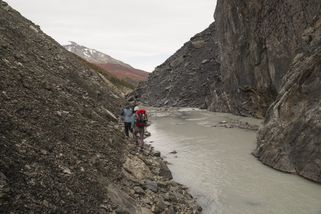
Over the course of my PhD, I had been in contact with Martin, a local community member who manages the Mosco Hostel. Martin has lived in O’Higgins for seven years, observing the changes in the landscape caused by flooding and deglaciation, and had twice before visited the Mosco glaciers. Generous with his knowledge and expertise, we spent the first evening in Villa O’Higgins planning the route to the Mosco glacier lakes. We learned that we had to navigate through a treacherous canyon which could be impassable due to the rapidly flowing and endlessly evolving Mosco River. The constant threat of landslides and debris flows from the surrounding mountains would also cast a shadow over our trek. 

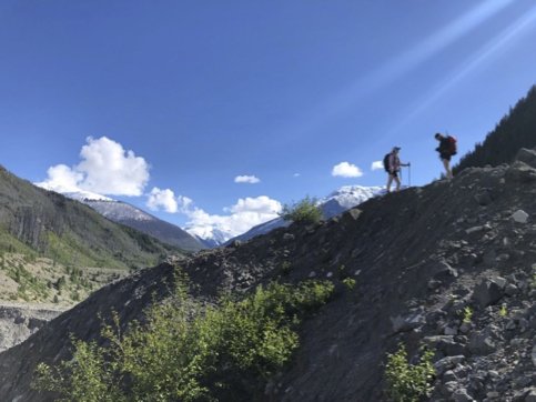
Setting out the next day, we hiked 10km of winding forest and set up camp at a refugio (shephards hut) around 5km from the lakes. Ditching our heavy packs, we went to scout the Mosco River and planned our route for crossing the sinuous channels leading up to the canyon. We camped out at the refugio, and early the following day, we began our journey to the lakes. Early mornings provide cooler temperatures, which in theory meant lower glacial melt and lower discharge in the Mosco River. In a perfect world, it would be flowing underground, making the canyon more easily accessible. This was not the case. 
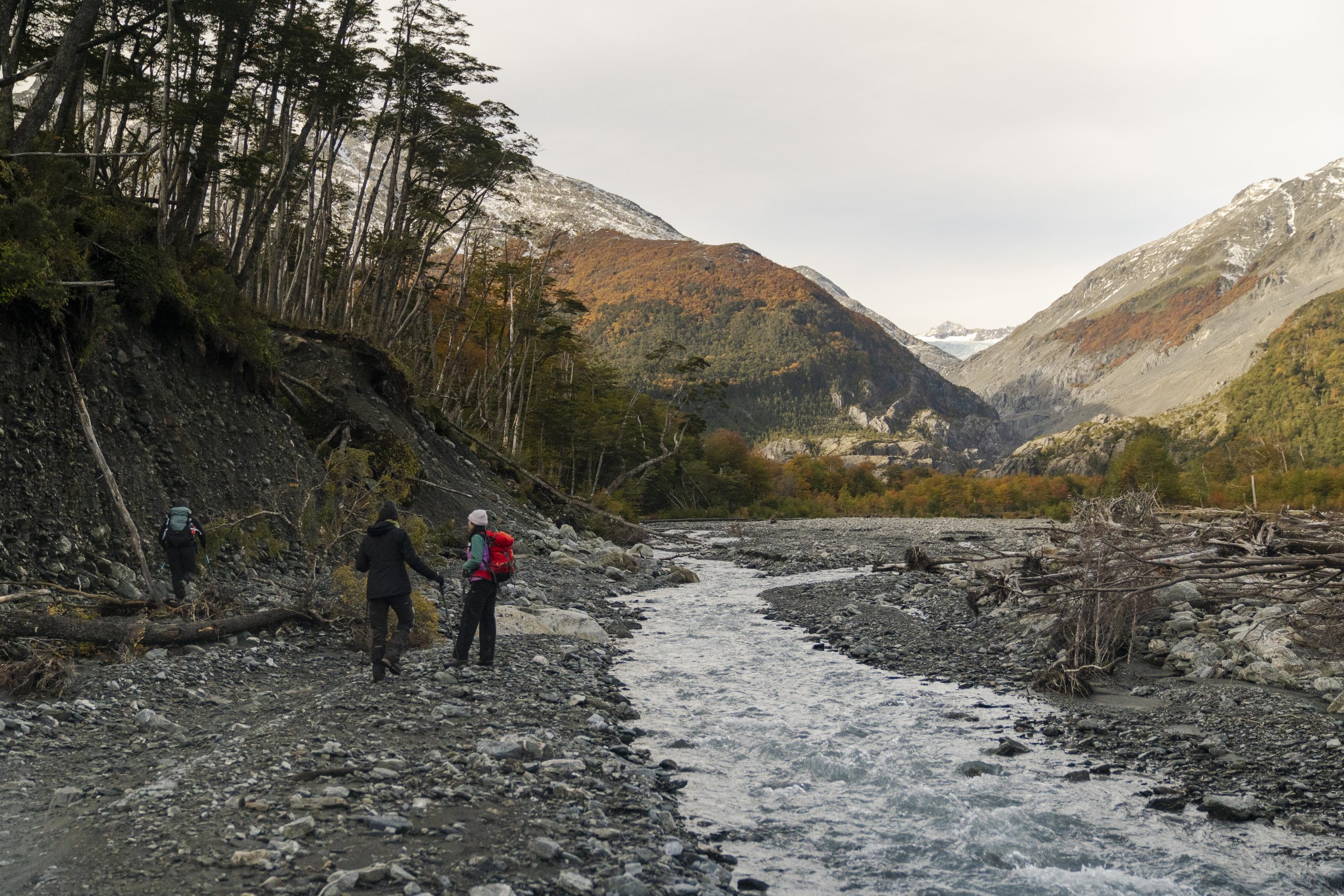
Mosco was flowing rapidly, but we crossed twice with relative ease. Moving rapidly across the alluvial fan, created by frequent landslides and debris flows running down from the surrounding mountains, we checked the first two trail cameras which had been installed by my PhD supervisor Professor Andy Russell and Dr Alejandro Dussaillant in 2021. To our surprise, these cameras were both operational, and provided two years of time lapse imagery of the landslide which created the first glacier lake. The trail cameras also yielded enormous spiders hiding in the cases secured to trees, and terror in me. 

Trail camera images showing the evolution of the Mosco river during a heavy rainfall event between April 3-5, 2021. We can see the widening of the river as a result of the heavy rainfall and increased glacier melt, which resulted erosion of colluvial sediments by the river. These eroded sediments are then transported downstream, contributing to increased flood risk in the lower reaches of the Mosco river where Villa O’Higgins is located

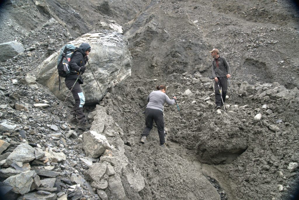
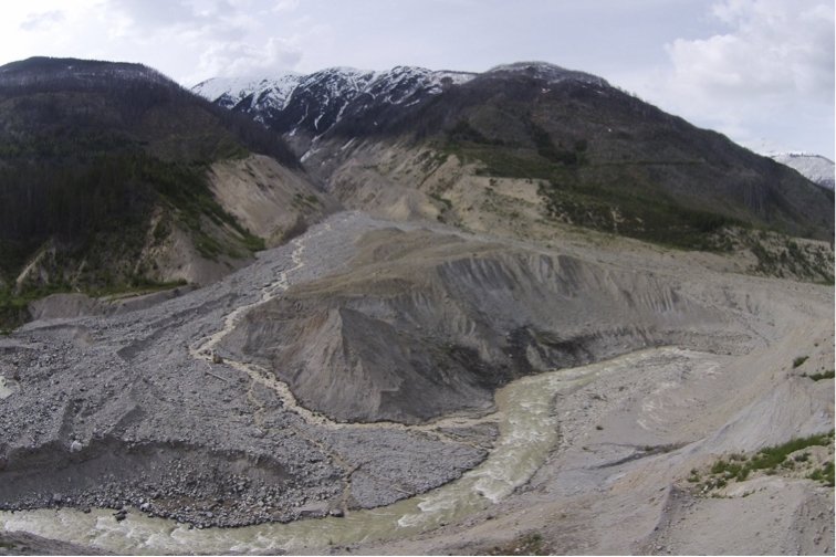
Continuing towards the lakes, we encountered fresh debris flow tracks which were likely triggered by recent rainfall. Another reminder of the dynamic landscape we were passing through, and a reminder to be vigilant about safety. We arrived at the mouth of the lake, and walked single file around its border. With every step, scree slipped and shifted beneath us, falling into the lake. As I walked forwards, I hoped that the large boulders balanced on the scree above us wouldn’t fall. They didn’t; we arrived safely on the side of the lake and began our work. Michele deployed hobo loggers, which would monitor the glacier lake level and temperature for the next 12 months. I flew the UAV, imaging the glaciers, lakes, mountain sides, and the headscarps of generations of slope failures. I would create 3D renderings of the area, using Agisoft photogrammetry software to build digital elevation models (DEM) based on the image X,Y, and Z coordinates. This DEM would be used in scenario modelling of potential inundation extents of CMM and flood events, and will also be used to quantify the changes in glacier volume, extent, as well as the size and volume of future CMM occurring across the Mosco watershed. 
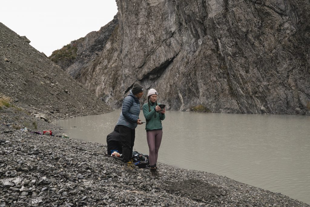
After we finished installing our monitoring equipment and surveying the glaciers, lakes and landslide deposits, we retraced our steps and left the treacherous canyon, reaching the alluvial fan and completed another UAV survey of the unstable mountain slopes surrounding the fan. Michele gathered sound recordings of the glacier streams and the sediments moving within the streams, and I took some time to speak to our guide Martin about the changes he observed in the valley since his last visit to the glacier in 2019. Tired but invigorated by the success of the day, we trekked back to Villa O’Higgins. 
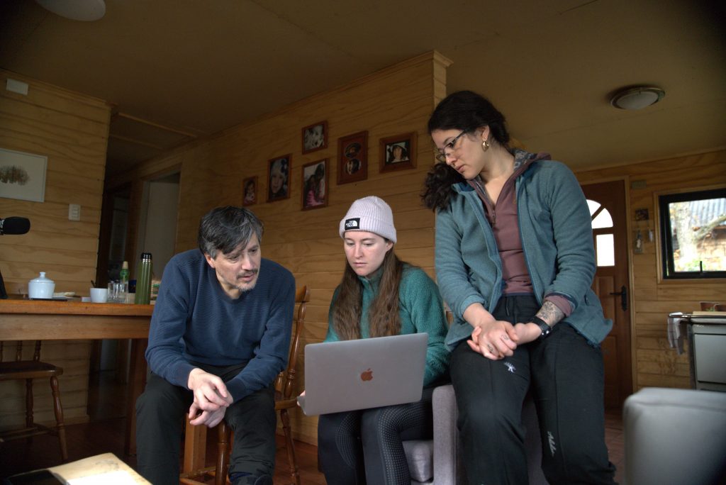
The following days in Villa O’Higgins were spent interviewing community members; three people generously gave us their time to share stories of landscape change over the course of their lives. Andrea and I delivered a presentation about my work to 30 community members, where we spoke about the changes in the glaciers, landslide histories, and future potential hazards which may impact the community. During a lively Question and Answer session, we learned about the concerns of flooding and future landslides which could impact people, houses, and future infrastructure development. We came to understand that the community concerned about the efficacy of new flood defenses which border the Mosco river. These flood walls were built by the municipality in response to an atmospheric river induced flooding event in 2019, which destroyed bridges, inundated homes, and caused two community members to permanently relocate to the other side of the river. We were encouraged that all attendees of the event thought more monitoring and research around the Mosco watershed is needed, that they want to be involved in the management of the watershed, being supportive of co-developing hazard management strategies during future visits. The community also expressed that scenario-based modelling of future flood and mass movement inundation is a priority for them, and they would welcome our support in generating this information. 
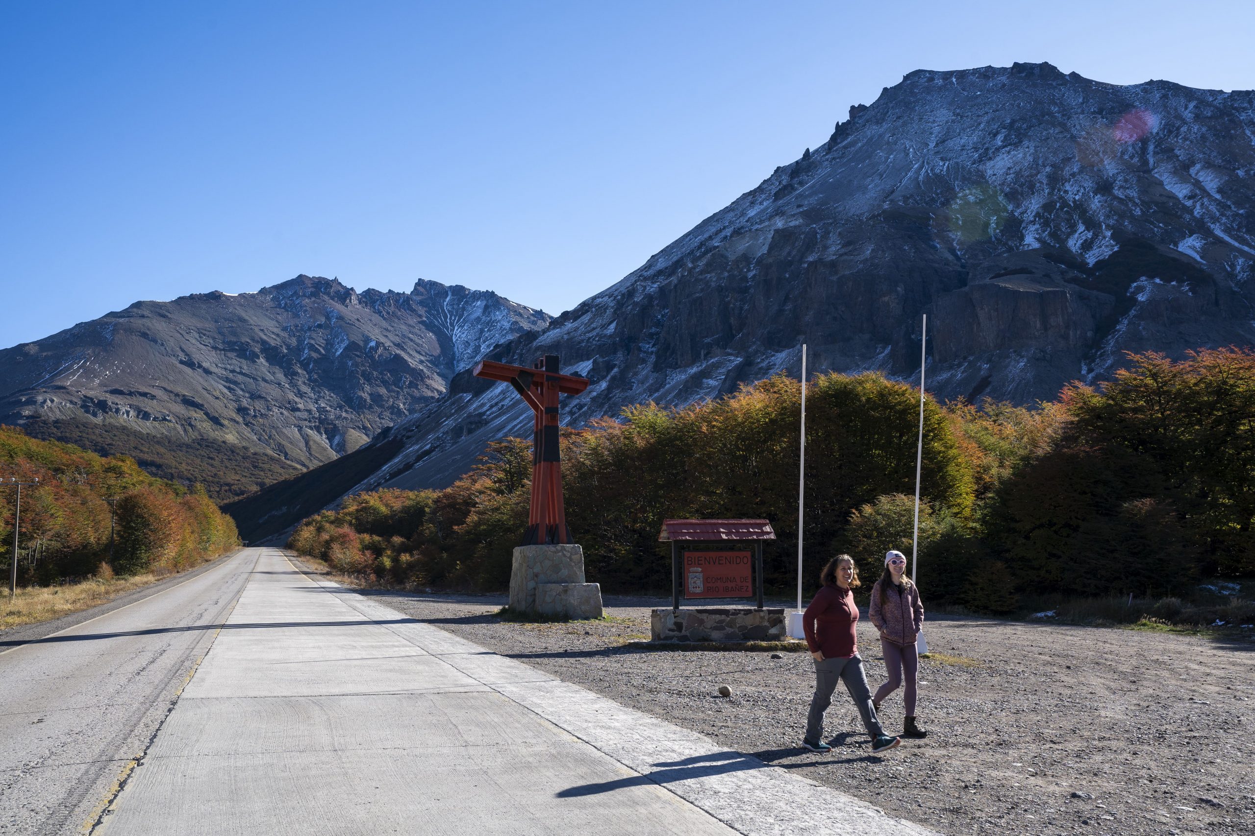
We left Villa O’Higgins after six days of learning, observing, and acquiring data. Ready for the next part of our journey, we returned to the Carretera, heading North to Villa Santa Lucia. 
Debris Flow Signatures in the Coast Mountains – Summary of the 2022 Field Season at Qw’elqw’elústen (Mount Meager) and N’skenú7 (Joffre Peak)

BY ISAAC LOWENTHAL WALSH

I joined the Climate and Cryosphere team in May 2022, as a recipient of UBC’s Work Learn International Undergraduate Research Award, to support data collection for Holly Chubb’s doctoral thesis. Over the course of the summer, we have worked in the lab and at two field sites in the Coast Mountains to plan, gather, analyze, and present data exploring the relationships between climate change, cryosphere degradation, and high mountain mass movement events.

Both field sites are located on Líl’wat First Nation territory. Qw’elqw’elústen (Mt. Meager) translates to “cooked face place,” or “really hot face” in Ucwalmícwts, the language of the Líl’wat First Nation. Qw’elqw’elústen is the only currently active Canadian volcano formed during the Quaternary period, sitting roughly 160 km north of Vancouver and 65 km northwest of Pemberton. Quaternary volcanoes such as Qw’elqw’elústen in the South Coast Mountains of British Columbia are often composed of weak rock, which is eroded easily, and often display patterns of rock fall near glacial trimlines (Friele et al., 2008). The August 2010 landslide/debris flow mass movement event at Qw’elqw’elústen was one of the largest in Canadian recorded history (Allstadt, 2013), producing a seismic signature with a magnitude equivalent to M = 2.6 and a flow path measuring a total length of 12.7 km (Guthrie et al., 2012).

Qw’elqw’elústen field work took place from May 31st to June 3rd, June 9th to the 13th, and on August 18th. We were able to access the runout zones of the 2010 Qw’elqw’elústen Landslide via the Meager Creek Hotsprings FSR, to the west of Líl̓watátkwa7 (Lillooet River), and the Lillooet River FSR, to the east of the river. During our first site visit, we investigated the southwest deposit lobe, taking systematic sediment samples and recording precise survey points using a GNSS receiver system, discussed in further detail below. We enjoyed a consistent weather window of partial sun and mild temperatures. On the second visit, Michele Koppes joined us for the first two days, during which we explored the easternmost deposits, using the same methods, in intermittent showers. On the final two days of our second trip the skies cleared, and we surveyed the eastern debris floodplain in mostly sunny, ~15° C weather.

N’skenú7 (Joffre Peak) is located roughly 25 km east of Pemberton, bordering Joffre Lakes Park to the west and the Nlháxten/Cerise Creek Consevancy to the east. The landslide events of May 13 and 16, 2019, lie almost exclusively within the Nlháxten/Cerise Creek Consevancy, a culturally important area to the Líl’wat First Nation. The Líl’wat First Nation shares joint management and supervision of the Conservancy with BC Parks (Geohazard Report, 2019). Similar to Qw’elqw’elústen, N’skenú7 was subject to glaciation during the Quaternary period, and has experienced significant glacial retreat since 1980. A moraine on the now-failed north slope of N’skenú7 marks the maximum Holocene extent of the glacier that used to lie there. The thinning and recession of this glacier eroded and steepened the north slope, and the patchy remnants of this glacier were swept away in the 2019 landslides (Friele, 2020). It is hypothesized that the mass movement events of May 2019 were directly preconditioned by melting permafrost, in conjunction with rapid snowmelt. This resulted in higher groundwater levels and increased porewater pressure within the rock, which would have weakened the structural integrity of the entire face.

Although significantly smaller in size, the slide at N’skenú7 is more impressive to me, since the boulders are consistently larger, requiring focused scrambling and route planning to traverse, and the entire flow path can be seen in full as you approach the middle. We collected data over the course of three trips, from July 13th to 16th, July 21st to the 22nd, and on August 17th. The site is accessed via the Keith’s hut summer route trail, and we stayed overnight at Keith’s hut, perched on the west ridge of N’skenú7. The first days of the first trip were very hot and cloudless, but the weather turned rainier on the third day. Concerned about the risk associated with crossing the highly unstable deposit while it was wet, we extended our stay an extra night. On the second trip, it was mostly sunny and still, favorable drone-flying weather.

N’skenú7 headscarp. The two failures are exposed, slightly below and to the viewer’s right of the peak. The terminal moraine of the now-extinct Joffre glacier smiles near the base of the mountain.

Methods

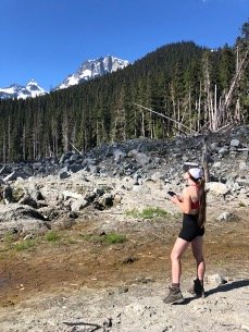
Whilst in the field, we used an EMLID GNSS receiver system to take survey points of significant features with centimeter-level accuracy of their position and elevation. Features that we recorded with the EMLID included the extents of the flow paths, heights and locations of hummocks, and locations of woody dams and large woody debris. The EMLID was also useful in characterizing the general topography of the area. By taking survey points in locations representative of each deposit area, we were able to gather data on the undulating terrain we encountered in all areas of the flow path.

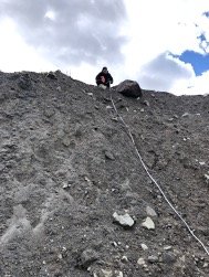
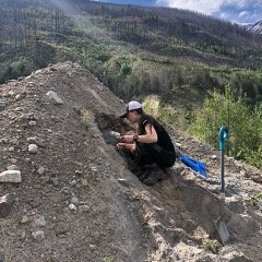
Sediment samples, 40 from Qw’elqw’elústen and 11 from N’skenú7, were dug from significant and characteristic locations in each flow path, using a trowel, to a depth of roughly 15 cm. These samples will be sieved in the coming months to determine their grain-size distribution; the grain-size distribution will be analyzed to understand the rheological dynamics of the debris flow in greater detail. We also took sediment logs in areas where the deposit profile was exposed, noting the degree of mixing and sorting within the deposit.

On the second and third visits to each site, we flew the new Mavic 3 cinematography UAS (Unmanned Aircraft System). At Qw’elqw’elústen, we photographed the eastern debris floodplain and the easternmost deposits from the event (east of Líl̓watátkwa7). Flying over N’skenú7, we captured nearly all of the deposit and photographed of the headscarp from afar. These flights captured 3cm-resolution imagery instrumental in the creation of an accurate orthophoto of the N’skenú7 flow path. Orthophoto analysis helps to visualize deposit features—hummocks, fluvial channels, woody dams, etc.—from an overhead angle, on a broader scale.

PERSONAL REFLECTION

The field season was not without challenge. At Qw’elqw’elústen, we had multiple grizzly and black bear sightings, and we came back to the campsite one evening to a fresh claw mark in our bear canister. What we anticipated as a relatively simple river crossing to access the plug of the slide turned out to be a ~30m wide impassible torrent of rapids. We felt the presence of a very real danger crossing the flow path at N’skenú7. The eastern buttress hung overhead, cracks propagating into the rock along the fault where the other two buttresses had already failed. Nevertheless, the season was greatly successful. Beyond completing our research objectives and collecting the data we hoped to collect, it was incredible to drink in the beauty of the South Coast Mountains and marvel at the power and scale of these two enormous mass movement events. I feel incredibly blessed to have received the opportunity to work on this project, and while my time in the lab may be coming to a close, I look forward to seeing how the study comes together in the coming year.

Cascading effects of climate change on CBC’s ‘What on Earth’ podcast

Michele had an opportunity to speak with the producer of CBC’s What on Earth podcast on September 13, to discuss the various impacts of glacier loss on communities downstream.

Listen here to the episode: Why Canada’s glaciers are becoming endangered species.