by Sara Cannon
In June 2015, I visited the Ulithi Atoll in the outer islands of Yap, Micronesia for the third time while working with One People One Reef. Just a few months before, on March 31, 2015, the communities had survived Super Typhoon Maysak which slammed the islands with 265 km/hour winds. I remember the way my heart sank as the familiar sight of Falalop, the largest island in the atoll, became visible in the window of the small twin-engine airplane (a sight that would have otherwise filled my heart with joy). The typhoon’s damage was obvious even from a distance.
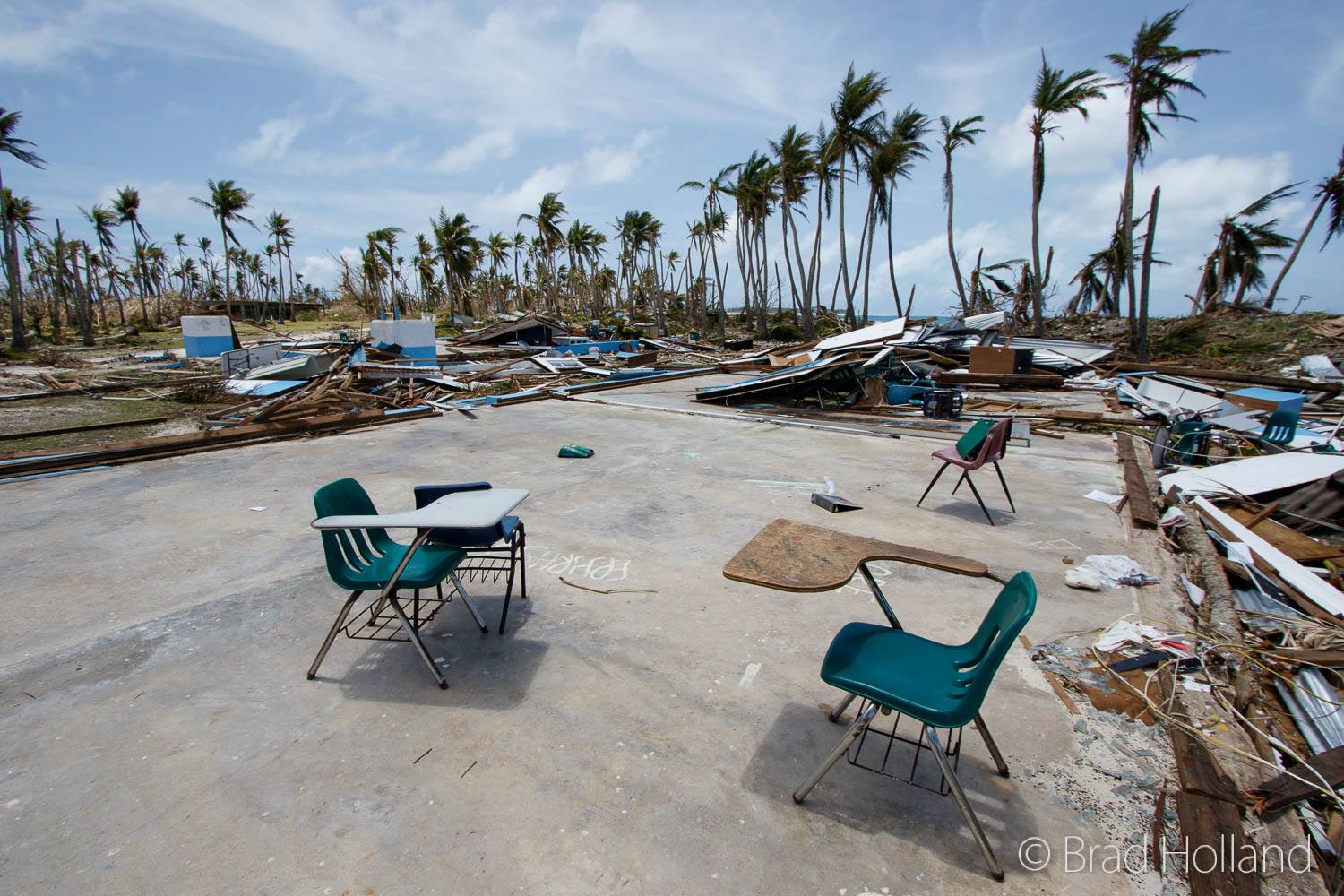
Outer Islands High School, Falalop, Ulithi (April 2015). Photo via Brad Holland
The impacts of Maysak were devastating. Most of the trees were gone, and in the lack of shade, the sun was relentless. The majority of the islanders’ homes were destroyed, along with much of their infrastructure. Only homes made of concrete were still standing. Ulithi’s high school, one of only two high schools in all of Yap’s outer islands, was virtually flattened. In normal years, students from an approximately 250 km radius come to Ulithi for high school; the only other high school in the outer islands is located in Woleai, over 550 km away. There was no running water and a recently completed multi-million dollar solar panel project on Falalop was ruined. Water filters were provided by the International Organization for Migration and electricity was being provided sporadically via a diesel-power generator.
During my visit, people were still reeling from the damage, but were eager for the opportunity to talk about what they had been through. Because Ulithi has no phone or internet, it’s a challenge for community members to share their experiences with the outside world. With the blessing of Ulithi’s communities, we created Yangdidi, a website that highlights the stories of Super Typhoon Maysak survivors. I worked closely with Kelsey Doyle, a graduate student in Journalism at New York University, and John Rulmal, Jr., a community leader and organizer from the island of Falalop, to compile a series of audio, visual, and written interviews from a wide breadth of community members from all over Ulithi.
To the Ulithian people, yangdidi (or “wind force”) describes what has happened to their islands. The force of Maysak’s winds has drastically shaped the future of this remote atoll. With sea levels rising, and scientists predicting that cyclone intensities will continue to increase due to climate change (2015 set a new annual record for category 4 and 5 hurricanes and typhoons), wind and flood damage from storms may become all too common in the low-lying island nations in the Pacific.