To determine areas most suitable for a new food bank site, a MCE was done using median household income, land use categories, and transit stop data. Before normalizing these factors, each layer was converted to a raster. The three factors were normalized using a Near Fuzzy Membership to display the data on a 0-1 scale.
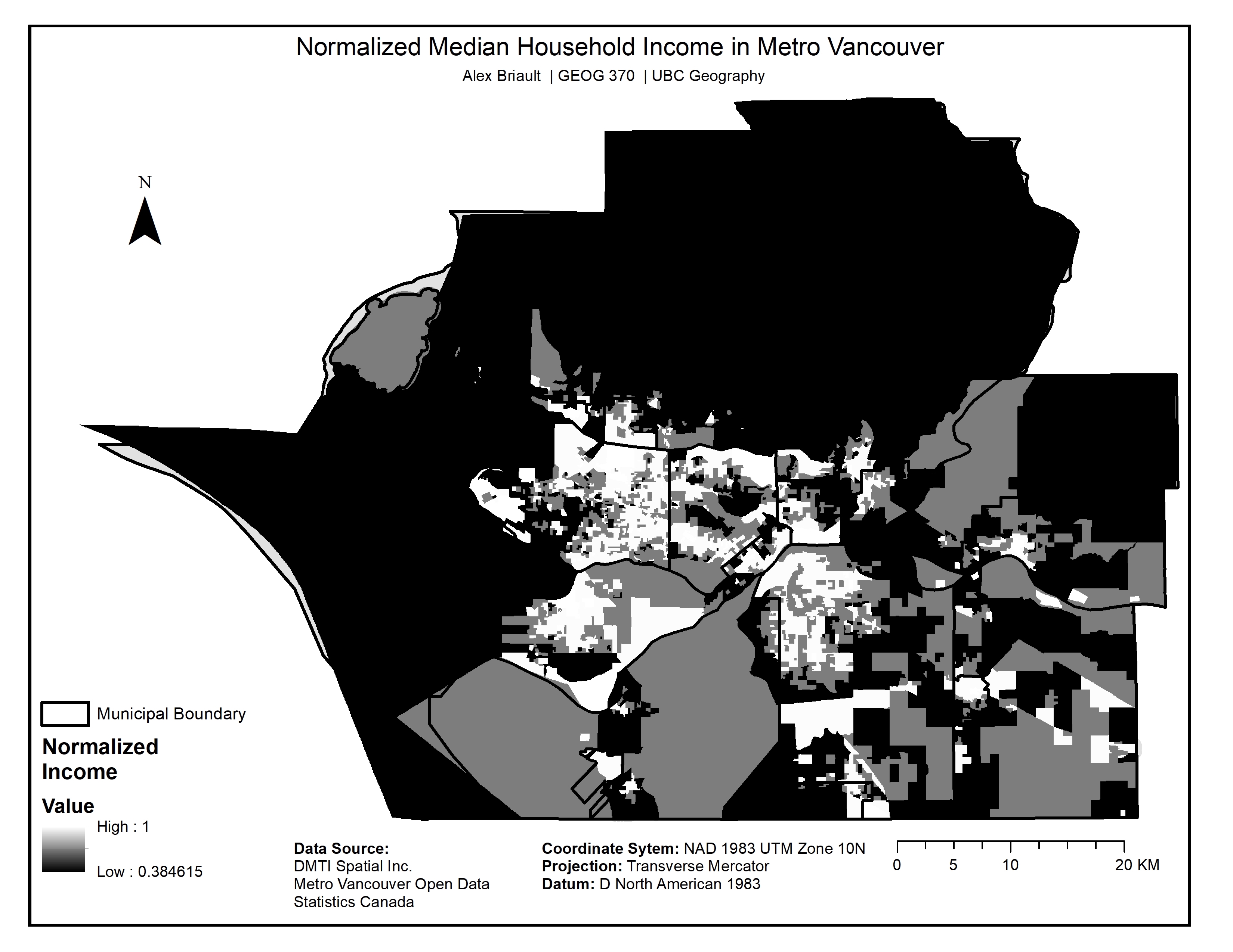
Map 7: Normalized Median Household Income
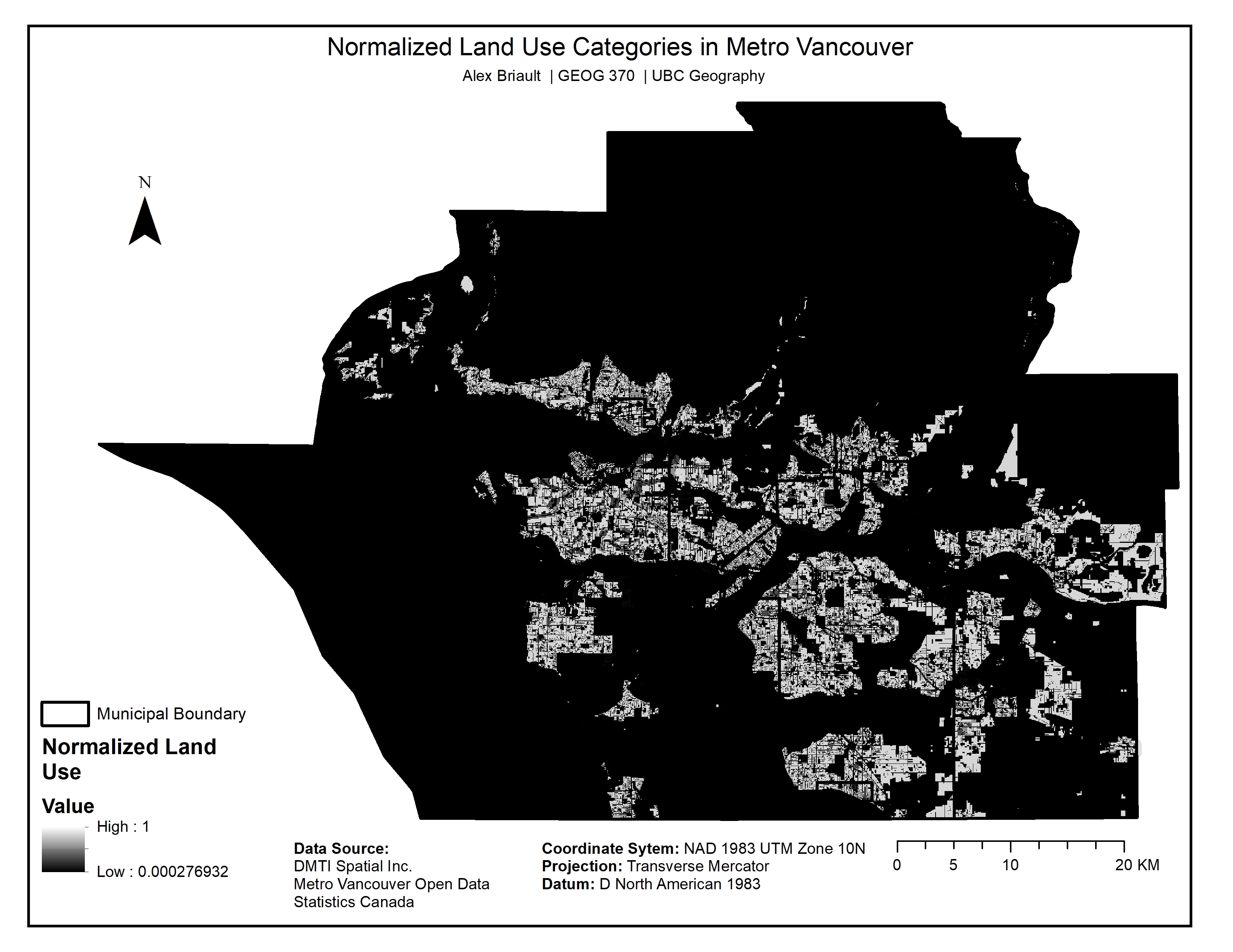
Map 8: Normalized Land Use Categories
Map 9: Normalized Transit Stops
Using an analytical hierarchy process (AHP), the normalized factors were assigned weights based on their importance:
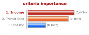
Figure 3: AHP to weigh Median Income, Transit Stops, and Land Use
Using the weighted factors, a MCE was then done to determine which areas in Metro Vancouver would be best suited for a food bank site. Results closest to 1.0 represent areas that best meet the criteria and will be the focus of the next section in the Results.
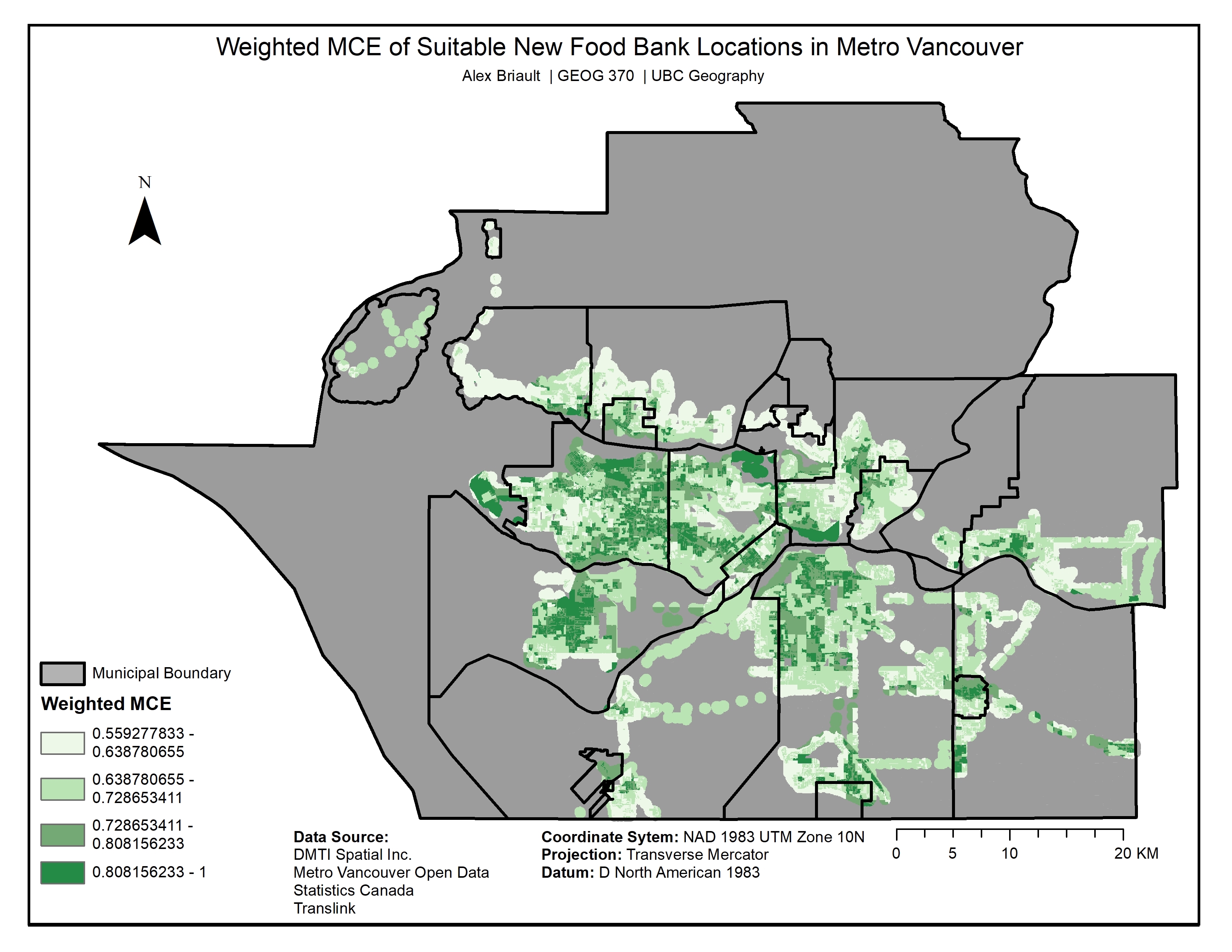
Map 10: Weighted MCE of Suitable New Food Bank Location in Metro Vancouver
A sensitivity analysis was then conducted to compare weighing the three factors equally. Weighing the factors evenly results in a very small area meeting the criteria for future food bank sites (click on map below to zoom in).
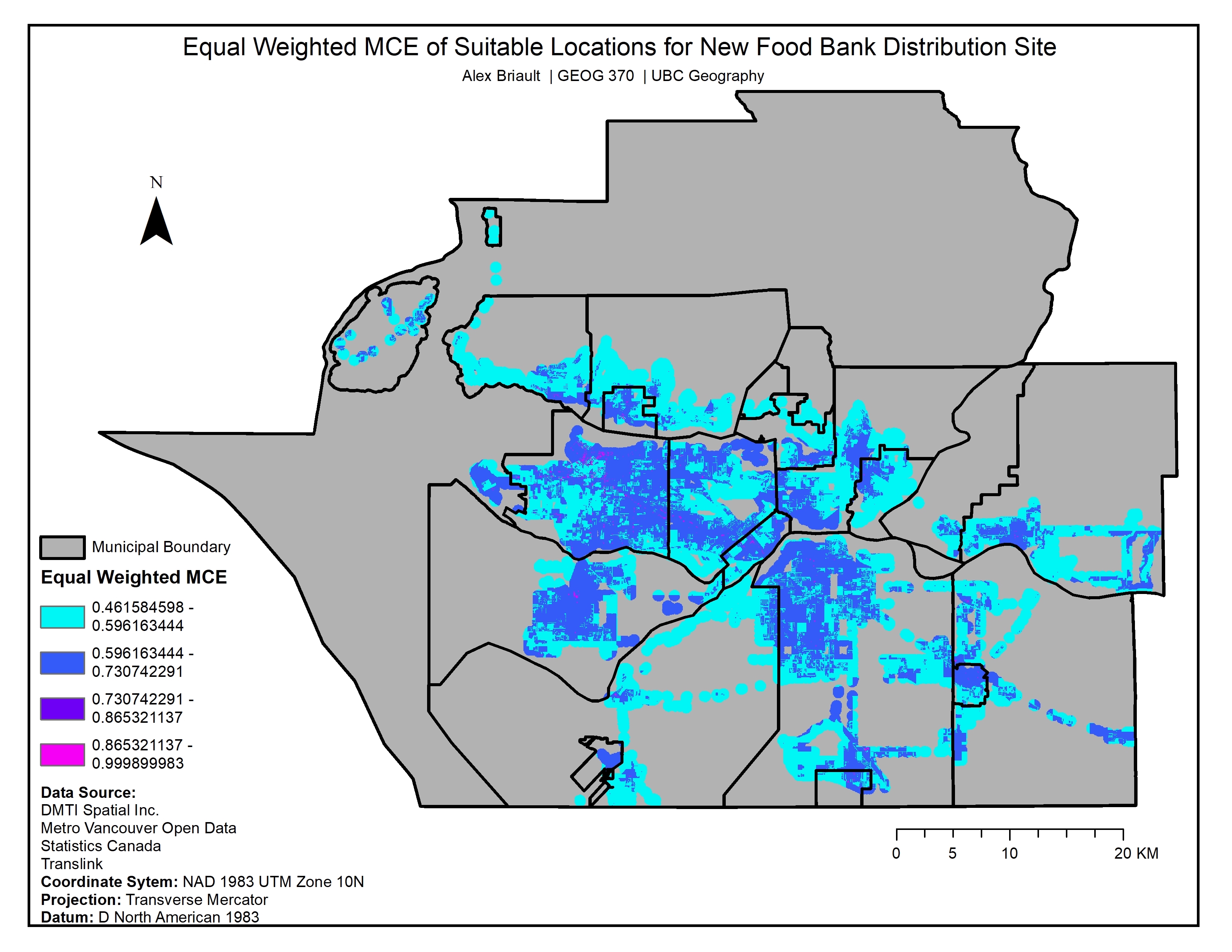
Map 11: Sensitivity Analysis