To determine how well-placed current food bank sites are, Euclidean distance rasters were created for both Low Income DA and Transit Stops. While living in a low income DA does not preclude a household from owning or having use of a personal vehicle, this distance analysis assumes no car use and thus set the maximum distance to 2km as this is not an unreasonable distance to walk with groceries for the majority of individuals. The same 2km distance was used for the Transit Stops Euclidean distance raster for the same reason.
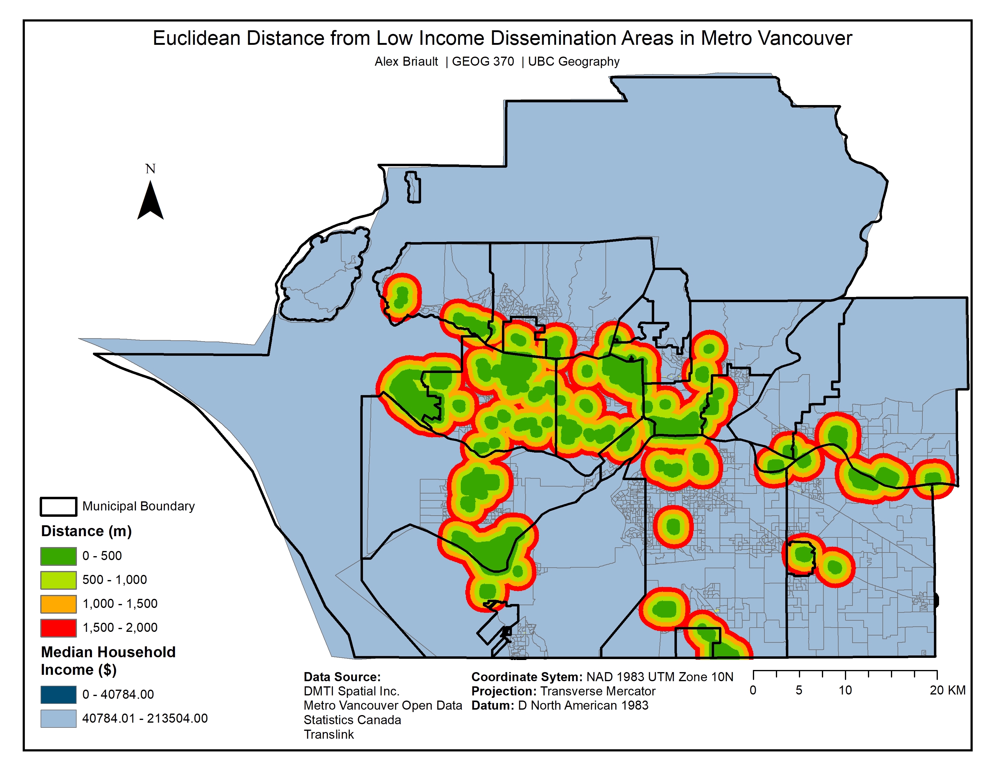
Map 5: Euclidean Distance from Low Income Dissemination Areas in Metro Vancouver
Map 6: Euclidean Distance from Transit Stops in Metro Vancouver