The majority of current food bank sites are located within 2km of low income DA and over half are located within 1km. This means that food banks in Metro Vancouver are well-placed to meet the needs of low income residents. The food banks that are more than 2km from low income DA are still accessible by transit as is visible in Map X below. All current food bank sites fall within 500m of a transit stop which means that they are all accessible by transit users. While all food bank sites are transit-accessible, accessibility is still mediated by the distance an individual must travel from their home to the transit stop.
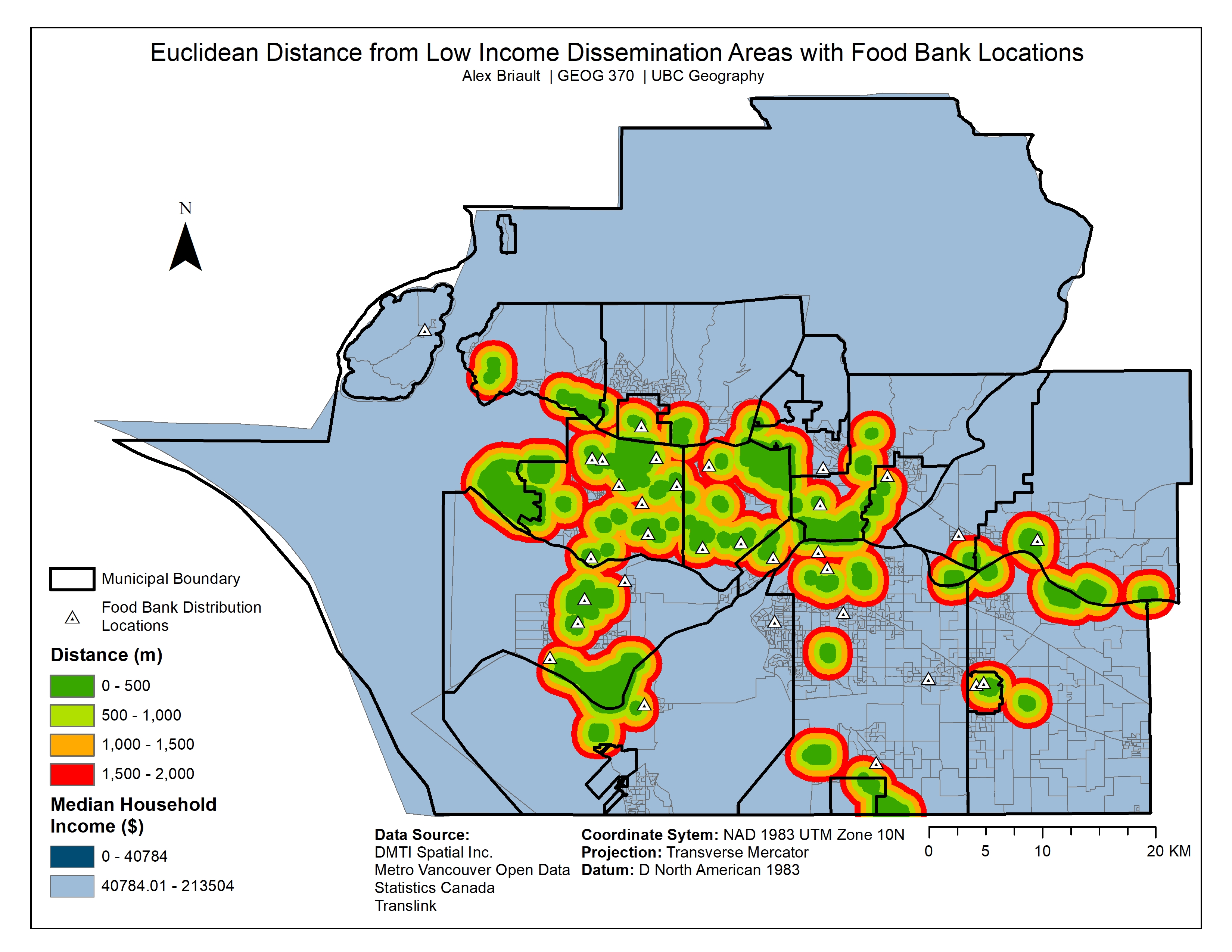
Euclidean Distance from Low Income Dissemination Areas with Current Food Bank Sites Visible
Euclidean Distance from Transit Stops with Current Food Bank Locations Visible
The MCE was reclassified to select only the top 20% results. In Map X, the resulting top 20% of the MCE are visible in orange overlaid on top of low income DA. In Map X, the results of the weighted MCE include the current food bank sites.
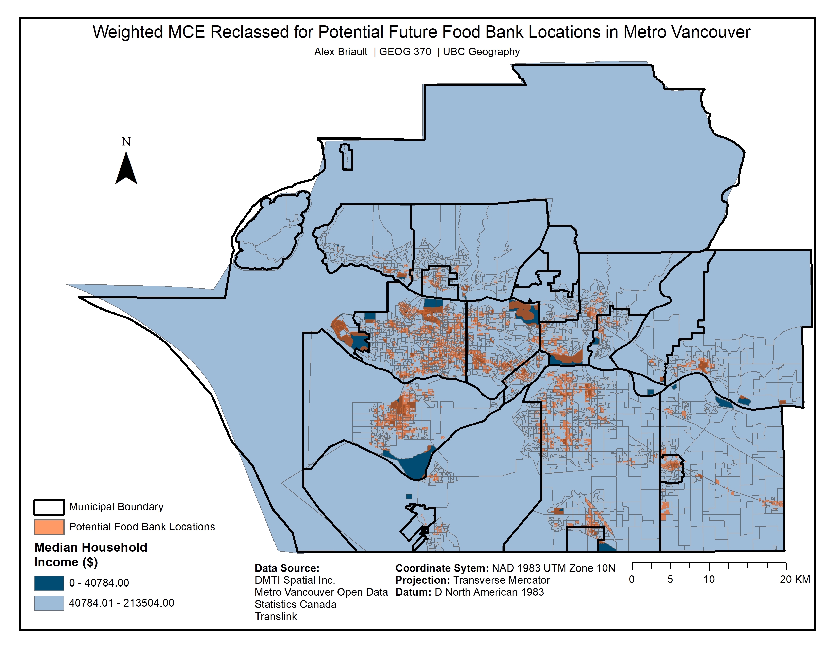
Weighted MCE Reclassified to Show Potential Future Food Bank Locations

Weighted MCE for Potential New Food Bank Sites Compared to Median Household Income with Current Food Bank Locations Visible
In Map X, the areas highlighted by red circles are where I recommend placing a food bank to better serve the area’s low income residents. Currently there is no food bank location in West Vancouver (the uppermost circled area) which leaves residents who face food insecurity with limited options as they must travel to the only North Shore location. The circled area at the bottom of the map, just outside of White Rock is another area highlighted by the MCE and a low income DA that I would recommend as the future site of a food bank as currently there is only one location nearby and as I will discuss in the Discussion section, food banks often have limited hours which means enough more barriers for individuals seeking their services. Lastly, the West Point Grey peninsula is highlighted as a potential future site for a food bank. The UBC campus is served by a food bank operated by the AMS but as this service is only available to students, it was not included in this analysis. The low income DA identified on Map X is primarily Pacific Spirit Park and is an example of the MAUP (Modifiable Areal Unit Problem) because the DA is not fully inhabited and is instead assigned a median household income based on the small number of households bordering the park. The Kitsilano area identified as a low income DA and by the MCE would be an ideal area for a future food bank site as currently households relying on food banks from that neighbourhood must travel across the city or to the downtown core.
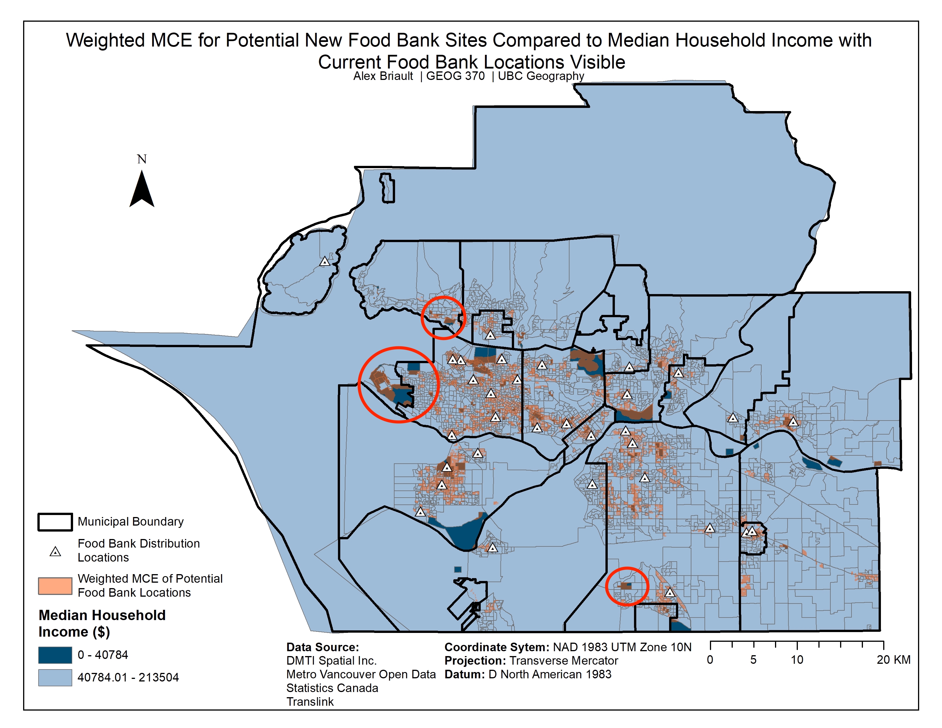
Weighted MCE for Potential New Food Bank Sites and Recommended New Sites