Overview:
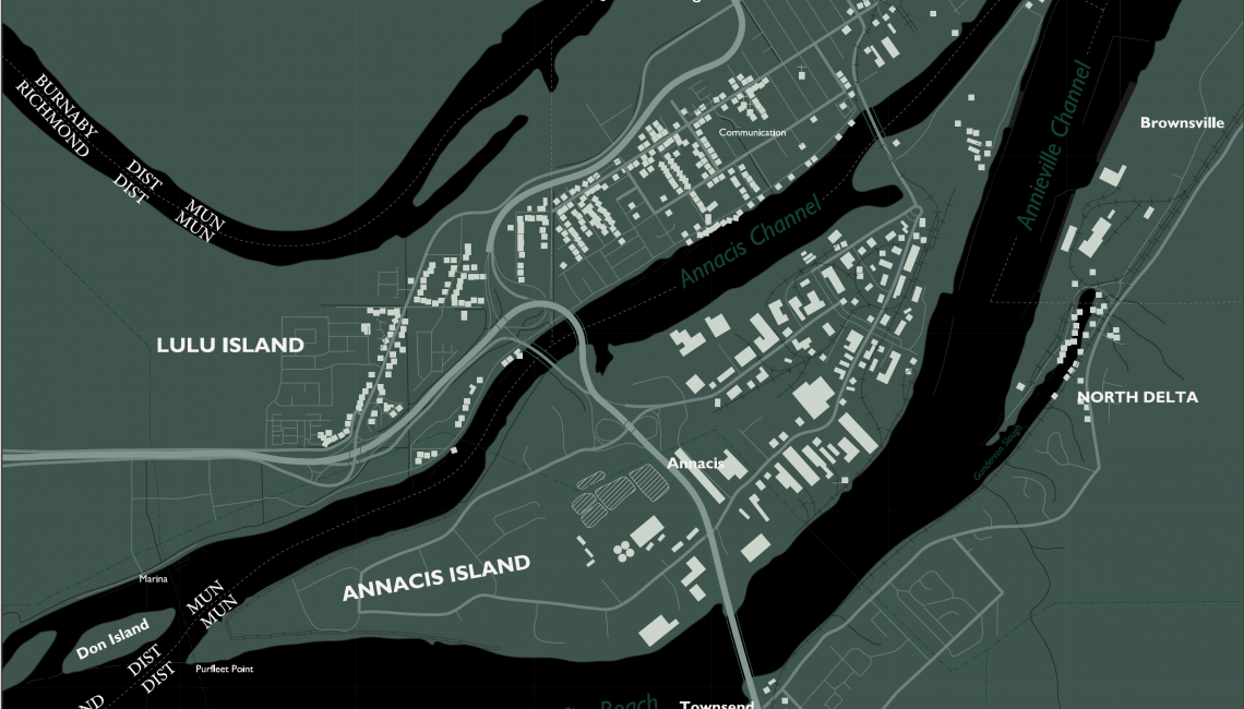
A regional study plan needs to be developed for Annacis Island. This project focused on developing a base map for this, based on an NTS 1:50,000 scale map. Following map sheet 92G, the project involves digitizing features from this to develop a new basemap.
Project Name: Annacis Island Regional Development
Objectives:
- Evaluate the mapping project
- Establish a Geographic Coordinate System
- Attach a non-georeferenced image
- Attach a georeferenced image
- Digitize the features from the map
- Create a sheet surround
- Create two final output maps, one with area fills and another using a pen table to create alternate coloring
Summary:
Find the breakdown and thought process: GIST 7109: Final Lab Write Up
Map 1:
Annacis Island Regional Development – Base Map
Map 2:
Map 2 – Alternate Colouring Pen Table