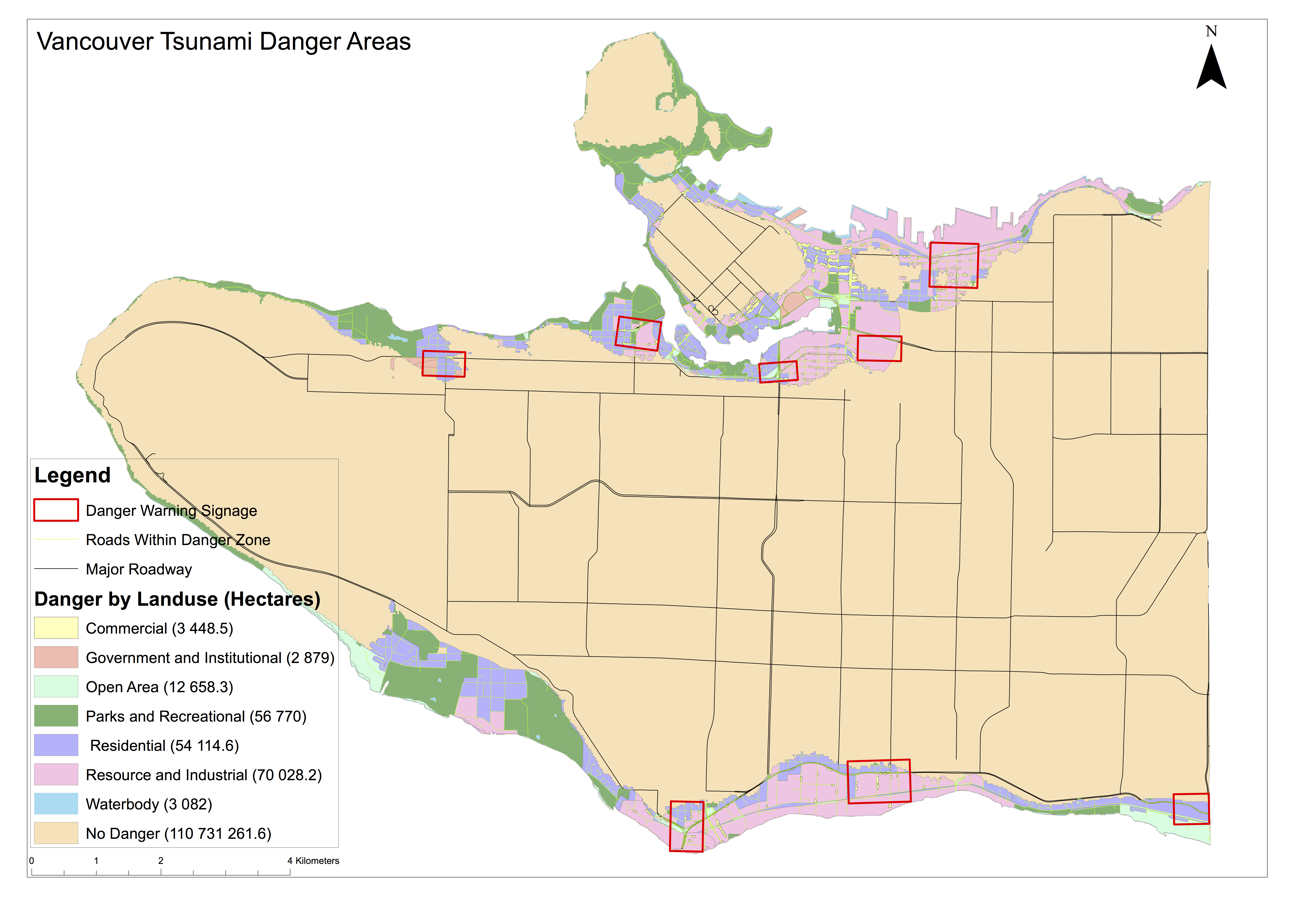
Vancouver sits on the border of the North American and Pacific tectonic plates. These plates represent a convergent boundary, where seismic activity is not uncommon. If a large earthquake happened along this boundary it would cause a tsunami that would impact the coastal areas of North America. As Vancouver is a coastal city, it faces a tsunami risk. From my analysis, I’ve determined that 15.5% of Vancouver is at risk of damage from a tsunami. My parameters were areas within 1 km of the coast and less than 15m below sea level. I performed an intersect command to determine where these two areas intersected to determine the danger area for Vancouver.
Within this tsunami risk area lie multiple schools and healthcare facilities. To determine these locations, I performed an intersect command of the danger area with schools and healthcare facilities. The facilities that have a tsunami risk are:
Schools
- St Anthony of Padua
- Ecole Rose Des Vents
- Heritage 3R’s School
- Vancouver Montessori School
- False Creek Elementary
- Emily Carr Institute of Art & Design
- Henry Hudson Elementary
- St John’s International
- St Francis Xavier
Healthcare
- False Creek Residence
- Broadway Pentecostal Lodge
- Coast West Community Home
- Yaletown House Society
- Villa Cathay Care Home
Accomplishment Statements Thus Far
- Gained a practical working knowledge of ArcGIS software and a variety of datasets for geographic analysis.
- Created composite images from remote sensing data to examine the effects of the Mt. St. Helens eruption by comparing the surrounding area pre- and post-eruption.
- Used spatial and tabular datasets to create a map to determine and communicate the areas of Vancouver and important facilities that may be at risk from a tsunami.