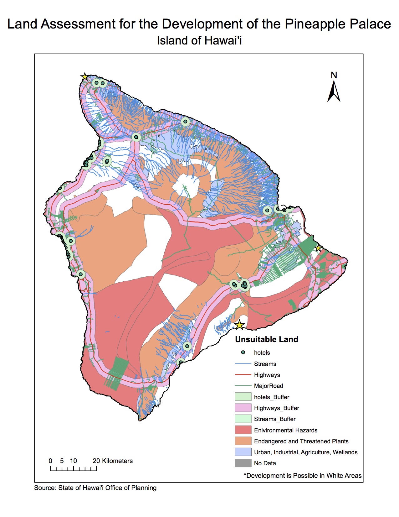
The proposal for our final project was to perform a land assessment for the island of Hawai’i in order to find an ideal location to being the development of the Pineapple Palace Resort and Spa, a relaxing getaway that tourists or locals could treat themselves to. Our goal was to find a couple of locations that would be ideal based on the land use on the island, while taking into consideration things such as the proximity of highways, other hotels and environmental hazards like tsunami and volcano danger zones.
For this project, I worked in a team with three other classmates. Our team worked well together as we were all dedicated and put in equal amounts of time and effort into our work and research. Two of us were in charge of creating maps and the flow chart and gathering information onto ArcGIS while the other two were in charge of gathering information and editing the report. I believe that our team worked well as a unit, as we were very efficient with our time and project management. However, it was difficult to agree on a topic to begin with because our horizons were so broad. We all came to a consensus that we did not want to analyze the Vancouver area because we had studied it so much in class, but we did not know exactly what we wanted to do. It took us much longer to decide than it should have and it was a bit alarming at first. Though we had our difficulties, once we were able to settle on a project proposal, our efficiency increased profusely.
Through working on this final project, I was able to learn a lot more about ArcGIS and all the aspects that are necessary when performing a land assessment. When we first started our project and found one main source for the island of Hawai’i that had all the datasets we required and were all projected and formatted the same, we thought that the project would be simple. However, we learned that a lot had to be done with the layers, rather than just download and add to the map as a layer. As well, when all the layers came together to produce our final map, above, it became more clear that planning for building development in an area with so many intricate parts to it is much harder than it seems.
You can view the final report with six maps attached to it at: Geob 270 Final Project
