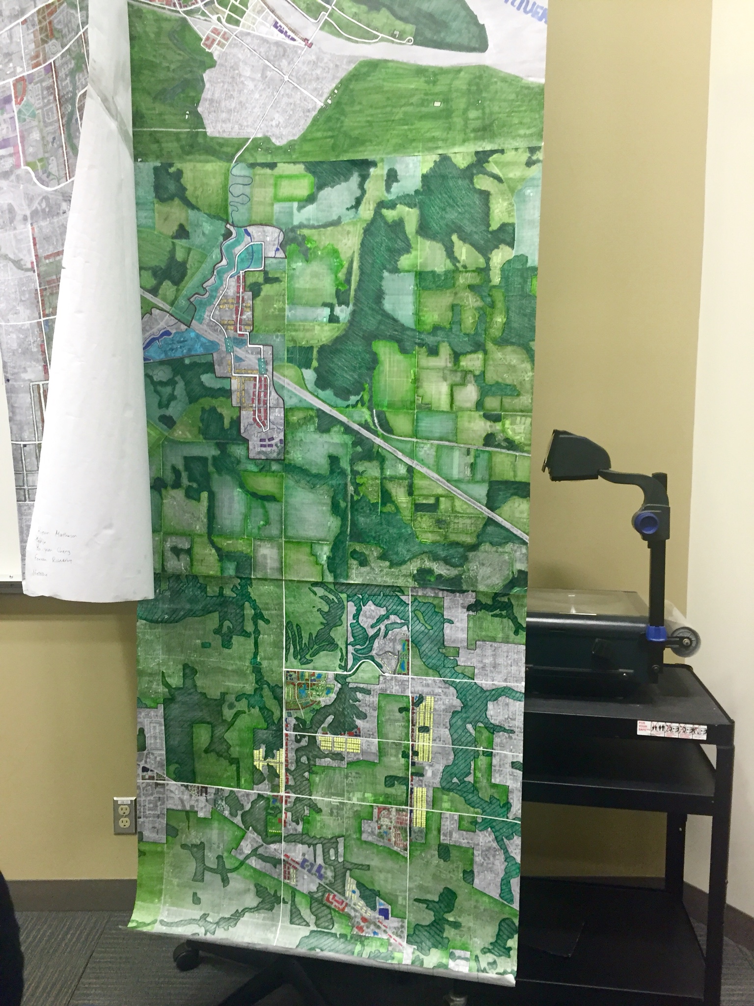
The section (5km by 5km in real) in the middle of the map below, which has massive green wrapping a tiny developable region, is done by me, Jacqueline, and Sequeira. This is a group project (small groups in the tutorial group) in a group project (tutorial groups in the entire class) focusing on redevelopment and avoiding green zones. Therefore, our group’s development area, deducting the massive green zones shown on the city’s website, has little space left. A challenge we faced towards sustainable design is the trans-Canada highway’s division of this region. In order to ameliorate the highway’s inhospitable atmosphere to pedestrians and cyclists, we decided to put two bridge parks (the blue blocks with dash white line on the map) across the highway, inspired by the Bridge Park proposal overtop the CPR rails in Saskatoon’s downtown. This served not only as an extension of the looped transportation system (white line) we added to serve the entire region, but also as an extension of the park we planned nearby. Seeing our project in related with maps created by other tutorial members’ group and finally the entire class is genuinely memorable.