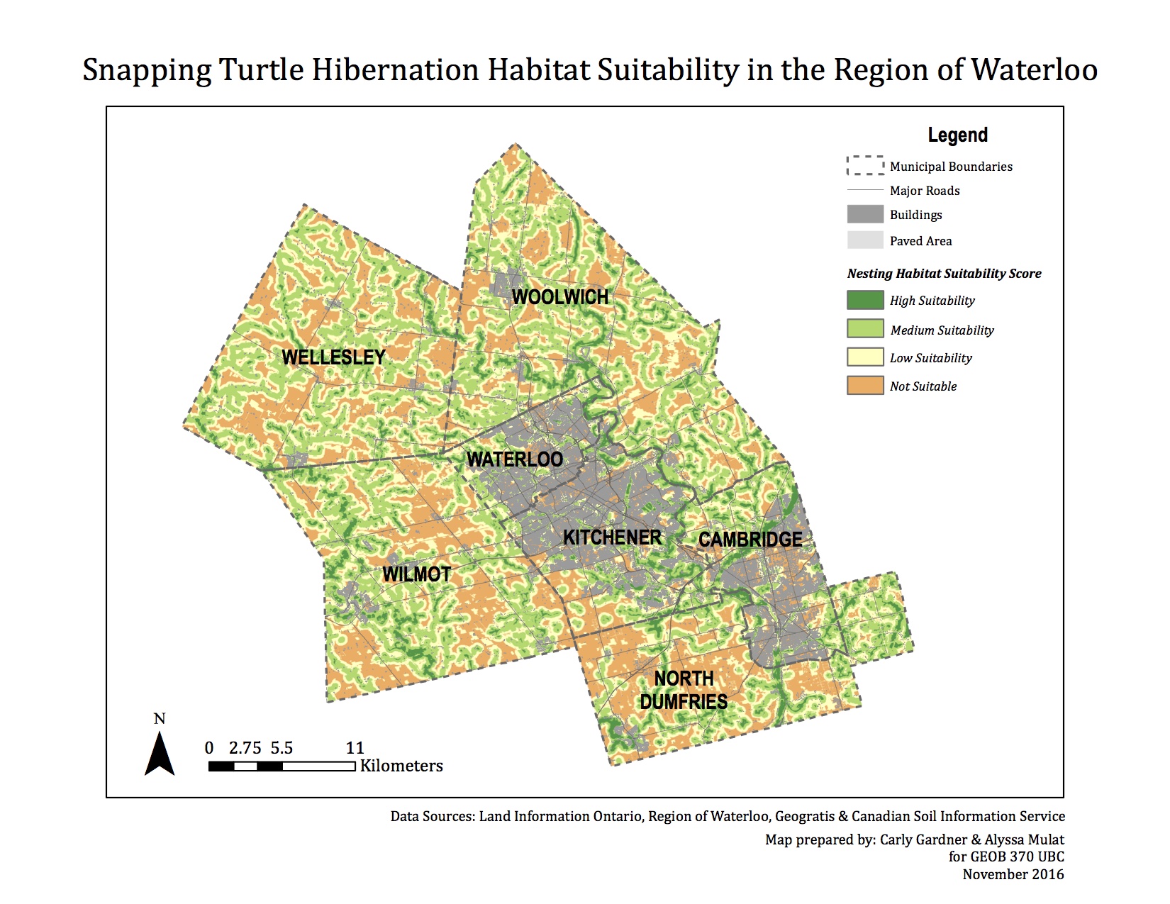
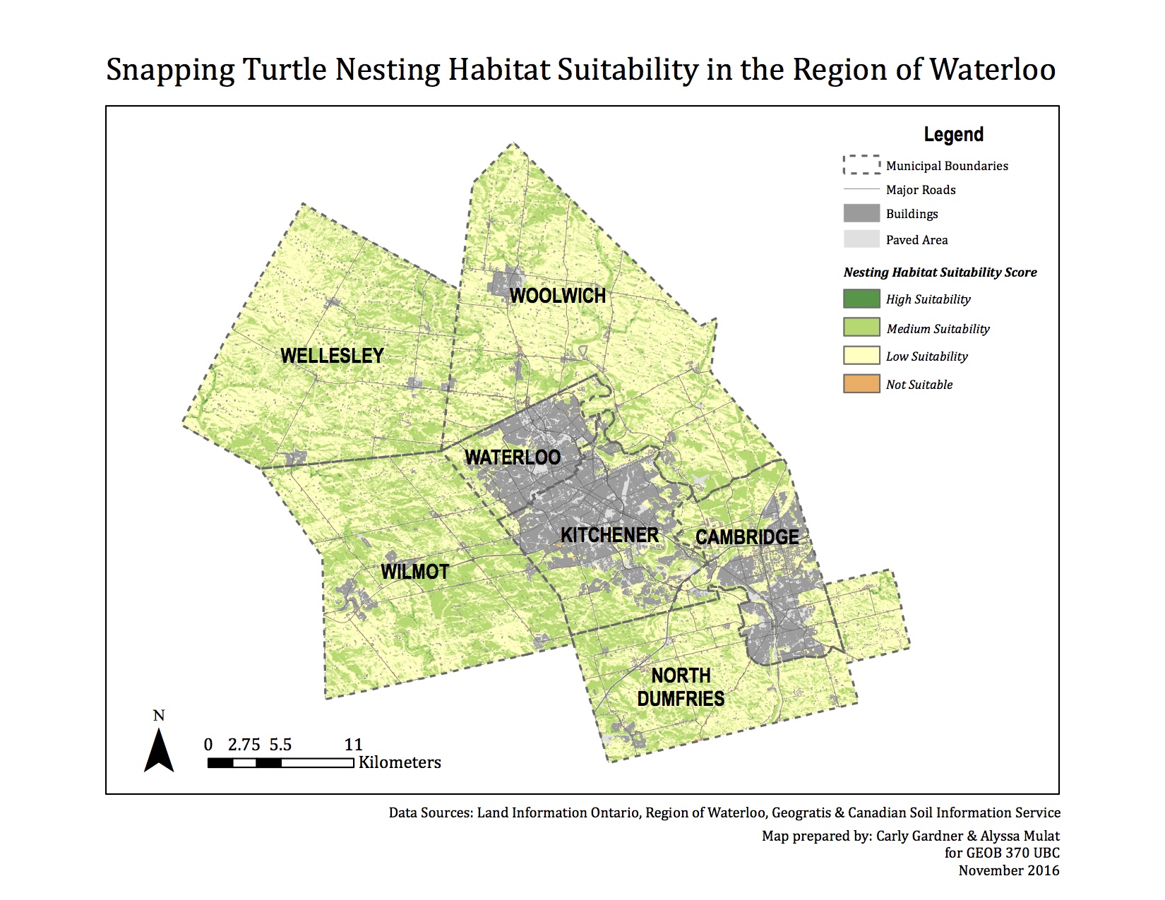
RESULTS OF MULTICRITERIA EVALUATION
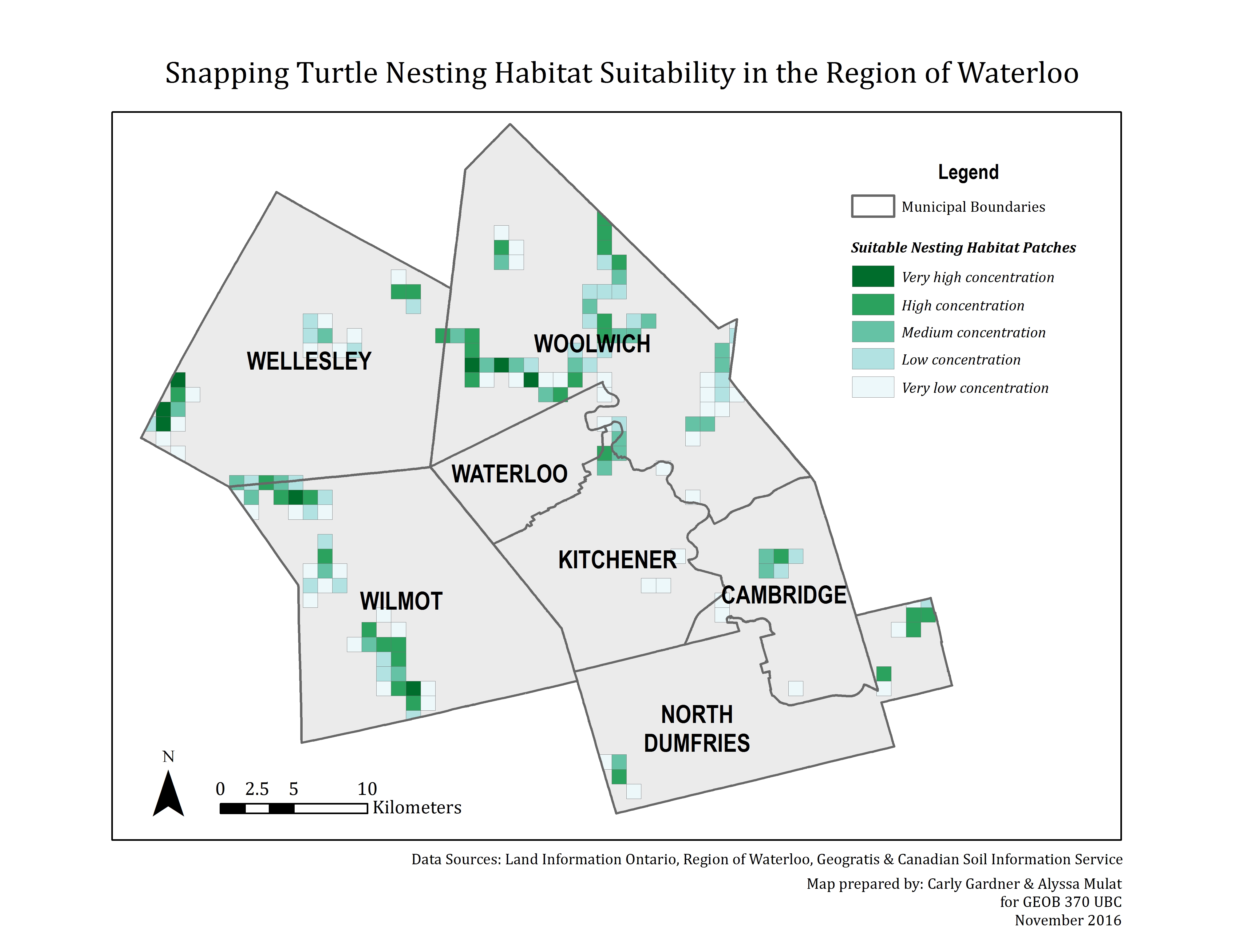
After running an MCE weighted sum analysis for both hibernation habitat suitability and nesting habitat suitability, we obtained these results. The suitable hibernation habitat is heavily dependent on bodies of water, which is why we observe clusters of highly suitable areas around the rivers and streams in the area. The suitable nesting habitat analysis did not place as much weight on proximity to water as it did on aspect (for sun exposure) and soil, so we see far less clustering of the high suitability areas- they are more dispersed over the region. While we changed the symbology to an ordinal scale, it is important to note that the numerical limits we set on each category were the same for both hibernation and nesting habitat. This indicates that hibernation habitat will likely play a greater role in an analysis of suitable sites as there is greater differentiation between unsuitable and highly suitable areas (the results are highly autocorrelated).
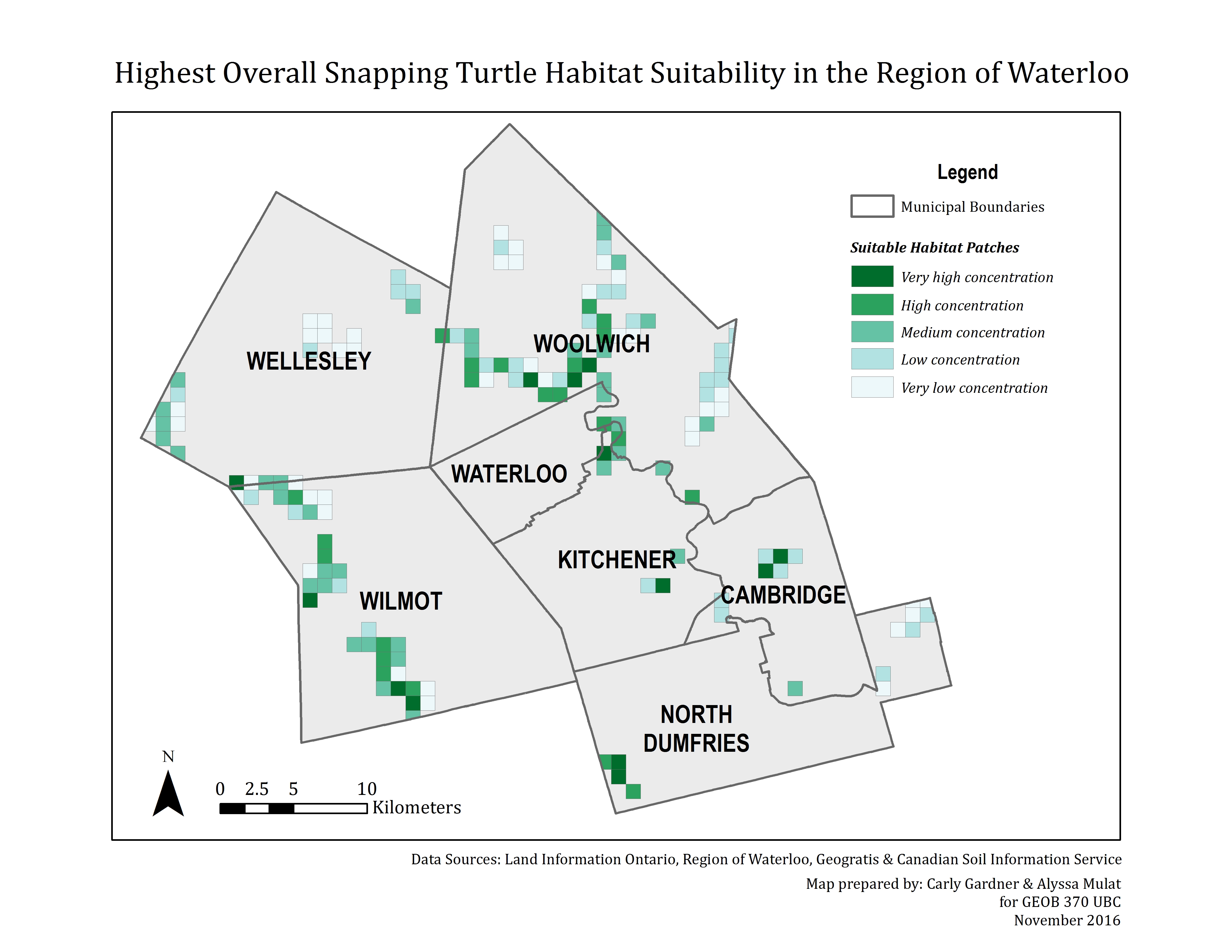
RESULTS OF HABITAT PATCH IDENTIFICATION
As mentioned under ‘Methodology,’ we realized that the level of detail in our MCE maps made it difficult to identify key target conservation regions. In order to aggregate our data and identify patterns, we used a fishnet grid overlay to identify patches in which the sum of suitable pixels was high. After overlaying this grid onto both MCE maps, we then combined the rasters to find the areas favoured by both analyses.
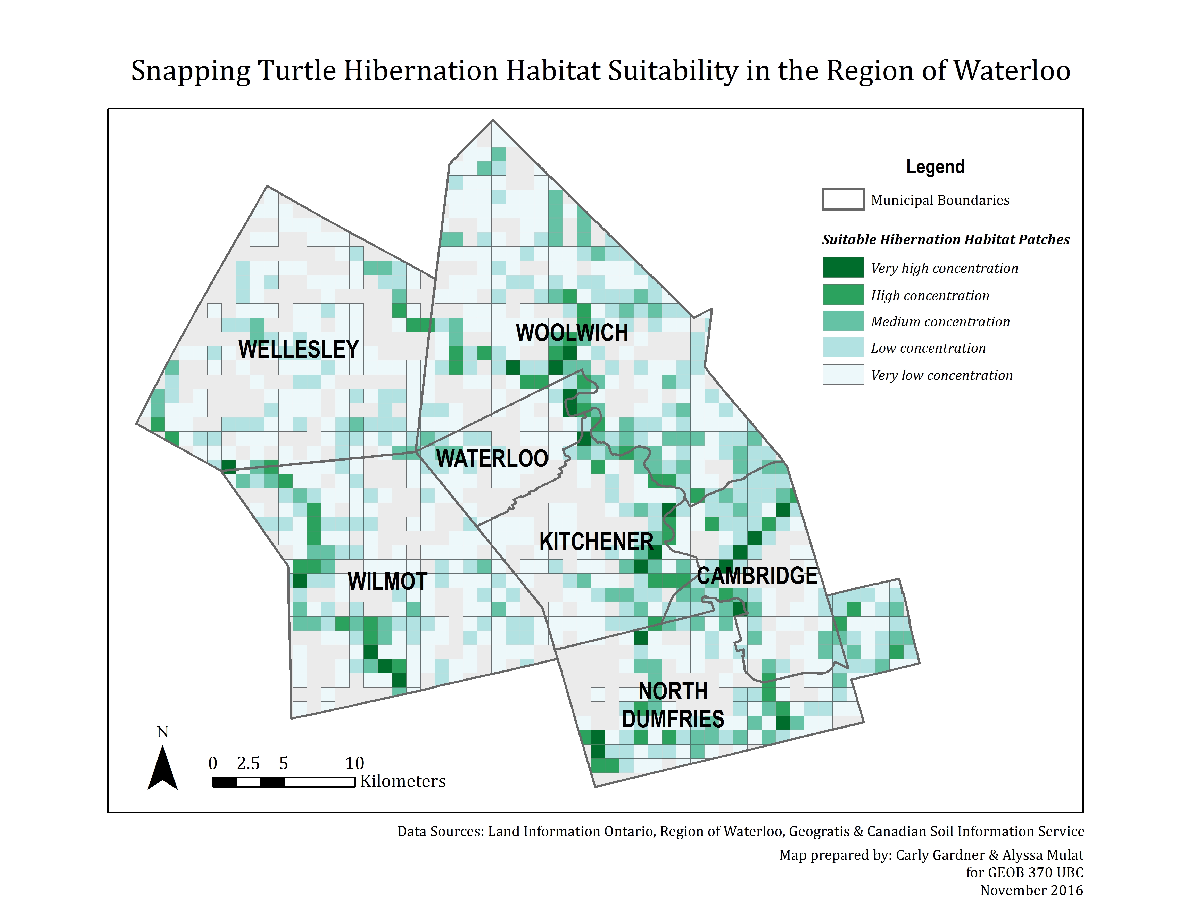
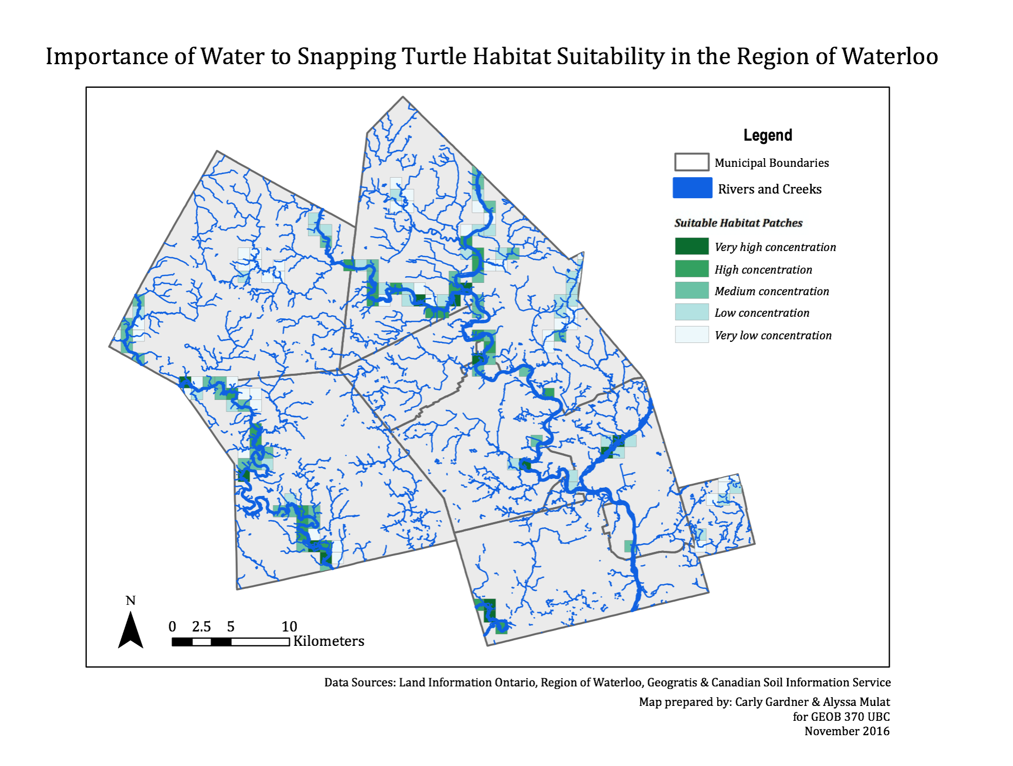
UNDERSTANDING THE IMPORTANCE OF WATER TO SNAPPING TURTLE HABITAT
To visually depict the importance of water to the habitat choice of snapping turtles, we created a map with the rivers overlaid onto our analysis of overall habitat suitability. Almost all of the suitable patches fall along major rivers in the region, and some along smaller creeks.
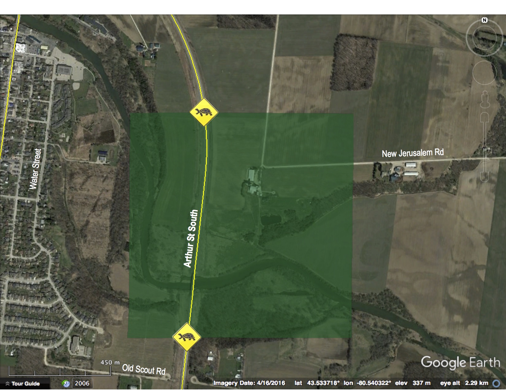
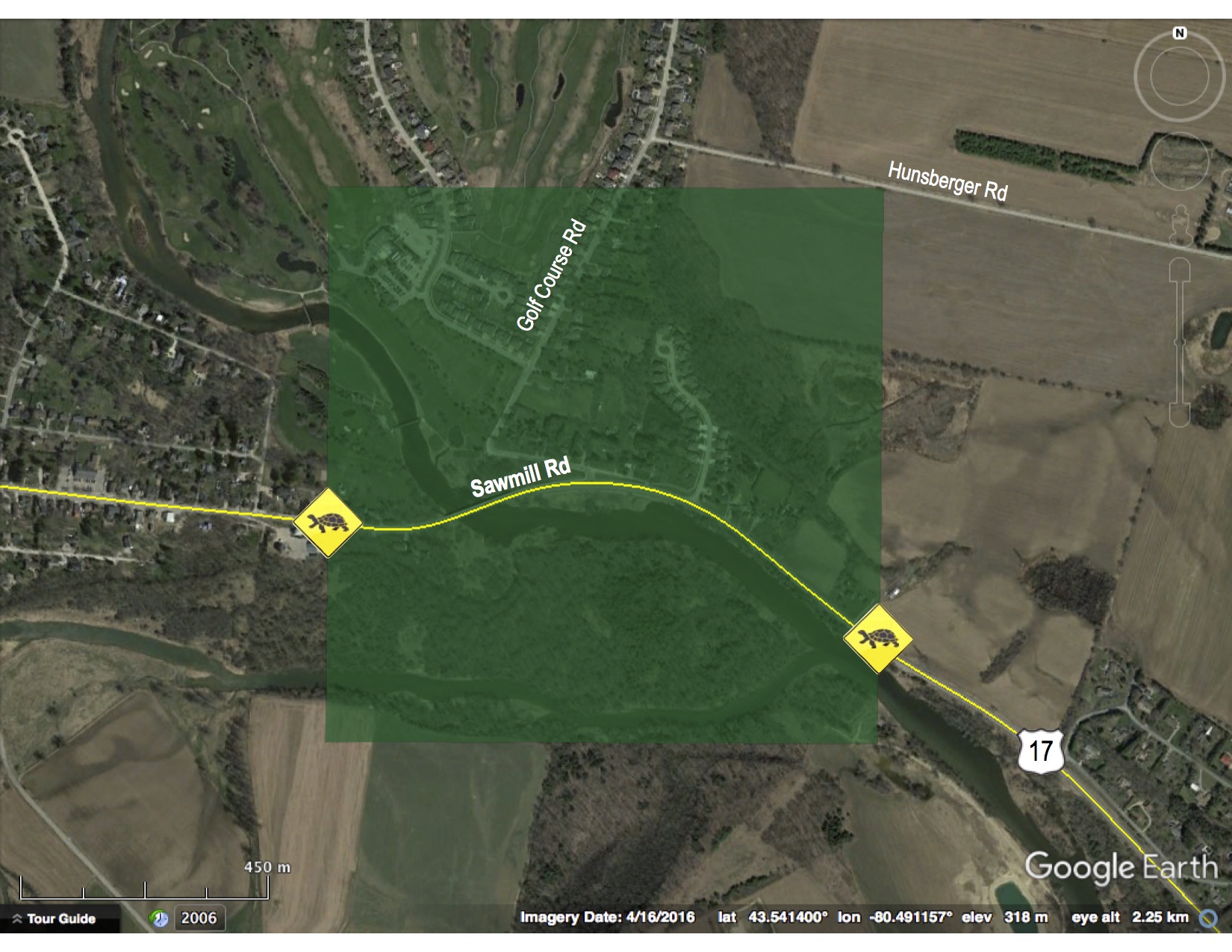
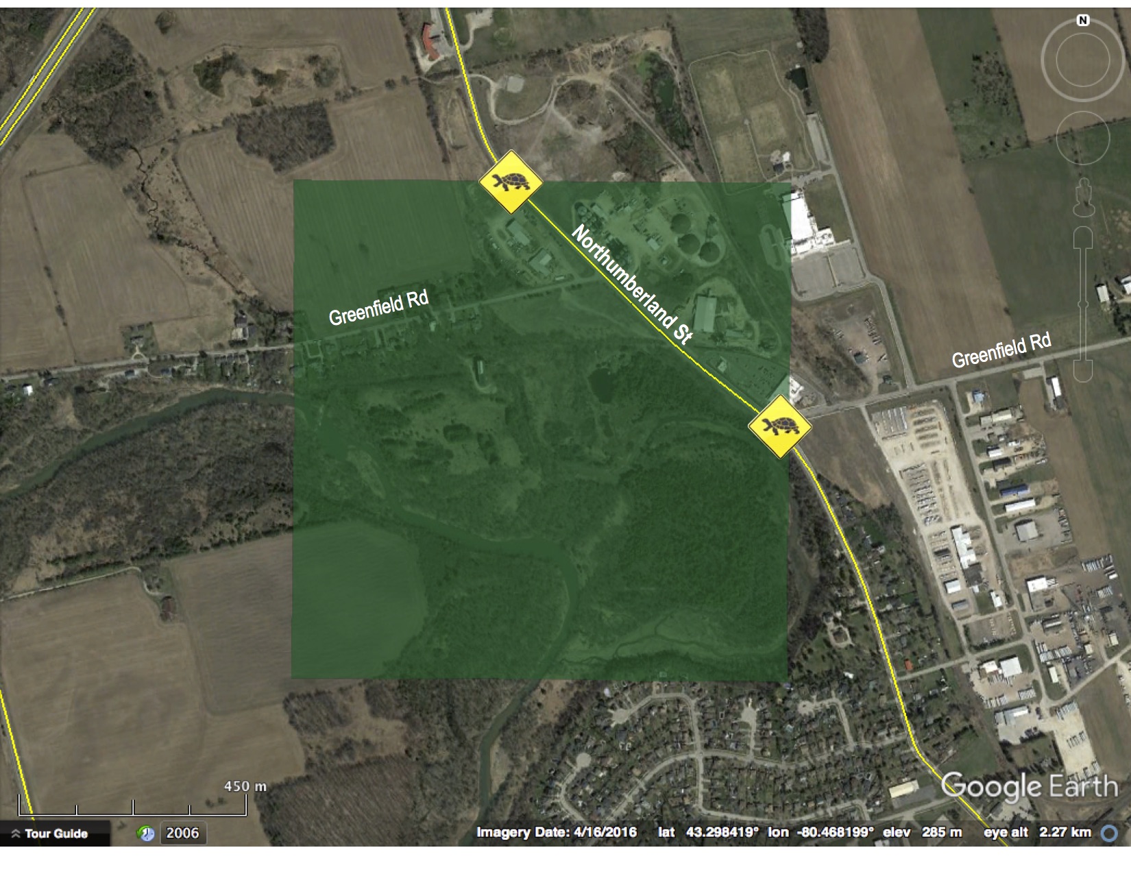
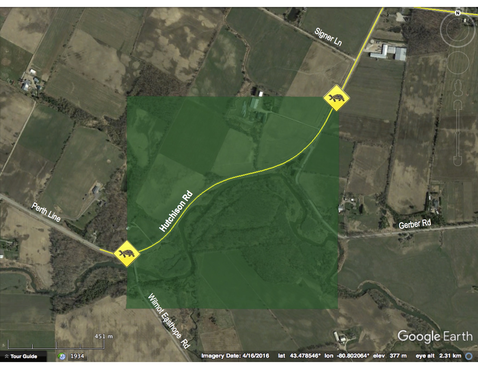
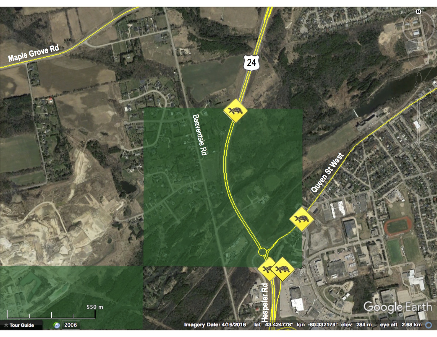
ASSESSING THE RESULTS OF OUR ANALYSIS AND IDENTIFYING ROAD RISK
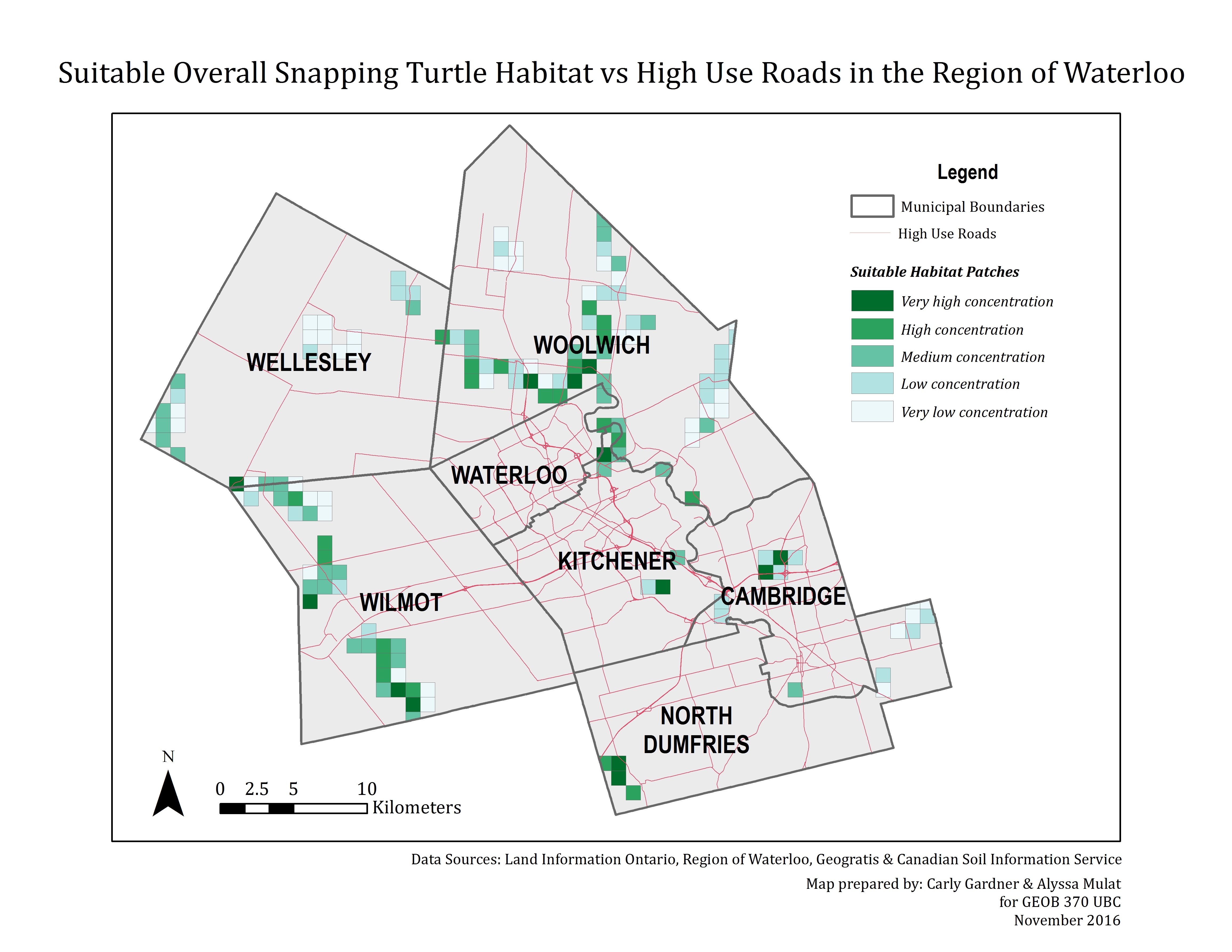
To situate our analysis in the real world, we wanted to overlay our results on top of aerial imagery. To do this, we first selected only cells with a very high concentration of suitable hibernation and nesting patches from our overall habitat suitability map, and from there, we selected only the cells with major roads intersecting them. We ended up with 6 key target zones in which high traffic roads and highly suitable habitat could result in greater rates of turtle mortality. We make recommendations for mitigation under ‘Discussion.’
1. Conestogo Community, Township of Woolwich, Region of Waterloo
2. Village of Ayr, Township of North Dumfries, Region of Waterloo
3. Township of Wilmot, Region of Waterloo
4. City of Cambridge, Region of Waterloo
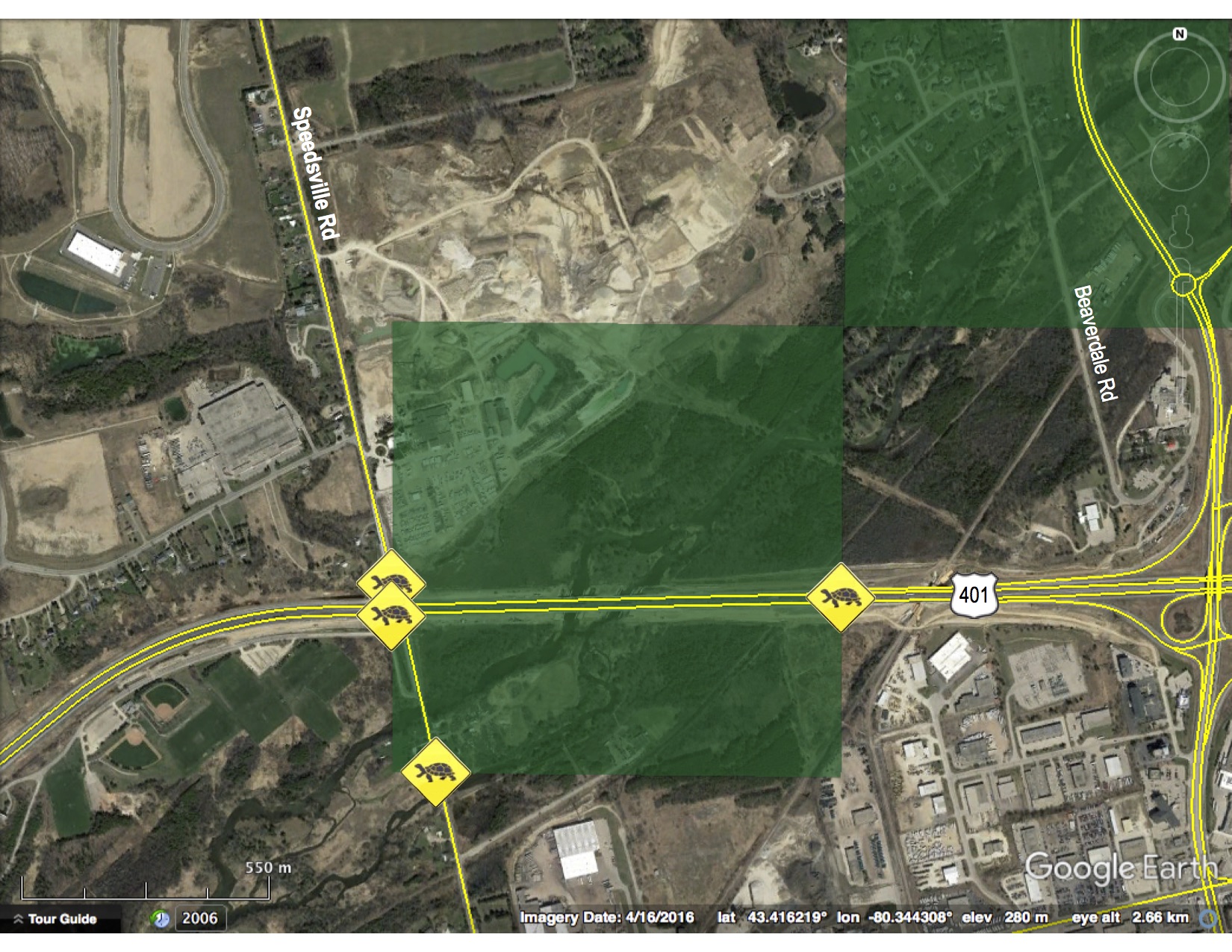
5. City of Cambridge, Region of Waterloo
6. City of Waterloo, Region of Waterloo