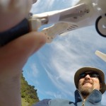
 In April 2015, I got my first taste of surveying with an unmanned aerial vehicle (UAV). With the guidance of Jon Tunnicliffe at the University of Auckland, we conducted a number of surveys of river reaches on the East Cape of the North Island, New Zealand. These rivers are amazing for their level of geomorphic activity, but the capacity of even a simple UAV system to develop a detailed topographic model of a river reach was equally impressive.
The system we (i.e. Jon) used was pretty basic, consisting of a gopro camera mounted to a DJI quadcopter. Jon set up the camera to collect a photo every 2 seconds, launched it, and flew a more-or-less regular pattern of flight lines over the study site at a couple different elevations (usually in the range of 60 to 80 m above the stream bed). We collected between 50 and 300 photos, depending on the size of the area being surveyed. In just two partial days of fieldwork, we collected information on four separate sites; most of our time was spent traveling from site to site, and each flight took less than 15 minutes.
The real magic happened once we returned to Auckland. I took the photos from the gopro, sorted them into “good” and “bad” photos (“bad” photos are blurry or include the sky in the image), and then loaded them into a structure-for-motion program called Photoscan. The program then worked out the location of the camera for each photograph using matching points identified in each image. Since we had quite a bit of overlap from photo to photo (as much as 90% in some cases), there were quite a few matching points and the program was able to reconstruct the location of all photos. Once the camera locations have been estimated by the program, it uses standard photogrammetric techniques to estimate the elevations of each pixel in the image. Long story short, our 15 minutes of flying typically produced a point cloud of nearly 5 million topographic points over a reach about 200 m wide by 600 m long, which then could be used to produced truly amazing ortho-photographs of the study reach. There were some slightly bizarre points (such as those associated with birds flying beneath the UAV), but nevertheless I found the results absolutely astounding.
This approach is going to revolutionize how we collect data on river morphology.