I. Approaches to Hong Kong History
II. The Settings
- Periodization
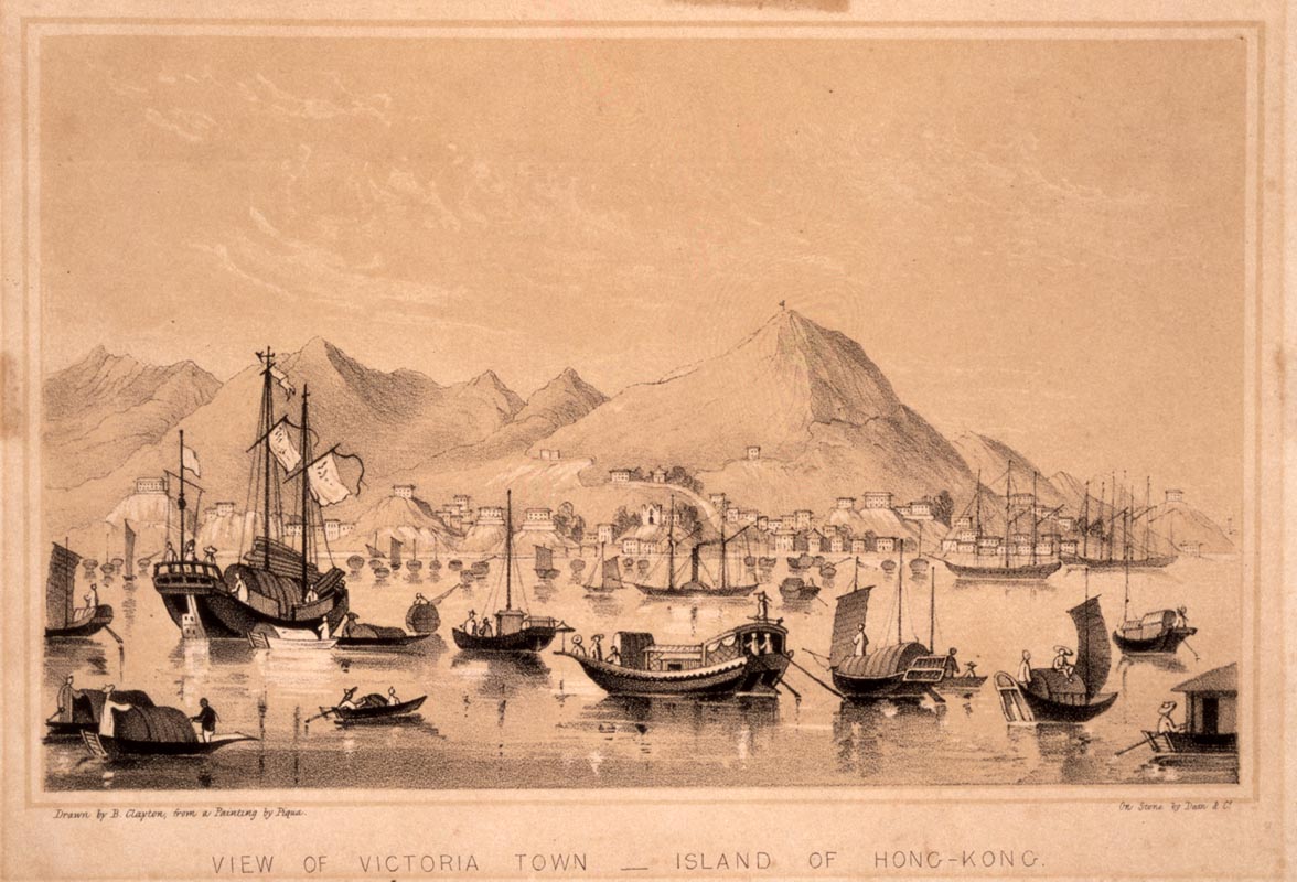
- Geography—80 miles from Canton (Guangzhou), Hong Kong Island (~30 sq mi), Kowloon Peninsula (1860; ~ 8 sq mi), New Territories (1898, ~365 sq mi) . . . cf. Greater Vancouver (~1,100 sq mi)
- Population (“guesstimates”)— 7,450 (1841) . . . 24,000 (1848) . . . 123,511 (1862) . . . 221,441 (1891) . . . 283,978 (1901)
III. Coming into View
- Early Chinese maps (dated to the 16th century)—Record of the Office of the Supreme Commander at Cangwu (Cangwu zong du jun men zhi) (1581 [1552]) . . . Yue da ji 粵大記 (1595)
- Early European maps (17th century–)—Dell’Arcano del Mare (1646–1648) by Robert Dudley . . . Vincenzo Maria Coronelli’s map (1695)
IV. From the Ground Up
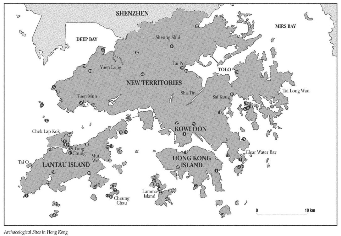
- The Search—Pioneers (e.g., C. M. Heanley, Walter Schofield, Fr. Daniel J. Finn, Chen Kung-che 陳公哲 [1890–1961]) . . . Hong Kong Archaeological Society (1967) . . . Antiquities and Monuments Office (GIS )
- Findings—archaeological sites . . . Song-dynasty (960–1276) inscription (Fat Tong Mun 佛堂門)
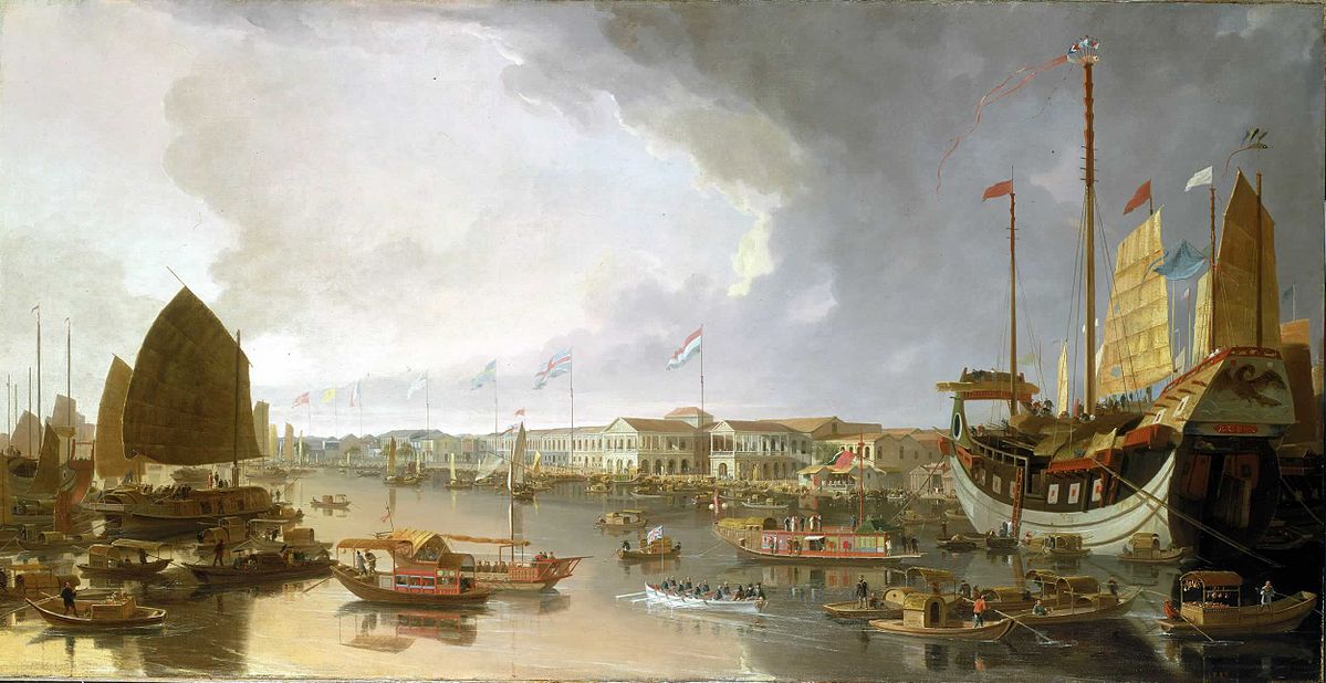
V. A Littoral Zone
- Settlements—clans in the New Territories . . . Tang (Deng 鄧), Man (Wen 文), Hau (Hou 侯), Pang (Peng 彭), and Liu (Liao 廖)
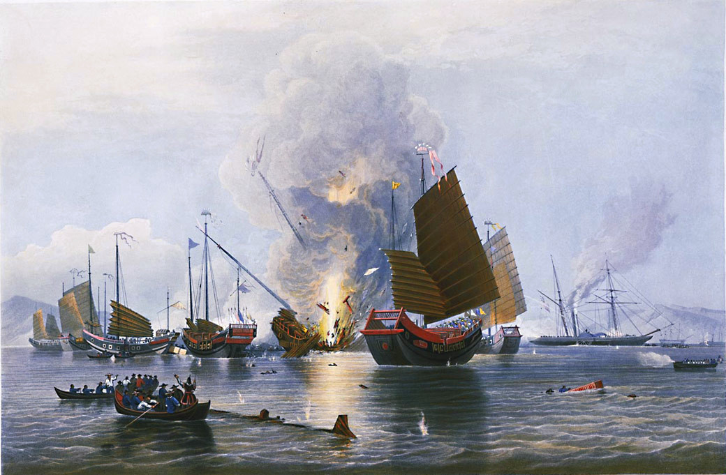
- Piracy in the South China Sea—Cheung Po Tsai 張保仔 (1783–1822; 200+ ships)
VI. Clash of Empires
- Qing-dynasty (1644–1912) China and Georgian (1714–ca. 1837)/Victorian (1837–1901) England
- The “Canton System” (1750s–1842)—Macartney Embassy (1793)
- British East India Company (1600–1874; monopoly terminated in 1834)
- Tea . . .silver . . . opium
Year Silver to China (Taels) 1760s >3 million 1770s ~7.5 million 1780s ~16 million By contrast, net flow out of China: ~2 million taels each year (1820s) and ~9 million taels each year (1830s)
British sale of opium to China (chest: 130–160 pounds; source: Jonathan Spence, The Search for Modern China [2013])
Year Number of Chests 1729 200 1800 4,570 1838 > 40,000 - The First Opium War (1839–1842)
- Lin Zexu (1785–1850) and the anti-opium campaign (1839)—seizure of drugs and pipes . . . letter to Queen Victoria . . . blockade (24 March 1939) . . . 20,000 chests (~3 million pounds) confiscated and destroyed”We have heard that in your honorable nation, too, the people are not permitted to smoke the drug, and that offenders in this particular expose themselves to sure punishments. . . . In order to remove the source of the evil thoroughly, would it not be better to prohibit its sale and manufacture rather than merely prohibit its consumptions?”
- Military response—16 warships, 4 armed steamers . . . 4,000 troops, 3,000 tons of coal, 16,000 gallons of rum . . . June 1840 . . . the 1841 agreement . . . Henry Pottinger . . . Treaty of Nanjng [Nanking] (signed 1842; ratified 1843) . . . Hong Kong . . . treaty ports (Canton, Fuzhou, Xiamen, Ningbo, and Shanghai) . . . the “most-favored nation” clause
- The Second Opium War (1858–1860)—the Arrow Incident . . . First Convention of Peking (1860)
Discussion
Revisit the article by James Hayes. Take a closer look at the "primary" sources he cites.
- Who are his "informants"? How would you describe the genres of sources he makes use of? What are the limitations of such sources?
- More generally, what are some of the challenges historians face in trying to reconstruct the history of pre-colonial Hong Kong?
- To what extent was Hong Kong "at the edge of empires"?