Digital Terrain Modelling and Multi-Criteria Analysis
Summary
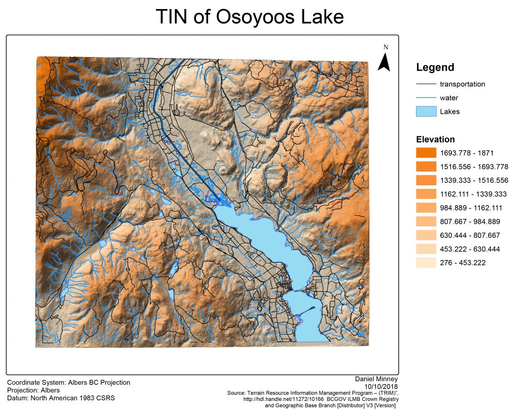
A Triangulated Irregular Network (TIN) was created from an elevation dataset for the Osoyoos Lake region.
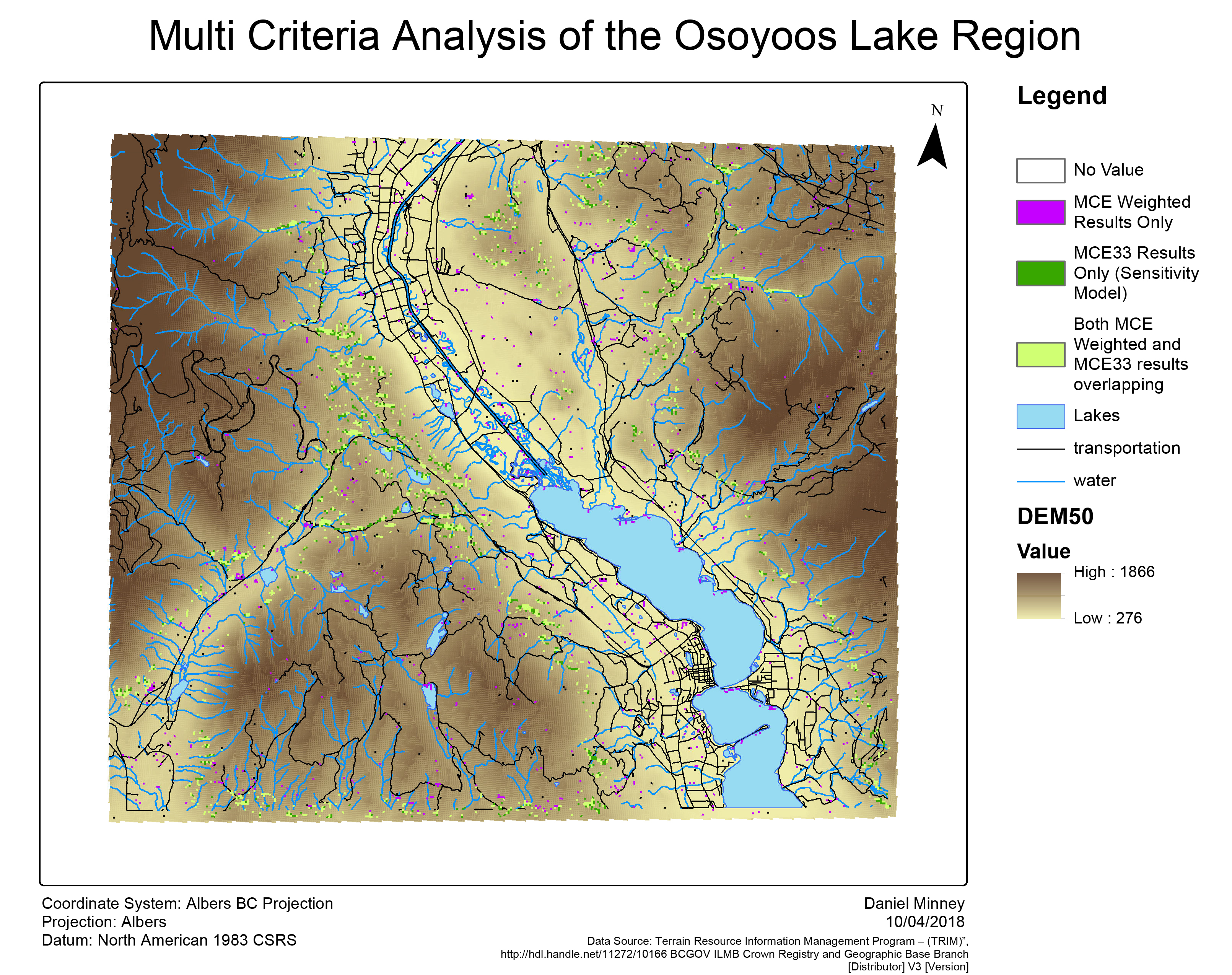
The multi-criteria analysis map was created to meet the criteria set out by the botanist. The criteria focused on in this situation were for an area of 700 hectares,with an importance of aspect over elevation and slope. To create this map, the following steps were taken:
- A DEM was created from an elevation dataset, with the cell size (resolution) set to 50m x 50m (equivalent to 0.25 hectares).
- From this DEM, I was able to create three files: Aspect, Elevation, and Slope. These were then normalized using Fuzzy Membership. Using an AHP calculator (as seen below), Aspect, Elevation, and Slope were weighted to create the multi-criteria evaluation layer.
- The layer was then classified so that only 700 hectares were shown.
The final map includes three classes. The first includes MCE weighted results only, where the results from the AHP calculator were used. Since aspect was determined to be slightly more important than both elevation and slope in determining sensitive areas for the identified species, it’s criteria of importance value was 0.6, whereas elevation and slope have a value of 0.2 each. The second includes an alternative method, using a equal weights for each of the three criteria. The third class is an overlay of both the MCE Weighted method and the MCE33 weighted method, producing the highest-ranking cells. Each of the classes however contain a different area. The first class includes 232 hectares. The second class also includes 232 hectares. The third class contains 455 hectares. Overall, there are a small amount of areas suitable for the rare species, however, through looking at this map, it should be easily identifiable.
Accomplishments
Gained an understanding of how to create TINs. Created data from a DEM such as aspect and slope, and normalized the data using fuzzy memberships and the raster calculator in order to perform a multi-criteria analysis.